Mauléon
Airport details
| Country | France |
| State | Nouvelle-Aquitaine |
| Region | LF |
| Airspace | Brest Ctr |
| Municipality | Mauléon |
| Elevation | 565ft (172m) |
| Timezone | GMT +1 |
| Coordinates | 46.90306, -0.69750 |
| Magnetic var | |
| Type | land |
| Available since | X-Plane v10.40 |
| ICAO code | LFJB |
| IATA code | n/a |
| FAA code | n/a |
Communication
| Mauléon CTAF | 123.500 |
| Mauléon Twr | 123.500 |
| Mauléon NANTES INFO | 119.400 |
| Mauléon Dep | 123.500 |
Nearby Points of Interest:
Logis du Puy-Blain
-Petit menhir du Champ de la Garde
-château de la Bonnelière
-église Saint-Martin de Chiché
-Ancienne église Saint-Christophe de Mesnard-la-Barotière
-Nécropole des Cous
-Château de Chemillé
-Polissoir de la Grouas
-Logis de Barroux
-Sanctuaire Notre-Dame-de-la-Salette de La Rabatelière
-pont des Ouillères
-Château du Bois de Sanzay
-Croix hosannière de Gourgé
-Église Saint-Paul de Parthenay
-Maison de la Dîme
-Église Saint-Pierre de Vaudelnay
-Cour de Douces
-Hôtel Desmazières
-Logis de la Pinsonnière
-Château de la Baugisière
-Abbaye de Trizay, Bournezeau
-Château de Sainte-Hermine
-Château de Chassenon
-Église de Varenne
-Chapelle des Templiers
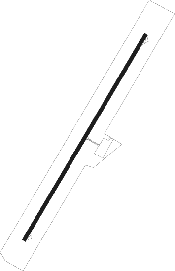
Runway info
| Runway 04 / 22 | ||
| length | 1301m (4268ft) | |
| bearing | 46° / 226° | |
| width | 20m (66ft) | |
| surface | asphalt | |
Nearby beacons
| code | identifier | dist | bearing | frequency |
|---|---|---|---|---|
| LP | CHOLET NDB | 15.1 | 329° | 357 |
| YN | LA ROCHE SUR YON LES AJONCS NDB | 27.4 | 250° | 334 |
| ANG | ANGERS VOR | 38.5 | 346° | 113 |
| NTS | NANTES ATLANTIQUE VOR/DME | 40.5 | 286° | 115.50 |
| GL | NANTES NDB | 41.5 | 279° | 369 |
| POI | POITIERS BIARDS VOR | 45.3 | 108° | 113.30 |
| AS | ANGERS NDB | 46.2 | 39° | 392 |
| RL | LA ROCHELLE NDB | 46.6 | 209° | 322 |
| PI | POITIERS NDB | 46.9 | 100° | 363 |
| TUR | TOURS VAL DE LOIRE TACAN | 66.1 | 70° | 113.80 |
| LM | LE MANS NDB | 69.1 | 41° | 326 |
| TUR | TOURS VAL DE LOIRE NDB | 72.3 | 66° | 331 |
Disclaimer
The information on this website is not for real aviation. Use this data with the X-Plane flight simulator only! Data taken with kind consent from X-Plane 12 source code and data files. Content is subject to change without notice.