Corlier
Airport details
| Country | France |
| State | Auvergne-Rhône-Alpes |
| Region | LF |
| Airspace | Marseille Ctr |
| Municipality | Corlier |
| Elevation | 2703ft (824m) |
| Timezone | GMT +1 |
| Coordinates | 46.03936, 5.49588 |
| Magnetic var | |
| Type | land |
| Available since | X-Plane v10.40 |
| ICAO code | LFJD |
| IATA code | n/a |
| FAA code | n/a |
Communication
| Corlier CORLIER INFO | 130.000 |
Nearby Points of Interest:
Moulin à farine de Cerdon
-Grotte de la Colombière
-Pont de Serrières-sur-Ain
-Plateau de Retord
-Gare de La Cluse
-Grotte de Corveissiat
-Centre nautique de Lagnieu
-Fresco of Saint Christopher of Saint-Sorlin-en-Bugey
-Habitat du premier âge féodal de Jasseron
-Lac Genin
-Maison Bolli
-Maison Mingat
-Town hall of Bellegarde-sur-Valserine
-Hôtel-Dieu de Bourg-en-Bresse
-Immeuble, 10 rue Victor-Basch (Bourg-en-Bresse)
-Bourg-en-Bresse city hall
-Aqueduc romain de Briord
-Grenier à sel
-Porte d'En-Bas
-Écurie Thimon
-Maison Messimy
-Maison Jean Escoffier
-Maison du Sergent de Justice
-Maison Nicolas
-Écuries Vernay
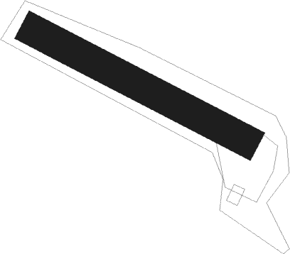
Runway info
| Runway 12 / 30 | ||
| length | 300m (984ft) | |
| bearing | 113° / 293° | |
| width | 40m (131ft) | |
| surface | grass | |
Nearby beacons
| code | identifier | dist | bearing | frequency |
|---|---|---|---|---|
| CBY | CHAMBERY VOR/DME | 14.4 | 121° | 115.40 |
| PAS | PASSEIRY VOR/DME | 22.2 | 76° | 116.60 |
| AT | ANNECY NDB | 24.3 | 109° | 384 |
| LSE | LYON SAINT EXUPERY VOR/DME | 24.4 | 234° | 114.75 |
| GVA | GENEVA VOR/DME | 29.4 | 71° | 115.75 |
| CH | CHAMBERY NDB | 31.3 | 139° | 346 |
| BR | LYON-BRON NDB | 33 | 230° | 388 |
| LTP | LA TOUR DU PIN VOR/DME | 33.1 | 186° | 115.55 |
| GLA | GLAND NDB | 38.1 | 64° | 375 |
| VNE | VIENNE REVENTIN VOR | 38.7 | 232° | 108.20 |
| EG | GRENOBLE NDB | 40.7 | 188° | 397 |
| WS | GRENOBLE NDB | 43.1 | 207° | 291 |
| SPR | ST PREX VOR/DME | 47.2 | 66° | 113.90 |
| CC | CHAMPFORGEUIL NDB | 49 | 316° | 391 |
| LAP | PRAZ DME | 53.9 | 55° | 110.65 |
| DO | DOLE NDB | 57 | 349° | 309 |
Disclaimer
The information on this website is not for real aviation. Use this data with the X-Plane flight simulator only! Data taken with kind consent from X-Plane 12 source code and data files. Content is subject to change without notice.