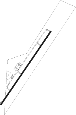
Metz / Nancy - Metz-nancy-lorraine
Airport details
| Country | France |
| State | Grand Est |
| Region | LF |
| Airspace | Reims Ctr |
| Municipality | Goin |
| Elevation | 870ft (265m) |
| Timezone | GMT +1 |
| Coordinates | 48.97738, 6.24007 |
| Magnetic var | |
| Type | land |
| Available since | X-Plane v10.40 |
| ICAO code | LFJL |
| IATA code | ETZ |
| FAA code | n/a |
Communication
| Metz-Nancy-Lorraine ATIS | 136.575 |
| Metz-Nancy-Lorraine Ground | 121.700 |
| Metz-Nancy-Lorraine Tower | 122.700 |
| Metz-Nancy-Lorraine Approche | 119.125 |
Approach frequencies
| ILS-cat-III | RW22 | 111.75 | 18.00mi |
| 3° GS | RW22 | 111.75 | 18.00mi |
Nearby Points of Interest:
Château Horgne de Montigny-lès-Metz
-Synagogue de Delme
-Fort de Queuleu
-University of Pont-à-Mousson
-Ossuaire d'Ancy-sur-Moselle
-Hospice Saint-Nicolas
-Hôtel de ville de Pont-à-Mousson
-Synagogue de Pont-à-Mousson
-Caserne Ney (Metz)
-Maison des Sept-Péchés-capitaux
-Remparts médiévaux
-Palais de Justice de Metz
-Collégiale Saint-Sauveur de Metz
-École d'application de l'artillerie et du génie
-Hôtel du Parlement (Metz)
-Hôtel de ville de Metz
-vestiges gallo-romains de Metz
-caserne du Cloître de Metz
-Chapelle du Petit-Saint-Jean, Metz
-König Johann Kaserne
-Ancien hôpital militaire de Fort-Moselle (Metz)
-Group Fortifications Of Saint-Quentin
-maison du pasteur Paul Ferry
-Gorze Abbey
-Abbaye de Sainte-Marie-au-Bois
Nearby beacons
| code | identifier | dist | bearing | frequency |
|---|---|---|---|---|
| LOU | LORRAINE NDB | 1.7 | 56° | 388 |
| MTZ | METZ NDB | 17.9 | 354° | 354 |
| GTQ | GROSTENQUIN VOR/DME | 18.7 | 89° | 111.25 |
| NAY | NANCY OCHEY TACAN | 26.2 | 216° | 116.80 |
| ETN | ETAIN NDB | 26.8 | 294° | 410 |
| WLU | LUXEMBOURG NDB | 36.2 | 343° | 346 |
| SAD | DME | 37.2 | 75° | 116.75 |
| LW | LUXEMBOURG NDB | 38.2 | 354° | 404 |
| EMT | EPINAL NDB | 38.7 | 184° | 419 |
| LUX | LUXEMBOURG VOR/DME | 39.7 | 1° | 112.25 |
| LE | LUXEMBOURG NDB | 39.8 | 1° | 318 |
| PHG | PHALSBOURG NDB | 39.9 | 102° | 424 |
| EPL | EPINAL MIRECOURT VOR | 40.2 | 195° | 113 |
| SR | ENSHEIM (SAARBRUECKEN) NDB | 41.1 | 76° | 360 |
| ELU | LUXEMBOURG NDB | 42.4 | 9° | 368 |
| DIK | DIEKIRCH NDB | 53.2 | 353° | 307 |
Departure and arrival routes
| Transition altitude | 5000ft |
| SID end points | distance | outbound heading | |
|---|---|---|---|
| RW04 | |||
| PHAL4N | 36mi | 103° | |
| MONC4N | 18mi | 145° | |
| MMD4N | 50mi | 290° | |
| DIK4P, DIK4N | 53mi | 353° | |
| RW22 | |||
| PHAL5S | 36mi | 103° | |
| MONC5S | 18mi | 145° | |
| EPL5T | 40mi | 195° | |
| MMD5S, MMD5T | 50mi | 290° | |
| DIK5T, DIK5S, DIK5U | 53mi | 353° | |
| STAR starting points | distance | inbound heading | |
|---|---|---|---|
| ALL | |||
| EPL2B | 40.2 | 15° | |
| MMD2J | 50.3 | 110° | |
| DIK2A | 53.2 | 173° | |
| PHAL2B | 35.8 | 283° | |
| MONC2C | 18.3 | 325° | |
Instrument approach procedures
| runway | airway (heading) | route (dist, bearing) |
|---|---|---|
| RW04 | EPL (15°) | EPL JL502 (12mi, 341°) JL503 (12mi, 341°) 5600ft IJL04 (5mi, 51°) 4000ft |
| RW04 | JL503 (50°) | JL503 5600ft IJL04 (5mi, 51°) 4000ft |
| RW04 | MONCE (325°) | MONCE JL502 (21mi, 247°) JL503 (12mi, 341°) 5600ft IJL04 (5mi, 51°) 4000ft |
| RW04 | MTZ (174°) | MTZ JL501 (29mi, 214°) 4000ft IJL04 (5mi, 118°) 4000ft |
| RNAV | IJL04 4000ft FJL04 (5mi, 51°) 4000ft LFJL (10mi, 50°) 909ft LOU (2mi, 56°) MONCE (19mi, 151°) | |
| RW22 | GTQ (269°) | GTQ JL401 (10mi, 334°) IJL22 (6mi, 292°) 4300ft |
| RW22 | MTZ (174°) | MTZ JL403 (8mi, 82°) IJL22 (8mi, 138°) 4300ft |
| RNAV | IJL22 4300ft FJL22 (5mi, 231°) 4300ft LFJL (12mi, 232°) 915ft JL409 (3mi, 228°) MTZ (20mi, 2°) |
Holding patterns
| STAR name | hold at | type | turn | heading* | altitude | leg | speed limit |
|---|---|---|---|---|---|---|---|
| DIK2A | MTZ | FIX | right | 293 (113)° | 6000ft - 11000ft | 1.0min timed | 220 |
| EPL2B | MTZ | FIX | right | 293 (113)° | 6000ft - 11000ft | 1.0min timed | 220 |
| MMD2J | MTZ | FIX | right | 293 (113)° | 6000ft - 11000ft | 1.0min timed | 220 |
| MONC2A | MTZ | FIX | right | 293 (113)° | 6000ft - 11000ft | 1.0min timed | 220 |
| MONC2C | GTQ | NDB | right | 129 (309)° | 4800ft - 7000ft | 1.0min timed | 220 |
| PHAL2B | GTQ | NDB | right | 129 (309)° | 4800ft - 7000ft | 1.0min timed | 220 |
| PHAL2B | MTZ | FIX | right | 293 (113)° | 6000ft - 11000ft | 1.0min timed | 220 |
| *) magnetic outbound (inbound) holding course | |||||||
Disclaimer
The information on this website is not for real aviation. Use this data with the X-Plane flight simulator only! Data taken with kind consent from X-Plane 12 source code and data files. Content is subject to change without notice.