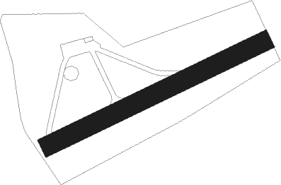
Lasclaverie - Lasclaveries
Airport details
| Country | France |
| State | Nouvelle-Aquitaine |
| Region | LF |
| Airspace | Bordeaux Ctr |
| Municipality | Lasclaveries |
| Elevation | 841ft (256m) |
| Timezone | GMT +1 |
| Coordinates | 43.42528, -0.28694 |
| Magnetic var | |
| Type | land |
| Available since | X-Plane v10.40 |
| ICAO code | LFJV |
| IATA code | n/a |
| FAA code | n/a |
Communication
| Lasclaveries Multicom | 123.350 |
Nearby Points of Interest:
Musée Bernadotte
-Église Saint-Jean-Baptiste de Poey-de-Lescar
-Commanderie de Caubin
-Maison carrée de Nay
-Tour de Maubourguet
-Town hall of Aire-sur-l'Adour
-Halle aux grains d'Aire-sur-l'Adour
-château de Tostat
-abbey of Sauvelade
-Prefecture hotel of Hautes-Pyrénées
-Haras national de Tarbes
-hôtel Pouts
-Temple protestant d'Orthez
-Chemin de croix des Espélugues
-Eglise Saint-Jacques-le-Majeur de Tillac
-Église Saint-Martin d'Orignac
-Église d'Espès
-Thermes de Salies-de-Béarn
-Bagnères-de-Bigorre war memorial
Runway info
| Runway 06 / 24 | ||
| length | 610m (2001ft) | |
| bearing | 74° / 254° | |
| width | 50m (164ft) | |
| surface | grass | |
Nearby beacons
| code | identifier | dist | bearing | frequency |
|---|---|---|---|---|
| PU | PAU/PYRENEES NDB | 6.3 | 190° | 364 |
| PO | PAU/PYRENEES NDB | 8.5 | 133° | 397 |
| LMB | LEMBEYE VOR | 11.9 | 81° | 111.80 |
| TL | TARBES NDB | 16.8 | 112° | 321 |
| TBO | TARBES VOR/DME | 19.6 | 102° | 113.90 |
| LGH | MARSAN (MONT-DE-MARSAN) VOR/DME | 30.5 | 337° | 111.65 |
| MDM | MARSAN (MONT-DE-MARSAN) TACAN | 30.5 | 336° | 108.70 |
| DX | DAX SEYRESSE NDB | 36.1 | 290° | 334 |
| LMT | AUCH NDB | 42.5 | 72° | 420 |
| AGN | AGEN VOR/DME | 57.5 | 68° | 114.80 |
| TW | TOULOUSE NDB | 57.5 | 85° | 406 |
| AG | AGEN NDB | 60.2 | 53° | 400 |
| MUT | MURET NDB | 64.1 | 88° | 350 |
| TLF | FRANCAZAL NDB | 66 | 83° | 332 |
| BRS | BISCARROSSE NDB | 67.1 | 318° | 358 |
Disclaimer
The information on this website is not for real aviation. Use this data with the X-Plane flight simulator only! Data taken with kind consent from X-Plane 12 source code and data files. Content is subject to change without notice.
