Hagéville - Chambley
Airport details
| Country | France |
| State | Grand Est |
| Region | LF |
| Airspace | Reims Ctr |
| Municipality | Hagéville |
| Elevation | 866ft (264m) |
| Timezone | GMT +1 |
| Coordinates | 49.02380, 5.86457 |
| Magnetic var | |
| Type | land |
| Available since | X-Plane v10.40 |
| ICAO code | LFJY |
| IATA code | n/a |
| FAA code | n/a |
Communication
| Chambley CTAF | 119.550 |
| Chambley Twr | 119.550 |
| Chambley Dep | 119.550 |
Nearby Points of Interest:
Gorze Abbey
-Abbaye de Sainte-Marie-au-Bois
-Ossuaire d'Ancy-sur-Moselle
-University of Pont-à-Mousson
-Maison des Sept-Péchés-capitaux
-Hôtel de ville de Pont-à-Mousson
-Synagogue de Pont-à-Mousson
-Motte castrale de Chaillon
-Menhir de Woinville
-Group Fortifications Of Saint-Quentin
-maison du pasteur Paul Ferry
-Château Horgne de Montigny-lès-Metz
-Caserne Ney (Metz)
-Palais de Justice de Metz
-École d'application de l'artillerie et du génie
-caserne du Cloître de Metz
-Collégiale Saint-Sauveur de Metz
-Hospice Saint-Nicolas
-Hôtel du Parlement (Metz)
-Hôtel de ville de Metz
-Ancien hôpital militaire de Fort-Moselle (Metz)
-Chapelle du Petit-Saint-Jean, Metz
-vestiges gallo-romains de Metz
-Beffroi de Briey
-König Johann Kaserne
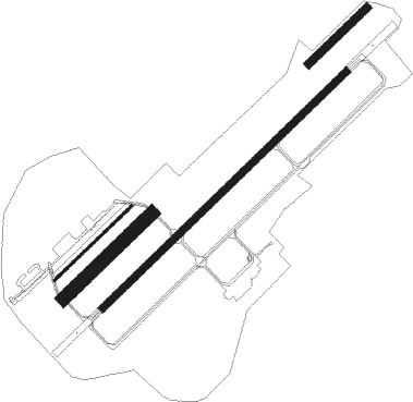
Runway info
Runway 05C / 23C  | ||
| length | 758m (2487ft) | |
| bearing | 62° / 242° | |
| width | 80m (262ft) | |
| surface | grass | |
| Runway 05L / 23R | ||
| length | 661m (2169ft) | |
| bearing | 62° / 242° | |
| width | 18m (59ft) | |
| surface | asphalt | |
| Runway 05 / 23 | ||
| length | 501m (1644ft) | |
| bearing | 61° / 241° | |
| width | 50m (164ft) | |
| surface | grass | |
| Runway 05R / 23L | ||
| length | 2102m (6896ft) | |
| bearing | 61° / 241° | |
| width | 45m (148ft) | |
| surface | asphalt | |
Nearby beacons
| code | identifier | dist | bearing | frequency |
|---|---|---|---|---|
| ETN | ETAIN NDB | 14.3 | 317° | 410 |
| LOU | LORRAINE NDB | 16 | 94° | 388 |
| MTZ | METZ NDB | 20.3 | 54° | 354 |
| NAY | NANCY OCHEY TACAN | 26.6 | 169° | 116.80 |
| WLU | LUXEMBOURG NDB | 33.5 | 19° | 346 |
| GTQ | GROSTENQUIN VOR/DME | 33.6 | 93° | 111.25 |
| MMD | MONTMEDY VOR | 36.4 | 296° | 109.40 |
| LW | LUXEMBOURG NDB | 37.3 | 28° | 404 |
| LUX | LUXEMBOURG VOR/DME | 39.8 | 32° | 112.25 |
| LE | LUXEMBOURG NDB | 39.9 | 32° | 318 |
| EPL | EPINAL MIRECOURT VOR | 43 | 165° | 113 |
| EMT | EPINAL NDB | 43.5 | 155° | 419 |
| ELU | LUXEMBOURG NDB | 43.8 | 37° | 368 |
| SDI | SAINT DIZIER ROBINSON TACAN | 45 | 248° | 114 |
| DIK | DIEKIRCH NDB | 51.3 | 18° | 307 |
| SPA | SPANGDAHLEM TACAN | 65.9 | 41° | 109.50 |
Instrument approach procedures
| runway | airway (heading) | route (dist, bearing) |
|---|---|---|
| RWNVA | JY400 (135°) | JY400 2600ft JY402 (6mi, 93°) JY404 (9mi, 93°) IJY23 (4mi, 165°) 2600ft |
| RWNVA | MTZ (234°) | MTZ 5000ft JY404 (8mi, 243°) IJY23 (4mi, 165°) 2600ft |
| RNAV | IJY23 2600ft FJY23 (4mi, 242°) 2600ft LFJY (6mi, 243°) 912ft JY420 (2mi, 234°) JY400 (14mi, 322°) 2600ft |
Disclaimer
The information on this website is not for real aviation. Use this data with the X-Plane flight simulator only! Data taken with kind consent from X-Plane 12 source code and data files. Content is subject to change without notice.