Saint Jean En Royans
Airport details
| Country | France |
| State | Auvergne-Rhône-Alpes |
| Region | LF |
| Airspace | Marseille Ctr |
| Municipality | Saint-Jean-en-Royans |
| Elevation | 872ft (266m) |
| Timezone | GMT +1 |
| Coordinates | 45.02639, 5.30917 |
| Magnetic var | |
| Type | land |
| Available since | X-Plane v10.40 |
| ICAO code | LFKE |
| IATA code | n/a |
| FAA code | n/a |
Communication
| Saint Jean en Royans CTAF | 123.500 |
Nearby Points of Interest:
Abbey of Saint-Antoine-l'Abbaye
-Château de Quincivet
-Hôtel Thomé
-Hôtel du Puy de Peyrins
-abbaye de Vernaison
-jardin zen d'Erik Borja
-Altars for bull offers
-Remparts de Die
-Ferme des Bonnettes
-Cartoucherie de Bourg-lès-Valence
-Clos Genest
-Maison Dupré-Latour
-Pendentif de Valence
-Valence city hall
-Alpexpo
-borne milliaire de Saillans
-Garage hélicoïdal de Grenoble
-Bibliothèque municipale de Grenoble
-Palais du parlement du Dauphiné
-Isère prefecture (building)
-Hôtel de François Marc
-Town hall of Grenoble
-Vauban powder magazine in Grenoble
-Puits de Rioux
-Prieuré de Manthes
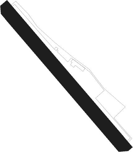
Runway info
| Runway 14 / 32 | ||
| length | 668m (2192ft) | |
| bearing | 134° / 314° | |
| width | 50m (164ft) | |
| surface | grass | |
| displ threshold | 60m (197ft) / 0m (0ft) | |
Nearby beacons
| code | identifier | dist | bearing | frequency |
|---|---|---|---|---|
| VE | VALENCE NDB | 18.4 | 243° | 320 |
| EG | GRENOBLE NDB | 20.5 | 15° | 397 |
| WS | GRENOBLE NDB | 21.2 | 335° | 291 |
| LTP | LA TOUR DU PIN VOR/DME | 28.3 | 16° | 115.55 |
| MTL | MONTELIMAR ANCONE VOR/DME | 36.2 | 228° | 113.65 |
| VNE | VIENNE REVENTIN VOR | 36.5 | 321° | 108.20 |
| BR | LYON-BRON NDB | 37.8 | 332° | 388 |
| CH | CHAMBERY NDB | 41.7 | 45° | 346 |
| LSE | LYON SAINT EXUPERY VOR/DME | 44.1 | 343° | 114.75 |
| CBY | CHAMBERY VOR/DME | 54.7 | 28° | 115.40 |
| ORG | ORANGE NDB | 56.3 | 207° | 328 |
| ORG | ORANGE TACAN | 56.5 | 207° | 109.40 |
| AT | ANNECY NDB | 58.4 | 40° | 384 |
| SCL | SAINT CHRISTOL NDB | 59.1 | 169° | 348 |
Disclaimer
The information on this website is not for real aviation. Use this data with the X-Plane flight simulator only! Data taken with kind consent from X-Plane 12 source code and data files. Content is subject to change without notice.