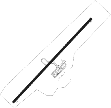
Figari Sud-corse - Figari Sud Corse
Airport details
| Country | France |
| State | Corsica |
| Region | LF |
| Airspace | Marseille Ctr |
| Municipality | Figari |
| Elevation | 85ft (26m) |
| Timezone | GMT +1 |
| Coordinates | 41.50214, 9.09981 |
| Magnetic var | |
| Type | land |
| Available since | X-Plane v10.40 |
| ICAO code | LFKF |
| IATA code | FSC |
| FAA code | n/a |
Communication
| Figari Sud Corse LFKF ATIS | 118.725 |
| Figari Sud Corse FIGARI Ground Control | 121.800 |
| Figari Sud Corse FIGARI Tower | 120.300 |
| Figari Sud Corse AJACCIO Approach | 121.050 |
Approach frequencies
| ILS-cat-I | RW23 | 110.5 | 18.00mi |
| 3.5° GS | RW23 | 110.5 | 18.00mi |
Nearby Points of Interest:
Citadel of Bonifacio
-U Frate è a Sora
-Église San Giovanni de Grossa
-Bibliothèque Fesch
Nearby beacons
| code | identifier | dist | bearing | frequency |
|---|---|---|---|---|
| FGI | FIGARI VOR/DME | 0.7 | 270° | 116.70 |
| FA | FIGARI NDB | 9.1 | 57° | 325 |
| AJO | AJACCIO VOR/DME | 21.7 | 310° | 114.80 |
| CT | AJACCIO NDB | 24.3 | 308° | 387 |
| RB | AJACCIO NDB | 28.1 | 324° | 365 |
| SZA | SOLENZARA NDB | 29 | 34° | 349 |
| SZA | SOLENZARA TACAN | 29.3 | 35° | 114 |
| IS | AJACCIO NDB | 32.3 | 309° | 341 |
| SME | SMERALDA (OLBIA) VOR/DME | 40.9 | 147° | 113.90 |
| BP | BASTIA NDB | 58.8 | 25° | 369 |
| AEA | ALGHERO VOR/DME | 63.4 | 223° | 111.65 |
| AHO | ALGHERO TACAN | 63.6 | 223° | 109.30 |
| ALG | ALGHERO VORTAC | 65.2 | 224° | 113.80 |
Departure and arrival routes
| Transition altitude | 5000ft |
| SID end points | distance | outbound heading | |
|---|---|---|---|
| RW05 | |||
| BTA3G | 66mi | 19° | |
| CORS3G | 16mi | 240° | |
| NEGA3G | 56mi | 266° | |
| AJO3G | 22mi | 310° | |
| RW23 | |||
| BTA3M | 66mi | 19° | |
| CORS3M | 16mi | 240° | |
| NEGA3M | 56mi | 266° | |
| URAT3M | 50mi | 295° | |
| AJO3N | 22mi | 310° | |
| STAR starting points | distance | inbound heading | |
|---|---|---|---|
| RW05 | |||
| TERE2R, TERE2G | 10.5 | 20° | |
| POUL2R, POUL2G | 25.9 | 72° | |
| NEGA2R, NEGA2G | 55.9 | 86° | |
| RUBA2R, RUBA2G | 124.6 | 109° | |
| VARE2R | 69.8 | 126° | |
| VARE2G | 21.7 | 130° | |
| LONS2R, LONS2G | 90.3 | 140° | |
| TORT2R, TORT2G | 113.4 | 176° | |
| BTA2R, BTA2G | 66.4 | 199° | |
| ASKA2R | 33.9 | 246° | |
| RW23 | |||
| TERE2M, TERE2V | 10.5 | 20° | |
| POUL2V, POUL2M | 25.9 | 72° | |
| NEGA2M, NEGA2V | 55.9 | 86° | |
| RUBA2V, RUBA2M | 124.6 | 109° | |
| VARE2M, VARE2V | 69.8 | 126° | |
| LONS2V, LONS2M | 90.3 | 140° | |
| TORT2M, TORT2V | 113.4 | 176° | |
| BTA2V, BTA2P, BTA2M, BTA2F | 66.4 | 199° | |
| ASKA2F, ASKA2V | 33.9 | 246° | |
Instrument approach procedures
| runway | airway (heading) | route (dist, bearing) |
|---|---|---|
| RW05 | GALDA (72°) | GALDA 4000ft IKF05 (3mi, 141°) 1900ft FKF05 (5mi, 69°) 1900ft |
| RNAV | FKF05 1900ft MKF05 (5mi, 40°) 319ft MASAL (13mi, 94°) 4000ft MASAL (turn) 4000ft | |
| RW23 | MASAL (277°) | MASAL 5000ft KF501 (6mi, 41°) IKF23 (8mi, 309°) 3500ft |
| RW23 | PINAL (237°) | PINAL 6000ft IKF23 (6mi, 240°) 3500ft |
| RNAV | IKF23 3500ft FKF23 (4mi, 236°) 3500ft LFKF (10mi, 235°) 134ft KF520 (4mi, 237°) MASAL (15mi, 88°) 4000ft MASAL (turn) 4000ft |
Holding patterns
| STAR name | hold at | type | turn | heading* | altitude | leg | speed limit |
|---|---|---|---|---|---|---|---|
| ASKA2F | PINAL | VHF | left | 48 (228)° | 6000ft - 9000ft | DME 5.0mi | 220 |
| ASKA2R | GALDA | VHF | right | 345 (165)° | 5000ft - 8000ft | DME 3.0mi | 220 |
| ASKA2V | MASAL | VHF | right | 277 (97)° | 5000ft - 8000ft | DME 3.0mi | 220 |
| ASKA2V | PINAL | VHF | left | 48 (228)° | 6000ft - 9000ft | DME 5.0mi | 220 |
| BTA2F | PINAL | VHF | left | 48 (228)° | 6000ft - 9000ft | DME 5.0mi | 220 |
| BTA2G | GALDA | VHF | right | 345 (165)° | 5000ft - 8000ft | DME 3.0mi | 220 |
| BTA2M | MASAL | VHF | right | 277 (97)° | 5000ft - 8000ft | DME 3.0mi | 220 |
| BTA2M | PINAL | VHF | left | 48 (228)° | 6000ft - 9000ft | DME 5.0mi | 220 |
| BTA2P | PINAL | VHF | left | 48 (228)° | 6000ft - 9000ft | DME 5.0mi | 220 |
| BTA2R | GALDA | VHF | right | 345 (165)° | 5000ft - 8000ft | DME 3.0mi | 220 |
| BTA2V | MASAL | VHF | right | 277 (97)° | 5000ft - 8000ft | DME 3.0mi | 220 |
| BTA2V | PINAL | VHF | left | 48 (228)° | 6000ft - 9000ft | DME 5.0mi | 220 |
| LONS2G | GALDA | VHF | right | 345 (165)° | 5000ft - 8000ft | DME 3.0mi | 220 |
| LONS2M | MASAL | VHF | right | 277 (97)° | 5000ft - 8000ft | DME 3.0mi | 220 |
| LONS2R | GALDA | VHF | right | 345 (165)° | 5000ft - 8000ft | DME 3.0mi | 220 |
| LONS2V | MASAL | VHF | right | 277 (97)° | 5000ft - 8000ft | DME 3.0mi | 220 |
| NEGA2G | GALDA | VHF | right | 345 (165)° | 5000ft - 8000ft | DME 3.0mi | 220 |
| NEGA2M | MASAL | VHF | right | 277 (97)° | 5000ft - 8000ft | DME 3.0mi | 220 |
| NEGA2R | GALDA | VHF | right | 345 (165)° | 5000ft - 8000ft | DME 3.0mi | 220 |
| NEGA2V | MASAL | VHF | right | 277 (97)° | 5000ft - 8000ft | DME 3.0mi | 220 |
| POUL2G | GALDA | VHF | right | 345 (165)° | 5000ft - 8000ft | DME 3.0mi | 220 |
| POUL2M | MASAL | VHF | right | 277 (97)° | 5000ft - 8000ft | DME 3.0mi | 220 |
| POUL2R | GALDA | VHF | right | 345 (165)° | 5000ft - 8000ft | DME 3.0mi | 220 |
| POUL2V | MASAL | VHF | right | 277 (97)° | 5000ft - 8000ft | DME 3.0mi | 220 |
| RUBA2G | GALDA | VHF | right | 345 (165)° | 5000ft - 8000ft | DME 3.0mi | 220 |
| RUBA2M | MASAL | VHF | right | 277 (97)° | 5000ft - 8000ft | DME 3.0mi | 220 |
| RUBA2R | GALDA | VHF | right | 345 (165)° | 5000ft - 8000ft | DME 3.0mi | 220 |
| RUBA2V | MASAL | VHF | right | 277 (97)° | 5000ft - 8000ft | DME 3.0mi | 220 |
| TERE2G | GALDA | VHF | right | 345 (165)° | 5000ft - 8000ft | DME 3.0mi | 220 |
| TERE2M | MASAL | VHF | right | 277 (97)° | 5000ft - 8000ft | DME 3.0mi | 220 |
| TERE2R | GALDA | VHF | right | 345 (165)° | 5000ft - 8000ft | DME 3.0mi | 220 |
| TERE2V | MASAL | VHF | right | 277 (97)° | 5000ft - 8000ft | DME 3.0mi | 220 |
| TORT2G | GALDA | VHF | right | 345 (165)° | 5000ft - 8000ft | DME 3.0mi | 220 |
| TORT2M | MASAL | VHF | right | 277 (97)° | 5000ft - 8000ft | DME 3.0mi | 220 |
| TORT2R | GALDA | VHF | right | 345 (165)° | 5000ft - 8000ft | DME 3.0mi | 220 |
| TORT2V | MASAL | VHF | right | 277 (97)° | 5000ft - 8000ft | DME 3.0mi | 220 |
| VARE2G | GALDA | VHF | right | 345 (165)° | 5000ft - 8000ft | DME 3.0mi | 220 |
| VARE2M | MASAL | VHF | right | 277 (97)° | 5000ft - 8000ft | DME 3.0mi | 220 |
| VARE2R | GALDA | VHF | right | 345 (165)° | 5000ft - 8000ft | DME 3.0mi | 220 |
| VARE2V | MASAL | VHF | right | 277 (97)° | 5000ft - 8000ft | DME 3.0mi | 220 |
| *) magnetic outbound (inbound) holding course | |||||||
Disclaimer
The information on this website is not for real aviation. Use this data with the X-Plane flight simulator only! Data taken with kind consent from X-Plane 12 source code and data files. Content is subject to change without notice.