Bourges
Airport details
| Country | France |
| State | Centre-Val de Loire |
| Region | LF |
| Airspace | Paris Ctr |
| Municipality | Bourges |
| Elevation | 526ft (160m) |
| Timezone | GMT +1 |
| Coordinates | 47.06083, 2.37000 |
| Magnetic var | |
| Type | land |
| Available since | X-Plane v10.40 |
| ICAO code | LFLD |
| IATA code | BOU |
| FAA code | n/a |
Communication
| Bourges INFO | 119.600 |
Nearby Points of Interest:
Bourges, Lycée Marguerite de Navarre
-Halle au blé de Bourges
-Prefecture hotel of Cher
-Portail Saint-Ursin
-hotel de panette - un chateau en ville
-Palais archiépiscopal de Bourges
-Hôtel-Dieu de Bourges
-abbaye Saint-Ambroix de Bourges
-Remparts gallo-romains de Bourges
-Collège des Jésuites de Bourges
-Couvent des Augustins de Bourges
-Église Saint-Amand de Saint-Denis-de-Palin
-Château de Dun-sur-Auron
-Porte de Dun-sur-Auron
-Fortifications de Dun-sur-Auron
-Château de Maupas
-Abbaye Saint-Martin de Massay
-Église Saint-Martin de Vallenay
-Buildings by ceramist Jean Linard
-Église Saint-Denis de Condé
-Nançay Radio Telescope
-Maison forte de Mornay
-site antique de Drevant
-Pont-canal de la Tranchasse
-Pont-canal de la Croix
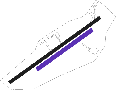
Runway info
Runway 06 / 24  | ||
| length | 1547m (5075ft) | |
| bearing | 68° / 248° | |
| width | 45m (148ft) | |
| surface | concrete | |
| displ threshold | 0m (0ft) / 130m (427ft) | |
| blast zone | 0m (0ft) / 150m (492ft) | |
| Runway 06R / 24L | ||
| length | 916m (3005ft) | |
| bearing | 68° / 248° | |
| width | 60m (197ft) | |
| surface | grass | |
Nearby beacons
| code | identifier | dist | bearing | frequency |
|---|---|---|---|---|
| BRG | BOURGES NDB | 4.4 | 244° | 375 |
| AVD | AVORD TACAN | 10.6 | 91° | 110.60 |
| AVD | AVORD NDB | 17.9 | 82° | 288 |
| NEV | NEVERS VOR | 23.5 | 81° | 113.40 |
| CTX | CHATEAUROUX DEOLS NDB | 24.4 | 258° | 428 |
| AV | AVORD NDB | 25.3 | 108° | 306 |
| NV | NEVERS NDB | 34.1 | 97° | 394 |
| LPD | MONTLUCON-GUERET NDB | 45.5 | 182° | 398 |
| ORS | ORLEANS SAINT DENIS DE L'HOTEL NDB | 52.8 | 352° | 322 |
| BCY | ORLEANS VOR/DME | 60.8 | 326° | 117.35 |
| OAN | ORLEANS-BRICY NDB | 61.5 | 327° | 385 |
| CAD | CHATEAUDUN VOR/DME | 71.9 | 315° | 115.95 |
| CHN | CHATEAUDUN TACAN | 72 | 315° | 110.20 |
Instrument approach procedures
| runway | airway (heading) | route (dist, bearing) |
|---|---|---|
| RW06-Y | DEXEV (67°) | DEXEV 2100ft |
| RW06-Y | NAPSU (85°) | NAPSU 2100ft DEXEV (4mi, 139°) 2100ft |
| RW06-Y | SITSA (53°) | SITSA 2100ft DEXEV (4mi, 0°) 2100ft |
| RNAV | DEXEV 2100ft FLD06 (4mi, 67°) 2100ft LFLD (5mi, 67°) 578ft NAPSU (10mi, 265°) 2100ft DEXEV (4mi, 139°) | |
| RW06-Z | DEXEV (67°) | DEXEV 2100ft |
| RW06-Z | NAPSU (85°) | NAPSU 2100ft DEXEV (4mi, 139°) 2100ft |
| RW06-Z | SITSA (53°) | SITSA 2100ft DEXEV (4mi, 0°) 2100ft |
| RNAV | DEXEV 2100ft FLD06 (4mi, 67°) 2100ft LFLD (5mi, 67°) 578ft LD409 (turn) NAPSU (10mi, 264°) 2100ft DEXEV (4mi, 139°) |
Disclaimer
The information on this website is not for real aviation. Use this data with the X-Plane flight simulator only! Data taken with kind consent from X-Plane 12 source code and data files. Content is subject to change without notice.