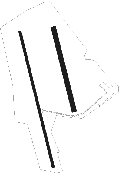
Chalon/champforgueil - Chalon Champforgueil
Airport details
| Country | France |
| State | Bourgogne-Franche-Comté |
| Region | LF |
| Airspace | Reims Ctr |
| Municipality | Fragnes-la-Loyère |
| Elevation | 623ft (190m) |
| Timezone | GMT +1 |
| Coordinates | 46.82560, 4.82683 |
| Magnetic var | |
| Type | land |
| Available since | X-Plane v10.40 |
| ICAO code | LFLH |
| IATA code | XCD |
| FAA code | n/a |
Communication
| Chalon Champforgueil CHALON INFO | 118.600 |
Nearby Points of Interest:
Pont de la Thalie
-Hôtel de sous-préfecture de Chalon-sur-Saône
-Hôtel de Sassenay (Chalon-sur-Saône)
-Palais épiscopal de Chalon-sur-Saône
-Abbaye Saint-Pierre de Chalon-sur-Saône
-Atelier de stuc Benoît
-Hôtel de Colmont-Fusselet
-Bureau des coches et des diligences
-Hôpital de Chalon-sur-Saône
-Hôtel de ville de Givry
-Domaine Besson
-Chapelle Saint-Michel du Meix-Saint-Michel
-Chalet d'Agneux
-Château de Gergy
-Église Saint-Martin de Granges
-Presbytère de Barizey
-Église Notre-Dame-de-l'Assomption (Puligny-Montrachet)
-La Ferté Abbey
-Léproserie de Meursault
-Triptych of the Virgin (Auxey-Duresses)
-Maison des Templiers de Couches
-Halles de Nolay (Côte-d'Or)
-Porche des Antonins
-Église de Saint-Romain, Côte-d'Or
-Hospices de Beaune
Nearby beacons
| code | identifier | dist | bearing | frequency |
|---|---|---|---|---|
| CC | CHAMPFORGEUIL NDB | 6.3 | 171° | 391 |
| DO | DOLE NDB | 21.6 | 72° | 309 |
| DJL | DIJON LONGVIC VOR/DME | 28.9 | 31° | 111.45 |
| SN | SAINT YAN NDB | 43.2 | 233° | 430 |
| RNN | ROANNE NDB | 53.8 | 228° | 358 |
| ROA | ROANNE VOR | 57.3 | 227° | 110.25 |
| CBY | CHAMBERY VOR/DME | 68.5 | 135° | 115.40 |
Instrument approach procedures
| runway | airway (heading) | route (dist, bearing) |
|---|---|---|
| RW35 | LH401 (310°) | LH401 3000ft ILH35 (3mi, 241°) 3000ft |
| RW35 | LH403 (351°) | LH403 3000ft LH502 (3mi, 61°) 3000ft LH401 (5mi, 130°) 3000ft ILH35 (3mi, 241°) 3000ft |
| RNAV | ILH35 3000ft FLH35 (5mi, 310°) 2800ft LFLH (6mi, 351°) 657ft LH501 (2mi, 331°) LH502 (7mi, 135°) 3000ft LH401 (5mi, 130°) 3000ft |
Disclaimer
The information on this website is not for real aviation. Use this data with the X-Plane flight simulator only! Data taken with kind consent from X-Plane 12 source code and data files. Content is subject to change without notice.

