Courcheval - Courchevel
Airport details
| Country | France |
| State | Auvergne-Rhône-Alpes |
| Region | LF |
| Airspace | Marseille Ctr |
| Municipality | Courchevel |
| Elevation | 6583ft (2006m) |
| Timezone | GMT +1 |
| Coordinates | 45.39583, 6.63250 |
| Magnetic var | |
| Type | land |
| Available since | X-Plane v10.40 |
| ICAO code | LFLJ |
| IATA code | CVF |
| FAA code | n/a |
Communication
| Courchevel Tower | 120.075 |
| Courchevel Approach | 120.075 |
| Courchevel Departure | 120.075 |
Nearby Points of Interest:
Termignon war memorial
-Bardonecchia - Val Fredda
-chaire à prêcher à Beaufort
-Pont Royal de Chamousset
-Pian della Mussa
-Pont Morens
-Hôtel Nicolle de La Place
-Manoir de la Tour
-Centro di documentazione sulla resistenza
-Châtel de Theys
-Mont Blanc massif
-Maison de Mosse
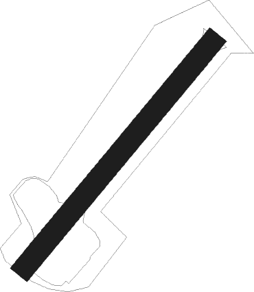
Runway info
| Runway 04 / 22 | ||
| length | 538m (1765ft) | |
| bearing | 54° / 234° | |
| width | 40m (131ft) | |
| surface | ||
Nearby beacons
| code | identifier | dist | bearing | frequency |
|---|---|---|---|---|
| CH | CHAMBERY NDB | 33.6 | 285° | 346 |
| SCS | AOSTA VOR/DME | 36.3 | 64° | 109.25 |
| AT | ANNECY NDB | 37.9 | 307° | 384 |
| CBY | CHAMBERY VOR/DME | 46.9 | 299° | 115.40 |
| PAS | PASSEIRY VOR/DME | 53.1 | 321° | 116.60 |
| GVA | GENEVA VOR/DME | 55.6 | 330° | 115.75 |
| SIO | SION VOR/DME | 56.3 | 39° | 112.15 |
| LEV | CUNEO NDB | 66 | 131° | 371 |
Disclaimer
The information on this website is not for real aviation. Use this data with the X-Plane flight simulator only! Data taken with kind consent from X-Plane 12 source code and data files. Content is subject to change without notice.