Annecy/meythet - Annecy Meythet
Airport details
| Country | France |
| State | Auvergne-Rhône-Alpes |
| Region | LF |
| Airspace | Marseille Ctr |
| Municipality | Épagny Metz-Tessy |
| Elevation | 1520ft (463m) |
| Timezone | GMT +1 |
| Coordinates | 45.93077, 6.10629 |
| Magnetic var | |
| Type | land |
| Available since | X-Plane v10.32 |
| ICAO code | LFLP |
| IATA code | NCY |
| FAA code | n/a |
Communication
| Annecy Meythet ANNECY Tower | 118.200 |
| Annecy Meythet CHAMBERY Approach | 123.700 |
| Annecy Meythet ANNECY ApproachROACH | 121.200 |
Nearby Points of Interest:
Haras national d'Annecy
-Grand séminaire d'Annecy
-Lanterne des morts, Nonglard
-Les Marais de Saint-Jorioz
-Château de Châteauvieux
-site de Morette
-Château de La Roche-sur-Foron
-Museum of the Order of Malta
-Veyrier
-Carouge
-Onex
-Archives communales de Carouge
-Allondon
-chaîne du Bargy
-Town hall of Bellegarde-sur-Valserine
-Geneva iconography centre
-Bibliothèque d'art et d'archéologie
-Bibliothèque de Genève
-Archives de la ville de Genève
-Geneva
-Conservatoire de Musique de Genève
-place Neuve
-Archives d'État de Genève
-Tavel House
-Fonds cantonal d'art contemporain, Genève
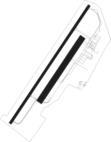
Runway info
Runway 04 / 22  | ||
| length | 1628m (5341ft) | |
| bearing | 49° / 229° | |
| width | 30m (98ft) | |
| surface | asphalt | |
| displ threshold | 269m (883ft) / 228m (748ft) | |
| Runway 4C / 22C | ||
| length | 848m (2782ft) | |
| bearing | 49° / 229° | |
| width | 70m (230ft) | |
| surface | grass | |
| displ threshold | 220m (722ft) / 68m (223ft) | |
Nearby beacons
| code | identifier | dist | bearing | frequency |
|---|---|---|---|---|
| AT | ANNECY NDB | 5.4 | 231° | 384 |
| PAS | PASSEIRY VOR/DME | 14.6 | 335° | 116.60 |
| CBY | CHAMBERY VOR/DME | 14.8 | 262° | 115.40 |
| GVA | GENEVA VOR/DME | 19.4 | 5° | 115.75 |
| CH | CHAMBERY NDB | 22.3 | 213° | 346 |
| GLA | GLAND NDB | 29.2 | 16° | 375 |
| SPR | ST PREX VOR/DME | 35.2 | 32° | 113.90 |
| LTP | LA TOUR DU PIN VOR/DME | 38.5 | 236° | 115.55 |
| EG | GRENOBLE NDB | 45.2 | 231° | 397 |
| LAP | PRAZ DME | 46.5 | 22° | 110.65 |
| WS | GRENOBLE NDB | 52.6 | 239° | 291 |
Departure and arrival routes
| Transition altitude | 6500ft |
| SID end points | distance | outbound heading | |
|---|---|---|---|
| RW22 | |||
| VENA8A, VENA8B | 28mi | 57° | |
| ROMA8B, ROMA8A | 64mi | 229° | |
| LTP8A, LTP8B | 39mi | 236° | |
| MURO8B, MURO8A | 81mi | 251° | |
| MEBA8A, MEBA8B | 62mi | 261° | |
| PIRU8A | 18mi | 262° | |
| DANB8B, DANB8A | 44mi | 270° | |
| MOKI8B, MOKI8A | 52mi | 297° | |
| PAS8A, PAS8B | 15mi | 335° | |
| STAR starting points | distance | inbound heading | |
|---|---|---|---|
| ALL | |||
| AMVA1P | 36.7 | 16° | |
| PINE1P | 61.0 | 32° | |
| ROMA1P | 63.6 | 49° | |
| LTP1A | 38.5 | 56° | |
| MURO1P | 81.0 | 71° | |
| MEBA1P | 62.4 | 81° | |
| OMAN1P | 102.2 | 103° | |
Instrument approach procedures
| runway | airway (heading) | route (dist, bearing) |
|---|---|---|
| RW04-Y | AT (51°) | AT LP409 (5mi, 262°) 5500ft LP408 (3mi, 229°) 5000ft IP04Y (3mi, 119°) 4500ft |
| RNAV | IP04Y 4500ft FP04Y (4mi, 49°) 4500ft LFLP (9mi, 50°) 1538ft LP411 (4mi, 46°) LP412 (5mi, 245°) 5000ft AT (5mi, 210°) 6500ft AT (turn) | |
| RW04-Z | COLLO (93°) | COLLO LP405 (4mi, 175°) LP402 (3mi, 131°) 5000ft IP04Z (3mi, 119°) 3900ft |
| RW04-Z | PIRUV (82°) | PIRUV LP403 (4mi, 96°) 6500ft LP402 (5mi, 98°) 5000ft IP04Z (3mi, 119°) 3900ft |
| RW04-Z | TOLNA (49°) | TOLNA LP404 (4mi, 49°) 6500ft IP04Z (6mi, 49°) 3900ft |
| RNAV | IP04Z 3900ft FP04Z (4mi, 49°) 3500ft LFLP (6mi, 51°) 1538ft LP411 (4mi, 46°) LP412 (5mi, 245°) 5000ft AT (5mi, 210°) 6500ft AT (turn) |
Holding patterns
| STAR name | hold at | type | turn | heading* | altitude | leg | speed limit |
|---|---|---|---|---|---|---|---|
| AMVA1P | GOMET | VHF | left | 163 (343)° | 10000ft - 14000ft | DME 5.0mi | 230 |
| AMVA1P | PIRUV | VHF | right | 277 (97)° | 6500ft - 9000ft | DME 4.0mi | 210 |
| MEBA1P | PIRUV | VHF | right | 277 (97)° | 6500ft - 9000ft | DME 4.0mi | 210 |
| MURO1P | PIRUV | VHF | right | 277 (97)° | 6500ft - 9000ft | DME 4.0mi | 210 |
| OMAN1P | PIRUV | VHF | right | 277 (97)° | 6500ft - 9000ft | DME 4.0mi | 210 |
| OMAN1P | RIPTU | VHF | right | 24 (204)° | 7000ft - 14000ft | 1.0min timed | 220 |
| PINE1P | GOMET | VHF | left | 163 (343)° | 10000ft - 14000ft | DME 5.0mi | 230 |
| PINE1P | PIRUV | VHF | right | 277 (97)° | 6500ft - 9000ft | DME 4.0mi | 210 |
| ROMA1P | PIRUV | VHF | right | 277 (97)° | 6500ft - 9000ft | DME 4.0mi | 210 |
| SALE1A | AT | VHF | right | 329 (149)° | 19500ft - 50000ft | 1.5min timed | ICAO rules |
| SALE1P | PIRUV | VHF | right | 277 (97)° | 6500ft - 9000ft | DME 4.0mi | 210 |
| SALE1Q | OSRIM | VHF | right | 59 (239)° | 7100ft - 11000ft | DME 4.1mi | 210 |
| SALE1Q | PIRUV | VHF | right | 277 (97)° | 6500ft - 9000ft | DME 4.0mi | 210 |
| *) magnetic outbound (inbound) holding course | |||||||
Disclaimer
The information on this website is not for real aviation. Use this data with the X-Plane flight simulator only! Data taken with kind consent from X-Plane 12 source code and data files. Content is subject to change without notice.