Domérat - Montlucon Domerat
Airport details
| Country | France |
| State | Auvergne-Rhône-Alpes |
| Region | LF |
| Airspace | Bordeaux Ctr |
| Municipality | Domérat |
| Elevation | 770ft (235m) |
| Timezone | GMT +1 |
| Coordinates | 46.35278, 2.57056 |
| Magnetic var | |
| Type | land |
| Available since | X-Plane v10.40 |
| ICAO code | LFLT |
| IATA code | MCU |
| FAA code | n/a |
Communication
| Montlucon Domerat CTAF | 123.500 |
| Montlucon Domerat Twr | 123.500 |
| Montlucon Domerat Dep | 123.500 |
Nearby Points of Interest:
Lanterne des Morts d'Estivareilles
-Gare de Néris-les-Bains
-Casino de Néris-les-Bains
-Néris-les-Bains amphitheatre
-Établissement thermal de Néris-les-Bains
-Chapelle Saint-Rémy de Saint-Sauvier
-Abbaye de Bussières-les-Nonains
-thermes romains d'Évaux-les-Bains
-Commanderie de Lavaufranche
-menhirs de Barbouly
-Abbaye de Bonlieu
-Pont-canal de la Croix
-Pont-canal de la Tranchasse
-Prieuré Saint-Étienne de Châteaumeillant
-Maison Grégueil
-Abbaye Saint-Ménelée
-site antique de Drevant
-pigeonnier-chapelle de La Chaze
-Maison de Charles IX
-Abbaye des Ternes
-Hôtel Calemard
-Château de Saint-Maixant
-Prieuré de Saint-Maurice
-Église Saint-Martin de Vallenay
-Château de La Châtre
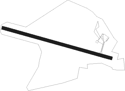
Runway info
| Runway 11 / 29 | ||
| length | 1001m (3284ft) | |
| bearing | 104° / 284° | |
| width | 30m (98ft) | |
| surface | asphalt | |
Nearby beacons
| code | identifier | dist | bearing | frequency |
|---|---|---|---|---|
| LPD | MONTLUCON-GUERET NDB | 10.1 | 258° | 398 |
| AV | AVORD NDB | 35 | 34° | 306 |
| VZ | VICHY NDB | 36.8 | 105° | 403 |
| BRG | BOURGES NDB | 41.6 | 337° | 375 |
| AVD | AVORD TACAN | 42.4 | 5° | 110.60 |
| CFA | CLERMONT FERRAND AUVERGNE VOR/DME | 42.7 | 132° | 114.35 |
| NV | NEVERS NDB | 44.3 | 46° | 394 |
| ASM | CLERMONT-FERRAND/AUVERGNE NDB | 46.5 | 125° | 367 |
| AVD | AVORD NDB | 47 | 17° | 288 |
| CTX | CHATEAUROUX DEOLS NDB | 47.2 | 307° | 428 |
| TIS | THIERS VOR/DME | 49.7 | 116° | 117.50 |
| NEV | NEVERS VOR | 50.2 | 24° | 113.40 |
Disclaimer
The information on this website is not for real aviation. Use this data with the X-Plane flight simulator only! Data taken with kind consent from X-Plane 12 source code and data files. Content is subject to change without notice.