Chabeuil - Valence Chabeuil
Airport details
| Country | France |
| State | Auvergne-Rhône-Alpes |
| Region | LF |
| Airspace | Marseille Ctr |
| Municipality | Chabeuil |
| Elevation | 522ft (159m) |
| Timezone | GMT +1 |
| Coordinates | 44.91752, 4.96707 |
| Magnetic var | |
| Type | land |
| Available since | X-Plane v10.40 |
| ICAO code | LFLU |
| IATA code | VAF |
| FAA code | n/a |
Communication
| Valence Chabeuil CTAF | 120.100 |
| Valence Chabeuil Twr | 120.100 |
| Valence Chabeuil LYON Approach | 136.075 |
| Valence Chabeuil Dep | 120.100 |
Nearby Points of Interest:
Clos Genest
-Cartoucherie de Bourg-lès-Valence
-Maison Dupré-Latour
-Pendentif de Valence
-Valence city hall
-murailles romaines de Toulaud
-abbaye de Vernaison
-jardin zen d'Erik Borja
-Hôtel du Puy de Peyrins
-Hôtel Thomé
-Fonderie de La Voulte-sur-Rhône
-viaduc de La Voulte
-Autel de Saint-Jean-de-Muzols
-Pont Grand
-poterie de Cliousclat
-Auberge La Cardinale
-borne milliaire de Saillans
-Porte de Besse
-Colonne solaire du Balayn
-Bornes milliaires de Cruas
-Abbey of Saint-Antoine-l'Abbaye
-Hôtel de Diane de Poitiers
-Altars for bull offers
-Remparts de Die
-Pont de Moulin sur Cance
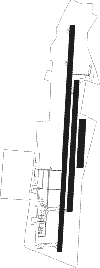
Runway info
Runway 01 / 19  | ||
| length | 2102m (6896ft) | |
| bearing | 11° / 191° | |
| width | 45m (148ft) | |
| surface | asphalt | |
| displ threshold | 255m (837ft) / 125m (410ft) | |
| blast zone | 14m (46ft) / 160m (525ft) | |
| Runway 01L / 19R | ||
| length | 1191m (3907ft) | |
| bearing | 11° / 191° | |
| width | 50m (164ft) | |
| surface | grass | |
| Runway 01R / 19L | ||
| length | 400m (1312ft) | |
| bearing | 11° / 191° | |
| width | 60m (197ft) | |
| surface | grass | |
Nearby beacons
| code | identifier | dist | bearing | frequency |
|---|---|---|---|---|
| VE | VALENCE NDB | 4.1 | 190° | 320 |
| MTL | MONTELIMAR ANCONE VOR/DME | 23.1 | 207° | 113.65 |
| WS | GRENOBLE NDB | 27.8 | 23° | 291 |
| EG | GRENOBLE NDB | 32.4 | 44° | 397 |
| VNE | VIENNE REVENTIN VOR | 38.5 | 353° | 108.20 |
| LTP | LA TOUR DU PIN VOR/DME | 39.7 | 40° | 115.55 |
| BR | LYON-BRON NDB | 41.9 | 2° | 388 |
| BO | SAINT ETIENNE NDB | 45.9 | 312° | 299 |
| ORG | ORANGE NDB | 46.5 | 188° | 328 |
| ORG | ORANGE TACAN | 46.9 | 187° | 109.40 |
| LSE | LYON SAINT EXUPERY VOR/DME | 50 | 8° | 114.75 |
| EB | SAINT ETIENNE NDB | 52 | 317° | 379 |
| CH | CHAMBERY NDB | 56 | 54° | 346 |
| AVN | AVIGNON VOR/DME | 56.1 | 193° | 114.60 |
| SCL | SAINT CHRISTOL NDB | 56.9 | 148° | 348 |
| DA | ALES CEVENNES NDB | 62.1 | 224° | 402 |
| CBY | CHAMBERY VOR/DME | 66.8 | 39° | 115.40 |
Instrument approach procedures
| runway | airway (heading) | route (dist, bearing) |
|---|---|---|
| RW01 | LARSU (10°) | LARSU 4300ft ILU01 (3mi, 11°) 3000ft |
| RW01 | VARUX (73°) | VARUX 4000ft LU405 (9mi, 191°) 3100ft ILU01 (5mi, 96°) 3000ft |
| RNAV | ILU01 3000ft FLU01 (4mi, 11°) 3000ft LFLU (8mi, 10°) 574ft LU410 (6mi, 12°) VARUX (10mi, 225°) 4000ft | |
| RWNVA | LU504 (191°) | LU504 3900ft ILU19 (3mi, 191°) 3000ft |
| RWNVA | LU520 (126°) | LU520 4000ft LU502 (9mi, 11°) 3500ft ILU19 (5mi, 96°) 3000ft |
| RNAV | ILU19 3000ft FLU19 (4mi, 191°) 3000ft LFLU (8mi, 192°) 567ft LU522 (3mi, 189°) LU520 (9mi, 324°) 4000ft |
Disclaimer
The information on this website is not for real aviation. Use this data with the X-Plane flight simulator only! Data taken with kind consent from X-Plane 12 source code and data files. Content is subject to change without notice.