Aix Les Milles
Airport details
| Country | France |
| State | Provence-Alpes-Côte d'Azur |
| Region | LF |
| Airspace | Marseille Ctr |
| Municipality | Aix-en-Provence |
| Elevation | 366ft (112m) |
| Timezone | GMT +1 |
| Coordinates | 43.50972, 5.36101 |
| Magnetic var | |
| Type | land |
| Available since | X-Plane v10.30 |
| ICAO code | LFMA |
| IATA code | QXB |
| FAA code | n/a |
Communication
| Aix Les Milles AIX ATIS | 136.225 |
| Aix Les Milles AIX Ground Control | 121.600 |
| Aix Les Milles AIX Tower | 118.750 |
| Aix Les Milles PROVENCE Approach | 131.225 |
| Aix Les Milles AIX Departure | 118.750 |
Nearby Points of Interest:
Oppidum de Pierredon à Éguilles
-Pavillon Cormis ou Enclos des Décormis
-Pavillon Vendôme
-casino municipal d'Aix-en-Provence
-Thermes romains d'Aix-en-Provence
-Hôtel de Venel
-Hôtel Peyronetti
-Immeuble, 8, place des Cardeurs
-Aix-en-Provence town hall
-Immeuble, 24 cours Mirabeau
-Mur romain
-Cloître de Saint-Sauveur d'Aix-en-Provence
-Hôtel particulier, 4 rue Clémenceau
-Hôtel de Thoron
-Hôtel Silvy
-Palace of Justice of Aix-en-Provence
-Maison, 10 rue de Montigny
-Hôtel de Roquesaule
-Hôtel de Valbelle
-Hôtel de Lacépède
-Maison, 8 rue de Lacépède
-Couvent des Jésuites
-Hôtel de Panisse
-Maison, 10 rue Félicien David
-Hôtel de Taillas
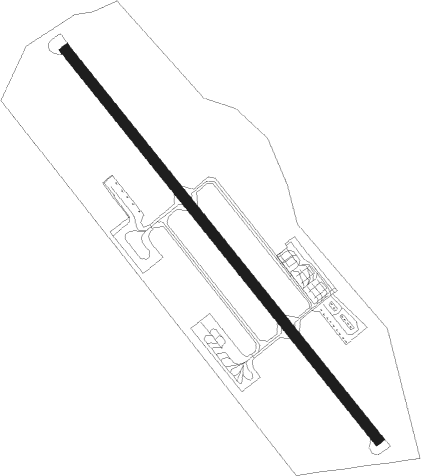
Runway info
| Runway 14 / 32 | ||
| length | 1504m (4934ft) | |
| bearing | 137° / 317° | |
| width | 30m (98ft) | |
| surface | asphalt | |
| displ threshold | 0m (0ft) / 306m (1004ft) | |
Nearby beacons
| code | identifier | dist | bearing | frequency |
|---|---|---|---|---|
| ALM | AIX LES MILLES NDB | 0.2 | 108° | 413 |
| MJ | MARSEILLE PROVENCE NDB | 7.6 | 244° | 406 |
| MRM | MARSEILLE PROVENCE VOR/DME | 8 | 195° | 108.80 |
| MS | MARSEILLE NDB | 8 | 213° | 343 |
| MAR | MARSEILLE NDB | 9.8 | 265° | 383 |
| SAL | SALON DE PROVENCE NDB | 12.8 | 291° | 334 |
| MTG | MARTIGUES VOR/DME | 14 | 246° | 117.30 |
| ITS | ISTRES LE TUBE VOR/DME | 18.3 | 269° | 112.70 |
| ITR | ISTRES LE TUBE NDB | 18.7 | 272° | 390 |
| ITR | ISTRES LE TUBE TACAN | 18.9 | 272° | 115.70 |
| OB | MARSEILLE PROVENCE NDB | 21.4 | 133° | 395 |
| MFB | BRIGNOLES NDB | 29.1 | 98° | 688 |
| CM | AVIGNON CAUMONT NDB | 31 | 311° | 369 |
| AN | CAUMONT DME-ILS | 31.2 | 311° | 110.50 |
| SCL | SAINT CHRISTOL NDB | 33 | 15° | 348 |
| NFA | CUERS NDB | 36.9 | 109° | 640 |
| AVN | AVIGNON VOR/DME | 39.5 | 308° | 114.60 |
| LUC | LE LUC LE CANNET VOR/DME | 39.7 | 98° | 113 |
| HYE | HYERES LE PALYVESTRE TACAN | 42.2 | 117° | 109 |
| DGN | DIGNE VOR | 43.2 | 57° | 113.85 |
| ORG | ORANGE TACAN | 43.4 | 322° | 109.40 |
| NG | GARONS DME-ILS | 43.7 | 285° | 109.55 |
| ORG | ORANGE NDB | 44 | 322° | 328 |
| TLN | HYERES NDB | 44.9 | 121° | 322 |
| NG | NIMES NDB | 46.4 | 290° | 354 |
Departure and arrival routes
| Transition altitude | 5000ft |
| STAR starting points | distance | inbound heading | |
|---|---|---|---|
| ALL | |||
| LANK2A, LANK2B | 33.1 | 293° | |
Holding patterns
| STAR name | hold at | type | turn | heading* | altitude | leg | speed limit |
|---|---|---|---|---|---|---|---|
| CM2A | ALM | FIX | left | 262 (82)° | 3000ft - 5000ft | 1.0min timed | 140 |
| LACA2A | ALM | FIX | left | 262 (82)° | 3000ft - 5000ft | 1.0min timed | 140 |
| LANK2A | ALM | FIX | left | 262 (82)° | 3000ft - 5000ft | 1.0min timed | 140 |
| LANK2B | ALM | FIX | left | 262 (82)° | 3000ft - 5000ft | 1.0min timed | 140 |
| *) magnetic outbound (inbound) holding course | |||||||
Disclaimer
The information on this website is not for real aviation. Use this data with the X-Plane flight simulator only! Data taken with kind consent from X-Plane 12 source code and data files. Content is subject to change without notice.