Cannes/mandelieu - Mandelieu
Airport details
| Country | France |
| State | Provence-Alpes-Côte d'Azur |
| Region | LF |
| Airspace | Marseille Ctr |
| Municipality | Mandelieu-la-Napoule |
| Elevation | 12ft (4m) |
| Timezone | GMT +1 |
| Coordinates | 43.54384, 6.95518 |
| Magnetic var | |
| Type | land |
| Available since | X-Plane v10.40 |
| ICAO code | LFMD |
| IATA code | CEQ |
| FAA code | n/a |
Communication
| Mandelieu CANNES ATIS | 130.480 |
| Mandelieu CANNES Ground Control | 121.805 |
| Mandelieu CANNES Tower | 118.625 |
| Mandelieu NICE ApproachROACH | 120.655 |
| Mandelieu NICE DepartureARTURE Tower | 118.700 |
Approach frequencies
| LOC | RW35 | 110.35 | 18.00mi |
Nearby Points of Interest:
Villa Rothschild
-Villa Victoria
-Château Vallombrosa
-tombeau de Prosper Mérimée
-Tour du Suquet
-Kiosque à musique des allées de la Liberté
-Château Thorenc
-Villa Fiorentina
-Villa Le Bosquet du Cannet
-Villa La Californie
-villa Les Lotus
-Villa Champfleuri
-Observatoire de Super-Cannes
-auberge de Super-Cannes
-Fours à boulets des îles de Lérins
-Batterie de la Convention
-Villa El Djézaïr
-Grasse Cathedral
-Hôtel Court de Fontmichel
-Villa Aujourd'hui
-temple protestant de Grasse
-Bastion Saint-André
-monument romain provenant de Biot
-Enceinte gréco-romaine d'Antibes
-Menhirs de Veyssières
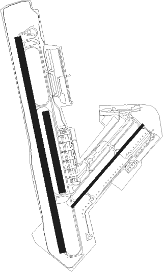
Runway info
Runway 17 / 35  | ||
| length | 1542m (5059ft) | |
| bearing | 170° / 350° | |
| width | 45m (148ft) | |
| surface | asphalt | |
| displ threshold | 121m (397ft) / 283m (928ft) | |
| blast zone | 0m (0ft) / 70m (230ft) | |
| Runway 04 / 22 | ||
| length | 770m (2526ft) | |
| bearing | 54° / 234° | |
| width | 18m (59ft) | |
| surface | asphalt | |
| displ threshold | 90m (295ft) / 29m (95ft) | |
| Runway 17L / 35R | ||
| length | 551m (1808ft) | |
| bearing | 170° / 350° | |
| width | 47m (154ft) | |
| surface | grass | |
Nearby beacons
| code | identifier | dist | bearing | frequency |
|---|---|---|---|---|
| CNM | CANNES VOR | 3.7 | 281° | 111.40 |
| CSC | MANDELIEU (CANNES) NDB | 4.1 | 103° | 385 |
| NC | NICE NDB | 8 | 75° | 338 |
| CGS | CAGNES-SUR-MER VOR/DME | 10.2 | 62° | 109.20 |
| AZR | NICE VOR/DME | 13.6 | 67° | 109.65 |
| MUS | NICE COTE D'AZUR NDB | 17.9 | 245° | 428 |
| NIZ | NICE COTE D'AZUR VOR/DME | 18.8 | 53° | 112.40 |
| LU | LE LUC NDB | 20.9 | 250° | 378 |
| STP | SAINT TROPEZ VOR/DME | 24.8 | 227° | 116.50 |
| LC | CANNET DME-ILS | 26.7 | 255° | 109.30 |
| LUC | LE LUC LE CANNET VOR/DME | 31.9 | 257° | 113 |
| NFA | CUERS NDB | 40.2 | 250° | 640 |
| MFB | BRIGNOLES NDB | 41.6 | 262° | 688 |
| HYE | HYERES LE PALYVESTRE TACAN | 44.2 | 241° | 109 |
| DGN | DIGNE VOR | 45.7 | 298° | 113.85 |
| TLN | HYERES NDB | 46.6 | 238° | 322 |
Departure and arrival routes
| Transition altitude | 5000ft |
| SID end points | distance | outbound heading | |
|---|---|---|---|
| RW04 | |||
| BASI9K | 48mi | 71° | |
| SODR9K | 70mi | 111° | |
| LONS9K | 66mi | 126° | |
| VARE9K | 87mi | 140° | |
| RUBI9K | 31mi | 239° | |
| LANK9K | 45mi | 251° | |
| TURI9K | 45mi | 251° | |
| PERU9K | 52mi | 306° | |
| BODR9K | 47mi | 319° | |
| BADO9K | 44mi | 328° | |
| OKTE9K | 59mi | 338° | |
| IRMA9K | 76mi | 353° | |
| RW17 | |||
| BASI9K | 48mi | 71° | |
| SODR9K | 70mi | 111° | |
| LONS9K | 66mi | 126° | |
| VARE9K | 87mi | 140° | |
| RUBI9K | 31mi | 239° | |
| TURI9K | 45mi | 251° | |
| LANK9K | 45mi | 251° | |
| PERU9K | 52mi | 306° | |
| BODR9K | 47mi | 319° | |
| BADO9K | 44mi | 328° | |
| OKTE9K | 59mi | 338° | |
| IRMA9K | 76mi | 353° | |
| RW22 | |||
| BASI9K | 48mi | 71° | |
| SODR9K | 70mi | 111° | |
| LONS9K | 66mi | 126° | |
| VARE9K | 87mi | 140° | |
| RUBI9K | 31mi | 239° | |
| LANK9K | 45mi | 251° | |
| TURI9K | 45mi | 251° | |
| PERU9K | 52mi | 306° | |
| BODR9K | 47mi | 319° | |
| BADO9K | 44mi | 328° | |
| OKTE9K | 59mi | 338° | |
| IRMA9K | 76mi | 353° | |
| RW35 | |||
| BASI9K | 48mi | 71° | |
| SODR9K | 70mi | 111° | |
| LONS9K | 66mi | 126° | |
| VARE9K | 87mi | 140° | |
| RUBI9K | 31mi | 239° | |
| LANK9K | 45mi | 251° | |
| TURI9K | 45mi | 251° | |
| PERU9K | 52mi | 306° | |
| BODR9K | 47mi | 319° | |
| BADO9K | 44mi | 328° | |
| OKTE9K | 59mi | 338° | |
| IRMA9K | 76mi | 353° | |
| STAR starting points | distance | inbound heading | |
|---|---|---|---|
| ALL | |||
| BIRG2D | 37.5 | 80° | |
| ABLA2A, ABLA2V | 66.1 | 88° | |
| AMFO2D | 37.2 | 93° | |
| ABDI2A, ABDI2V | 78.8 | 111° | |
| XATE2V, XATE2A | 88.3 | 112° | |
| PERU2V | 51.9 | 126° | |
| VEVA2V | 75.4 | 183° | |
| BORD2V | 44.9 | 239° | |
| OZMI2V | 54.8 | 267° | |
| KERI2V | 72.4 | 277° | |
| SODR2V | 69.6 | 291° | |
| MERL2D | 46.0 | 299° | |
| LONS2V | 65.6 | 306° | |
Instrument approach procedures
| runway | airway (heading) | route (dist, bearing) |
|---|---|---|
| RW35-Y | INLOV (284°) | INLOV 4000ft MD503 (22mi, 266°) MD504 (16mi, 276°) 3000ft OBOTA (4mi, 344°) 2000ft |
| RW35-Y | NEKIP (70°) | NEKIP MD403 (5mi, 115°) MD404 (10mi, 94°) MD405 (8mi, 68°) 3000ft OBOTA (7mi, 68°) 2000ft |
| RNAV | OBOTA 2000ft FD35Y (5mi, 344°) 2000ft MD35Y (4mi, 344°) 642ft MD410 (5mi, 117°) MD412 (9mi, 164°) MD504 (4mi, 262°) MD414 (3mi, 344°) 2000ft MD414 (turn) 2000ft | |
| RW35-Z | INLOV (284°) | INLOV 4000ft MD503 (22mi, 266°) MD504 (16mi, 276°) 3000ft BOLBA (4mi, 329°) 2000ft |
| RW35-Z | NEKIP (70°) | NEKIP MD403 (5mi, 115°) MD404 (10mi, 94°) MD405 (8mi, 68°) 3000ft BOLBA (6mi, 68°) 2000ft |
| RNAV | BOLBA 2000ft FD35Z (5mi, 350°) 2000ft MD409 (4mi, 350°) 393ft MD410 (6mi, 120°) MD412 (9mi, 164°) MD504 (4mi, 262°) MD414 (3mi, 344°) 2000ft MD414 (turn) 2000ft | |
| RWNVA | INLOV (284°) | INLOV 4000ft MD503 (22mi, 266°) MD504 (16mi, 276°) 3000ft OBOTA (4mi, 344°) 2000ft |
| RWNVA | NEKIP (70°) | NEKIP MD403 (5mi, 115°) MD404 (10mi, 94°) MD405 (8mi, 68°) 3000ft OBOTA (7mi, 68°) 2000ft |
| RNAV | OBOTA 2000ft FD17A (5mi, 344°) 2000ft MD17A (4mi, 344°) 2000ft MD410 (5mi, 117°) MD412 (9mi, 164°) MD504 (4mi, 262°) MD414 (3mi, 344°) 2000ft MD414 (turn) 2000ft |
Holding patterns
| STAR name | hold at | type | turn | heading* | altitude | leg | speed limit |
|---|---|---|---|---|---|---|---|
| ABDI2A | AMFOU | VHF | right | 315 (135)° | 20000ft - 23000ft | DME 9.0mi | 240 |
| ABDI2A | NEKIP | VHF | right | 301 (121)° | 7000ft - 11000ft | DME 5.0mi | 200 |
| ABDI2V | NEKIP | VHF | right | 301 (121)° | 7000ft - 11000ft | DME 5.0mi | 200 |
| ABLA2A | AMFOU | VHF | right | 315 (135)° | 20000ft - 23000ft | DME 9.0mi | 240 |
| ABLA2A | NEKIP | VHF | right | 301 (121)° | 7000ft - 11000ft | DME 5.0mi | 200 |
| ABLA2V | NEKIP | VHF | right | 301 (121)° | 7000ft - 11000ft | DME 5.0mi | 200 |
| AMFO2D | AMFOU | VHF | right | 315 (135)° | 20000ft - 23000ft | DME 9.0mi | 240 |
| AMFO2D | NEKIP | VHF | right | 301 (121)° | 7000ft - 11000ft | DME 5.0mi | 200 |
| BIRG2D | NEKIP | VHF | right | 301 (121)° | 7000ft - 11000ft | DME 5.0mi | 200 |
| BORD2V | AMGEL | VHF | right | 323 (143)° | 13000ft - 17000ft | 1.5min timed | 200 |
| BORD2V | INLOV | VHF | right | 124 (304)° | 4000ft - 14000ft | DME 4.0mi | 170 |
| KERI2V | INLOV | VHF | right | 124 (304)° | 4000ft - 14000ft | DME 4.0mi | 170 |
| LONS2V | INLOV | VHF | right | 124 (304)° | 4000ft - 14000ft | DME 4.0mi | 170 |
| MERL2D | INLOV | VHF | right | 124 (304)° | 4000ft - 14000ft | DME 4.0mi | 170 |
| OZMI2V | INLOV | VHF | right | 124 (304)° | 4000ft - 14000ft | DME 4.0mi | 170 |
| PERU2V | AMFOU | VHF | right | 315 (135)° | 20000ft - 23000ft | DME 9.0mi | 240 |
| PERU2V | NEKIP | VHF | right | 301 (121)° | 7000ft - 11000ft | DME 5.0mi | 200 |
| SODR2V | INLOV | VHF | right | 124 (304)° | 4000ft - 14000ft | DME 4.0mi | 170 |
| VEVA2V | AMGEL | VHF | right | 323 (143)° | 13000ft - 17000ft | 1.5min timed | 200 |
| VEVA2V | INLOV | VHF | right | 124 (304)° | 4000ft - 14000ft | DME 4.0mi | 170 |
| XATE2A | AMFOU | VHF | right | 315 (135)° | 20000ft - 23000ft | DME 9.0mi | 240 |
| XATE2A | NEKIP | VHF | right | 301 (121)° | 7000ft - 11000ft | DME 5.0mi | 200 |
| XATE2V | NEKIP | VHF | right | 301 (121)° | 7000ft - 11000ft | DME 5.0mi | 200 |
| *) magnetic outbound (inbound) holding course | |||||||
Disclaimer
The information on this website is not for real aviation. Use this data with the X-Plane flight simulator only! Data taken with kind consent from X-Plane 12 source code and data files. Content is subject to change without notice.