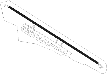
Le Castellet
Airport details
| Country | France |
| State | Provence-Alpes-Côte d'Azur |
| Region | LF |
| Airspace | Marseille Ctr |
| Municipality | Le Castellet |
| Elevation | 1391ft (424m) |
| Timezone | GMT +1 |
| Coordinates | 43.25222, 5.78611 |
| Magnetic var | |
| Type | land |
| Available since | X-Plane v10.40 |
| ICAO code | LFMQ |
| IATA code | CTT |
| FAA code | n/a |
Communication
| Le Castellet LFMQ AFIS | 119.000 |
| Le Castellet PROVENCE Approach | 120.200 |
| Le Castellet Dep | 119.000 |
Nearby Points of Interest:
Oratoire des Béguines
-Heritage House
-Bastide Marin
-Hôtel de Grimaldi-Régusse
-Monument aux morts de la Première Guerre mondiale, Toulon
-Hôpital Chalucet et jardin Alexandre Ier
-Comédie de Toulon
-Pont basculant de la Seyne-sur-Mer
-Corderie de Toulon
-Porte de l'Arsenal - Musée de la Marine
-Ancien hôtel de ville de Toulon
-Monument aux Morts de la Légion étrangère
-Ancienne synagogue de Trets
-Couvent des Dominicains de Saint-Maximin-la-Sainte-Baume
-Villa mauresque
-French submarine Alose
-Porte Saint-Paul, Hyères
-Porte de Fenouillet, Hyères
-Villa tunisienne
-Dellor mansion
-hotel du parc
-Pavillon de partage des eaux des Chutes-Lavie
-Le Plantier de Costebelle
-immeuble, 55 boulevard Rodocanachi
-Maison Gaston Castel
Nearby beacons
| code | identifier | dist | bearing | frequency |
|---|---|---|---|---|
| OB | MARSEILLE PROVENCE NDB | 5.4 | 259° | 395 |
| MFB | BRIGNOLES NDB | 14 | 55° | 688 |
| NFA | CUERS NDB | 14.9 | 91° | 640 |
| HYE | HYERES LE PALYVESTRE TACAN | 18.2 | 113° | 109 |
| TLN | HYERES NDB | 20.7 | 121° | 322 |
| MRM | MARSEILLE PROVENCE VOR/DME | 21.4 | 285° | 108.80 |
| LUC | LE LUC LE CANNET VOR/DME | 21.9 | 74° | 113 |
| MS | MARSEILLE NDB | 23.4 | 285° | 343 |
| ALM | AIX LES MILLES NDB | 23.8 | 301° | 413 |
| LC | CANNET DME-ILS | 27.2 | 77° | 109.30 |
| MJ | MARSEILLE PROVENCE NDB | 27.2 | 288° | 406 |
| MTG | MARTIGUES VOR/DME | 31.5 | 281° | 117.30 |
| MAR | MARSEILLE NDB | 31.7 | 290° | 383 |
| LU | LE LUC NDB | 33.2 | 80° | 378 |
| STP | SAINT TROPEZ VOR/DME | 35.7 | 92° | 116.50 |
| MUS | NICE COTE D'AZUR NDB | 36.7 | 81° | 428 |
| SAL | SALON DE PROVENCE NDB | 36.8 | 298° | 334 |
| ITS | ISTRES LE TUBE VOR/DME | 39.8 | 286° | 112.70 |
| ITR | ISTRES LE TUBE NDB | 40.8 | 288° | 390 |
| ITR | ISTRES LE TUBE TACAN | 40.9 | 288° | 115.70 |
| DGN | DIGNE VOR | 46.4 | 23° | 113.85 |
| SCL | SAINT CHRISTOL NDB | 49.5 | 341° | 348 |
| CM | AVIGNON CAUMONT NDB | 54.9 | 307° | 369 |
| AN | CAUMONT DME-ILS | 55.1 | 307° | 110.50 |
| ORG | ORANGE TACAN | 66.5 | 314° | 109.40 |
| ORG | ORANGE NDB | 67.1 | 314° | 328 |
Departure and arrival routes
| Transition altitude | 5000ft |
| SID end points | distance | outbound heading | |
|---|---|---|---|
| RW12 | |||
| NASI2S | 24mi | 70° | |
| LUC2S | 22mi | 74° | |
| MTG2S | 32mi | 281° | |
| MTL2S | 90mi | 322° | |
| RW30 | |||
| NASI2N | 24mi | 70° | |
| LUC2N | 22mi | 74° | |
| MTG2N | 32mi | 281° | |
| MTL2N | 90mi | 322° | |
| STAR starting points | distance | inbound heading | |
|---|---|---|---|
| ALL | |||
| LIPS2G | 34.6 | 65° | |
| FJR2G | 57.8 | 96° | |
| LERG2D, LERG2R | 148.8 | 135° | |
| MTL2R | 89.5 | 142° | |
| BALS2D, BALS2R | 133.8 | 184° | |
| LANK2G | 10.1 | 276° | |
Instrument approach procedures
| runway | airway (heading) | route (dist, bearing) |
|---|---|---|
| RW30 | GEMKO (95°) | GEMKO 5000ft MQ400 (2mi, 292°) PIPAX (3mi, 51°) MQ402 (13mi, 93°) MQ404 (4mi, 93°) 5000ft IMQ30 (5mi, 169°) 3700ft |
| RW30 | PIPAX (111°) | PIPAX MQ402 (13mi, 93°) MQ404 (4mi, 93°) 5000ft IMQ30 (5mi, 169°) 3700ft |
| RNAV | IMQ30 3700ft FMQ30 (4mi, 264°) 3400ft MMQ30 (5mi, 286°) 1672ft GEMKO (9mi, 277°) 5000ft GEMKO (turn) | |
| RWNVC | GEMKO (95°) | GEMKO 5000ft MQ502 (5mi, 260°) MQ504 (3mi, 342°) RALOS (3mi, 35°) 5000ft |
| RNAV | RALOS 5000ft FQ12C (4mi, 106°) 5000ft MQ12C (9mi, 106°) 1667ft GEMKO (7mi, 271°) 5000ft |
Holding patterns
| STAR name | hold at | type | turn | heading* | altitude | leg | speed limit |
|---|---|---|---|---|---|---|---|
| BALS2D | GEMKO | VHF | left | 117 (297)° | 5000ft - 8000ft | 1.0min timed | 185 |
| BALS2R | GEMKO | VHF | left | 117 (297)° | 5000ft - 8000ft | 1.0min timed | 185 |
| FJR2G | GEMKO | VHF | left | 117 (297)° | 5000ft - 8000ft | 1.0min timed | 185 |
| LANK2G | GEMKO | VHF | left | 117 (297)° | 5000ft - 8000ft | 1.0min timed | 185 |
| LERG2D | GEMKO | VHF | left | 117 (297)° | 5000ft - 8000ft | 1.0min timed | 185 |
| LERG2R | GEMKO | VHF | left | 117 (297)° | 5000ft - 8000ft | 1.0min timed | 185 |
| LIPS2G | GEMKO | VHF | left | 117 (297)° | 5000ft - 8000ft | 1.0min timed | 185 |
| MTL2D | GEMKO | VHF | left | 117 (297)° | 5000ft - 8000ft | 1.0min timed | 185 |
| MTL2R | GEMKO | VHF | left | 117 (297)° | 5000ft - 8000ft | 1.0min timed | 185 |
| *) magnetic outbound (inbound) holding course | |||||||
Disclaimer
The information on this website is not for real aviation. Use this data with the X-Plane flight simulator only! Data taken with kind consent from X-Plane 12 source code and data files. Content is subject to change without notice.