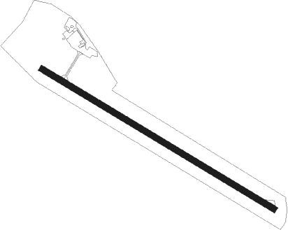
Mende/brénoux - Mende Brenoux
Airport details
| Country | France |
| State | Occitania |
| Region | LF |
| Airspace | Marseille Ctr |
| Municipality | Brenoux |
| Elevation | 3359ft (1024m) |
| Timezone | GMT +1 |
| Coordinates | 44.50408, 3.52763 |
| Magnetic var | |
| Type | land |
| Available since | X-Plane v10.40 |
| ICAO code | LFNB |
| IATA code | MEN |
| FAA code | n/a |
Communication
| Mende Brenoux MENDE INFO | 119.600 |
Nearby Points of Interest:
Ferme de Chapieu
-Hôtel de Ressouches
-Prefecture hotel of Lozère
-Synagogue of Mende (Lozère)
-Croix de Vitrolles
-église Saint-Étienne de Saint-Étienne-du-Valdonnez
-Ensemble patrimonial de Saint-Étienne-du-Valdonnez
-Clocher de tourmente d'Auriac
-Clocher de tourmente des Sagnes
-Menhirs de Colobrières
-Église Saint-Jean-Baptiste de Chanac
-Chapelle de Saint-Jean-du-Bleymard
-Site mégalithique du plateau de Poujoulet
-Dolmen de Chardonnet
-Croix de Serverette
-Gorges du Tarn
-Château de Canilhac
-The Causses and the Cévennes, Mediterranean agro-pastoral Cultural Landscape
-Croix de Briges
-Filature des Calquières
-Halles de Langogne
-Maison du Viguier (Meyrueis)
-Château d'Auberoques
-Croix des Anglais
-Coudoulous (Lozère)
Nearby beacons
| code | identifier | dist | bearing | frequency |
|---|---|---|---|---|
| MEN | MENDE VOR/DME | 16.8 | 286° | 115.30 |
| PY | LE PUY NDB | 33.2 | 29° | 372 |
| DA | ALES CEVENNES NDB | 37.2 | 125° | 402 |
| ROM | RODEZ NDB | 40.8 | 259° | 302 |
| NG | NIMES NDB | 54.2 | 126° | 354 |
| NG | GARONS DME-ILS | 58.6 | 130° | 109.55 |
| FJR | MONTPELLIER MEDITERRANEE VOR/DME | 58.8 | 154° | 114.45 |
| FG | MONTPELLIER NDB | 60.6 | 153° | 339 |
Instrument approach procedures
| runway | airway (heading) | route (dist, bearing) |
|---|---|---|
| RW12 | MEN (106°) | MEN 7000ft INB12 (4mi, 64°) 7000ft |
| RW12 | NB502 (130°) | NB502 7400ft INB12 (4mi, 201°) 7000ft |
| RNAV | INB12 7000ft FNB12 (6mi, 117°) 7000ft LFNB (8mi, 117°) 3370ft NB510 (2mi, 117°) 7000ft MEN (19mi, 287°) 7000ft MEN (turn) 7000ft |
Disclaimer
The information on this website is not for real aviation. Use this data with the X-Plane flight simulator only! Data taken with kind consent from X-Plane 12 source code and data files. Content is subject to change without notice.
