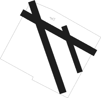
Pujaut - Avignon Pujaut
Airport details
| Country | France |
| State | Occitania |
| Region | LF |
| Airspace | Marseille Ctr |
| Municipality | Pujaut |
| Elevation | 146ft (45m) |
| Timezone | GMT +1 |
| Coordinates | 43.99611, 4.75444 |
| Magnetic var | |
| Type | land |
| Available since | X-Plane v11.50 |
| ICAO code | LFNT |
| IATA code | n/a |
| FAA code | n/a |
Communication
| Avignon Pujaut INFO | 123.350 |
| Avignon Pujaut ORANGE Approach | 118.925 |
| Avignon Pujaut PROVENCE Approach | 132.300 |
Nearby Points of Interest:
Roux
-Livrée de la Thurroye
-Calvet mansion
-Livrée Rossi de Giffone
-Chapelle Saint-Nicolas du pont Saint-Bénézet
-Ancienne Comédie d'Avignon
-hôtel Armand
-Hôtel Calvet de la Palun
-Pipe organ of Collégiale Saint-Jean de Roquemaure
-palais des papes d'Avignon - Chapelle Saint Marial
-Avignon - Grenier à Sel
-Hotel de Ratta
-Hotel Galeans des Issarts
-Hôtel d'Adhémar de Cransac
-Arcades romaines d'Avignon
-Chapelle des Pénitents Violets
-hôtel des Laurens
-hôtel Forbin de Sainte-Croix
-Hotel de Madon de Chateaublanc
-Desmarets de Montdevergues mansion
-hôtel Charavin
-Chapelle Sainte Catherine
-Chapellerie Mouret
-Chapelle, rue de la Velouterie
-Chapelle Saint-Charles (Avignon, France)
Runway info
Nearby beacons
| code | identifier | dist | bearing | frequency |
|---|---|---|---|---|
| AVN | AVIGNON VOR/DME | 0.3 | 265° | 114.60 |
| AN | CAUMONT DME-ILS | 8.1 | 120° | 110.50 |
| CM | AVIGNON CAUMONT NDB | 8.3 | 120° | 369 |
| ORG | ORANGE TACAN | 9.8 | 38° | 109.40 |
| ORG | ORANGE NDB | 10 | 34° | 328 |
| NG | NIMES NDB | 17.2 | 248° | 354 |
| NG | GARONS DME-ILS | 20 | 236° | 109.55 |
| DA | ALES CEVENNES NDB | 26.7 | 277° | 402 |
| SAL | SALON DE PROVENCE NDB | 27.5 | 138° | 334 |
| ITR | ISTRES LE TUBE NDB | 29.2 | 159° | 390 |
| ITS | ISTRES LE TUBE VOR/DME | 30.8 | 159° | 112.70 |
| SCL | SAINT CHRISTOL NDB | 32.5 | 86° | 348 |
| MTL | MONTELIMAR ANCONE VOR/DME | 33.5 | 3° | 113.65 |
| MAR | MARSEILLE NDB | 34.6 | 143° | 383 |
| MJ | MARSEILLE PROVENCE NDB | 39 | 140° | 406 |
| MTG | MARTIGUES VOR/DME | 39.3 | 151° | 117.30 |
| ALM | AIX LES MILLES NDB | 39.5 | 129° | 413 |
| FG | MONTPELLIER NDB | 41.5 | 239° | 339 |
| FJR | MONTPELLIER MEDITERRANEE VOR/DME | 42 | 242° | 114.45 |
| MS | MARSEILLE NDB | 43.1 | 139° | 343 |
| MRM | MARSEILLE PROVENCE VOR/DME | 44.7 | 137° | 108.80 |
| VE | VALENCE NDB | 51.9 | 13° | 320 |
| OB | MARSEILLE PROVENCE NDB | 60.7 | 130° | 395 |
Disclaimer
The information on this website is not for real aviation. Use this data with the X-Plane flight simulator only! Data taken with kind consent from X-Plane 12 source code and data files. Content is subject to change without notice.

