Airports for X-Plane offers a convenient way to explore airports and their related communication information for the X-Plane flight simulator. It only uses data from the X-Plane flight simulator itself, and is therefore more reliable than the data that comes from real aviation websites. You can search for airports by using the ICAO code, or browse for airports per country and state. The information displayed is categorized by airport details, runway information, airport communication, approach frequencies (ILS and Glidepath details), details of nearby beacons, SIDs, STARs and approach procedures.

takeoff flight airfield airport authority airport check-in international automated airport weather station rail transport buildings flights local government airspeed pilot capital newark stol terminal frankfurt airport military airliner

Mende - Bedarieux La Tour Sur Orb

Airport details

CountryFrance
StateOccitania
RegionLF
AirspaceMarseille Ctr
MunicipalityLa Tour-sur-Orb
Elevation1234ft (376m)
TimezoneGMT +1
Coordinates43.63972, 3.14472
Magnetic var
Typeland
Available sinceX-Plane v10.40
ICAO codeLFNX
IATA coden/a
FAA coden/a

Communication

No airport communication available for LFNX
Nearby Points of Interest:
Four à chaux de la Tour-sur-Orb
-
Maison du Bailli in Boussagues
-
Maison des Monnaies (Villemagne-l'Argentière)
-
Abbaye de Villemagne
-
Camplong war memorial
-
gorges d'Héric
-
Town hall, Lodève
-
Halle Dardé
-
Pipe organ of Cathédrale Saint-Fulcran de Lodève
-
Manufacture de Villeneuvette
-
Église de Saint-Nazaire de Roujan
-
église Saint-Pierre de Loiras
-
Puits renaissance (Fayet)
-
St-Julien de Saint-Félix-de-Lodez
-
Château de Canet
-
Abbaye de Saint-Chinian
-
Château de Bélarga
-
La Grange des Prés
-
pipe organ in St Jean collegiate church in Pézenas
-
Hôtel d'Alfonce
-
Hôtel de Malibran (Pézenas)
-
Cave cooperative de Maraussan
-
Pipe organ of Cathédrale Saint-Nazaire de Béziers
-
Castle, La Couvertoirade
-
old walls of La Couvertoirade

Runway info

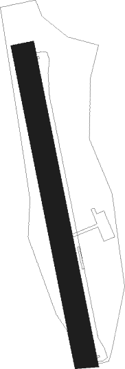
Runway 18 / 36
 length992m (3255ft)
 bearing171° / 351°
 width73m (240ft)
 surfacegrass

Airport layout


Parking locations

Nearby beacons

codeidentifierdistbearingfrequency
ZRBEZIERS VIAS NDB19.7156°397
ZRVIAS DME-ILS20.9148°109.35
FJRMONTPELLIER MEDITERRANEE VOR/DME36.294°114.45
FGMONTPELLIER NDB38.195°339
CVUCASTRES-MAZAMET NDB40.6270°356
ROMRODEZ NDB47.6322°302
CSCARCASSONNE SALVAZA NDB47.9246°345
DAALES CEVENNES NDB50.267°402
PPGPERPIGNAN RIVESALTES VOR/DME54.8197°117.20
RZRODEZ NDB56.5318°387
MENMENDE VOR/DME58.1115.30
PLRIVESALTES (PERPIGNAN) NDB58.4193°351

Disclaimer

The information on this website is not for real aviation. Use this data with the X-Plane flight simulator only! Data taken with kind consent from X-Plane 12 source code and data files. Content is subject to change without notice.