Rouen/vallée De Seine - Rouen Vallee De La Seine
Airport details
| Country | France |
| State | Normandy |
| Region | LF |
| Airspace | Paris Ctr |
| Municipality | Boos |
| Elevation | 512ft (156m) |
| Timezone | GMT +1 |
| Coordinates | 49.39095, 1.18394 |
| Magnetic var | |
| Type | land |
| Available since | X-Plane v10.40 |
| ICAO code | LFOP |
| IATA code | URO |
| FAA code | n/a |
Communication
| Rouen Vallee de la Seine ATIS | 120.575 |
| Rouen Vallee de la Seine ROUEN Tower | 120.200 |
| Rouen Vallee de la Seine ROUEN Approach | 118.575 |
Approach frequencies
| ILS-cat-I | RW22 | 110.5 | 18.00mi |
| 3° GS | RW22 | 110.5 | 18.00mi |
Nearby Points of Interest:
Église Saint-Jacques de Saint-Jacques-sur-Darnétal
-Chartreuse Notre-Dame-de-la-Rose
-Teinturerie Auvray
-aqueduc de Carville
-Couvent des Pénitents, Rouen
-Caserne Jeanne d'Arc
-Couvent des Ursulines de Rouen
-Séminaire de Saint-Vivien
-Hôtel de Senneville
-Hôtel d'Aligre
-Halle aux toiles
-Fierte Saint-Romain
-hôtel du département de Seine-Maritime
-méridienne du jardin de l'hôtel de ville
-Hôtel d'Étancourt
-Archepiscopal Complex of Rouen
-Jubert Brécourt Hotel
-Atelier de Ferdinand Marrou
-equestrian statue of Napoleon
-Hôtel de la Houssaye
-Reconstruction de Rouen
-Prieuré Saint-Crespin de Romilly-sur-Andelle
-Église Saint-Herbland de Rouen
-Fontaine Saint-Candé
-Hôtel de Miromesnil (Rouen)
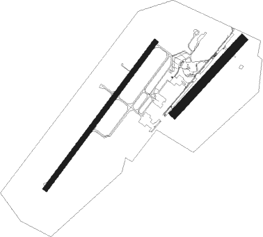
Runway info
Runway 04 / 22  | ||
| length | 1701m (5581ft) | |
| bearing | 53° / 233° | |
| width | 45m (148ft) | |
| surface | asphalt | |
| blast zone | 255m (837ft) / 0m (0ft) | |
| Runway 05 / 23 | ||
| length | 934m (3064ft) | |
| bearing | 59° / 239° | |
| width | 80m (262ft) | |
| surface | grass | |
| displ threshold | 152m (499ft) / 338m (1109ft) | |
Nearby beacons
| code | identifier | dist | bearing | frequency |
|---|---|---|---|---|
| ROU | ROUEN VALLEE DE SEINE VOR | 5.8 | 52° | 116.80 |
| EVX | EVREUX FAUVILLE VORTAC | 21.6 | 174° | 112.40 |
| DSA | DIEPPE NDB | 29.7 | 348° | 351 |
| DPE | DIEPPE VOR | 32.1 | 359° | 115.80 |
| BV | BEAUVAIS NDB | 33.5 | 83° | 391 |
| DVL | DEAUVILLE NORMANDIE VOR | 34.4 | 265° | 110.20 |
| PON | PONTOISE CORMEILLES EN VE VOR | 37.8 | 109° | 111.60 |
| BOV | BEAUVAIS TILLE VOR/DME | 37.9 | 87° | 109.65 |
| LGL | L'AIGLE VOR/DME | 44.2 | 227° | 112.70 |
| HOL | VILLACOUBLAY NDB | 46.9 | 136° | 315 |
| EPR | EPERNON VOR/DME | 49.5 | 148° | 115.65 |
| ABB | ABBEVILLE VOR/DME | 51.7 | 42° | 108.45 |
| TA | VILLACOUBLAY NDB | 51.7 | 124° | 286 |
| TSU | TOUSSUS LE NOBLE VOR | 52.6 | 125° | 108.25 |
| RBT | RAMBOUILLET VOR/DME | 54.5 | 132° | 114.70 |
| CHW | CHARTRES VOR/DME | 55.2 | 192° | 115.20 |
| CNE | CAEN NDB | 61.2 | 260° | 404 |
| CAN | CAEN CARPIQUET VOR/DME | 65.5 | 262° | 114.45 |
Departure and arrival routes
| Transition altitude | 5000ft |
| SID end points | distance | outbound heading | |
|---|---|---|---|
| RW04 | |||
| BANT3N | 36mi | 40° | |
| CAN3N | 66mi | 262° | |
| VEUL3N | 36mi | 310° | |
| RW22 | |||
| BANT3S | 36mi | 40° | |
| CAN3S | 66mi | 262° | |
| VEUL3S | 36mi | 310° | |
| STAR starting points | distance | inbound heading | |
|---|---|---|---|
| ALL | |||
| CAN4A | 65.5 | 82° | |
| LHO4A | 41.0 | 102° | |
| VEUL4A | 35.5 | 130° | |
| DPE4A | 32.1 | 179° | |
| BANT4A | 36.3 | 220° | |
Instrument approach procedures
| runway | airway (heading) | route (dist, bearing) |
|---|---|---|
| RW04 | ELSED (63°) | ELSED 2500ft FOP04 (4mi, 77°) 2500ft |
| RW04 | LUXEL (79°) | LUXEL 2500ft ELSED (4mi, 152°) 2500ft FOP04 (4mi, 77°) 2500ft |
| RNAV | FOP04 2500ft LFOP (7mi, 53°) 548ft OP510 (4mi, 54°) 2500ft OP512 (9mi, 300°) 2500ft IRDIB (4mi, 218°) 2500ft LUXEL (9mi, 218°) 2500ft LUXEL (turn) 3500ft | |
| RW22 | BOGVA (254°) | BOGVA 2500ft IDLAB (5mi, 300°) 2500ft |
| RW22 | NAKIB (194°) | NAKIB 2500ft IDLAB (7mi, 120°) 2500ft |
| RNAV | IDLAB 2500ft FOP22 (5mi, 234°) 2500ft LFOP (6mi, 234°) 562ft OP410 (6mi, 233°) OP412 (7mi, 300°) OP414 (12mi, 47°) 3500ft NAKIB (5mi, 67°) 2500ft IDLAB (7mi, 120°) 2500ft IDLAB (turn) 2500ft |
Holding patterns
| STAR name | hold at | type | turn | heading* | altitude | leg | speed limit |
|---|---|---|---|---|---|---|---|
| BANT4A | ROU | VHF | left | 357 (177)° | 3000ft - 10000ft | DME 5.0mi | 220 |
| CAN4A | ROU | VHF | left | 357 (177)° | 3000ft - 10000ft | DME 5.0mi | 220 |
| DPE4A | ROU | VHF | left | 357 (177)° | 3000ft - 10000ft | DME 5.0mi | 220 |
| LHO4A | ROU | VHF | left | 357 (177)° | 3000ft - 10000ft | DME 5.0mi | 220 |
| VEUL4A | ROU | VHF | left | 357 (177)° | 3000ft - 10000ft | DME 5.0mi | 220 |
| *) magnetic outbound (inbound) holding course | |||||||
Disclaimer
The information on this website is not for real aviation. Use this data with the X-Plane flight simulator only! Data taken with kind consent from X-Plane 12 source code and data files. Content is subject to change without notice.