Villefrancœur - Blois Le Breuil
Airport details
| Country | France |
| State | Centre-Val de Loire |
| Region | LF |
| Airspace | Paris Ctr |
| Municipality | La Chapelle-Vendômoise |
| Elevation | 395ft (120m) |
| Timezone | GMT +1 |
| Coordinates | 47.68033, 1.21161 |
| Magnetic var | |
| Type | land |
| Available since | X-Plane v10.40 |
| ICAO code | LFOQ |
| IATA code | n/a |
| FAA code | n/a |
Communication
| Blois Le Breuil BLOIS INFO | 118.450 |
| Blois Le Breuil Dep | 118.450 |
Nearby Points of Interest:
Prefecture hotel of Loir-et-Cher
-Palais de justice de Blois
-prieuré Saint-Lazare et hospice Lunier
-Chocolaterie Poulain in Blois
-Collégiale Saint-Sauveur de Blois
-Hôtel de ville de Blois
-Abbey at Guiche
-Ponts Chartrains
-théâtre gallo-romain d'Areines
-Trinity Abbey, Vendôme
-Château de Colliers
-Pont Saint-Michel
-chapelle du château de Chambord
-Maison Renaissance
-mur d'enceinte du domaine national de Chambord
-Abbey of St. Georges du Bois
-Arboretum de la Fosse
-Dolmen des Grosses-Pierres
-Pontlevoy Abbey
-Château de La Vallière
-Église Saint-Étienne de Beaugency
-Hôtel de Ville de Beaugency
-Viaduc ferroviaire de Beaugency
-Abbaye Notre-Dame de Beaugency
-Pont de Beaugency
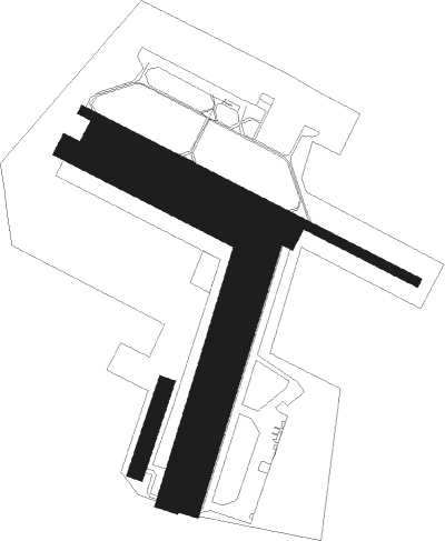
Runway info
Runway 12 / 30  | ||
| length | 1251m (4104ft) | |
| bearing | 112° / 292° | |
| width | 30m (98ft) | |
| surface | asphalt | |
| displ threshold | 50m (164ft) / 0m (0ft) | |
| Runway 12C / 30C | ||
| length | 721m (2365ft) | |
| bearing | 113° / 293° | |
| width | 80m (262ft) | |
| surface | grass | |
| Runway 12R / 30L | ||
| length | 631m (2070ft) | |
| bearing | 113° / 293° | |
| width | 80m (262ft) | |
| surface | grass | |
| blast zone | 0m (0ft) / 13m (43ft) | |
| Runway 02L / 20R | ||
| length | 300m (984ft) | |
| bearing | 32° / 212° | |
| width | 55m (180ft) | |
| surface | grass | |
| displ threshold | 30m (98ft) / 30m (98ft) | |
| Runway 02C / 20C | ||
| length | 931m (3054ft) | |
| bearing | 30° / 210° | |
| width | 80m (262ft) | |
| surface | grass | |
| displ threshold | 90m (295ft) / 0m (0ft) | |
| blast zone | 0m (0ft) / 21m (69ft) | |
| Runway 02R / 20L | ||
| length | 921m (3022ft) | |
| bearing | 30° / 210° | |
| width | 70m (230ft) | |
| surface | grass | |
| displ threshold | 90m (295ft) / 0m (0ft) | |
| blast zone | 0m (0ft) / 18m (59ft) | |
Nearby beacons
| code | identifier | dist | bearing | frequency |
|---|---|---|---|---|
| BLB | BLOIS NDB | 0.5 | 235° | 397 |
| AMB | AMBOISE VOR/DME | 16.2 | 210° | 113.70 |
| AMB | AMBOISE NDB | 17.1 | 213° | 341 |
| TUR | TOURS VAL DE LOIRE NDB | 18.6 | 255° | 331 |
| CHN | CHATEAUDUN TACAN | 23.4 | 24° | 110.20 |
| CAD | CHATEAUDUN VOR/DME | 23.8 | 25° | 115.95 |
| TUR | TOURS VAL DE LOIRE TACAN | 24.9 | 242° | 113.80 |
| BCY | ORLEANS VOR/DME | 28.5 | 61° | 117.35 |
| OAN | ORLEANS-BRICY NDB | 29.5 | 60° | 385 |
| CHW | CHARTRES VOR/DME | 48.8 | 344° | 115.20 |
| CTX | CHATEAUROUX DEOLS NDB | 50.7 | 142° | 428 |
| EPR | EPERNON VOR/DME | 59.5 | 25° | 115.65 |
| RBT | RAMBOUILLET VOR/DME | 66.3 | 39° | 114.70 |
| PI | POITIERS NDB | 67.2 | 219° | 363 |
Instrument approach procedures
| runway | airway (heading) | route (dist, bearing) |
|---|---|---|
| RW30 | BABOG (316°) | BABOG IOQ30 (5mi, 43°) 4000ft |
| RW30 | BALIV (272°) | BALIV OQ403 (3mi, 222°) IOQ30 (3mi, 222°) 4000ft |
| RW30 | BARAX (293°) | BARAX 2500ft IOQ30 (5mi, 293°) 4000ft |
| RNAV | IOQ30 2100ft FOQ30 (5mi, 293°) 2100ft LFOQ (6mi, 294°) 431ft OQ420 (2mi, 288°) OQ421 (8mi, 163°) BABOG (7mi, 108°) 2500ft |
Disclaimer
The information on this website is not for real aviation. Use this data with the X-Plane flight simulator only! Data taken with kind consent from X-Plane 12 source code and data files. Content is subject to change without notice.