Chartres / Champhol - Chartres Champhol
Airport details
| Country | France |
| State | Centre-Val de Loire |
| Region | LF |
| Airspace | Paris Ctr |
| Municipality | Chartres |
| Elevation | 506ft (154m) |
| Timezone | GMT +1 |
| Coordinates | 48.45889, 1.52389 |
| Magnetic var | |
| Type | land |
| Available since | X-Plane v10.40 |
| ICAO code | LFOR |
| IATA code | n/a |
| FAA code | n/a |
Communication
Nearby Points of Interest:
Château de Vauventriers
-Lorin workshop
-Abbey of Saint-Père-en-Vallée
-Maison du Saumon
-Chartres Cathedral labyrinth
-Boucherie Pinson
-West rose windows of Cathédrale Notre-Dame de Chartres baie 143
-Cellier de Loëns
-Couvent des Cordeliers (Chartres)
-Hôtel Montescot
-Maison de la Voûte
-Abbaye Notre-Dame de Josaphat
-Marceau statue in Chartres
-Éolienne de Nogent-le-Phaye
-Abbaye Notre-Dame de l'Eau
-Éolienne de Berchères-les-Pierres
-Briqueterie Lambert
-Les Pressoirs
-Camp de Voves
-Chapelle funéraire de la famille Hériot
-Château d'Illiers-Combray
-Forest of Rambouillet
-Moulin de Villeneuve
-belfry of Dreux
-castle of Dreux
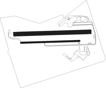
Runway info
Runway 09 / 27  | ||
| length | 834m (2736ft) | |
| bearing | 92° / 272° | |
| width | 25m (82ft) | |
| surface | asphalt | |
| displ threshold | 40m (131ft) / 39m (128ft) | |
| Runway 10L / 28R | ||
| length | 1058m (3471ft) | |
| bearing | 92° / 272° | |
| width | 61m (200ft) | |
| surface | grass | |
Nearby beacons
| code | identifier | dist | bearing | frequency |
|---|---|---|---|---|
| EPR | EPERNON VOR/DME | 11.3 | 38° | 115.65 |
| HOL | VILLACOUBLAY NDB | 20.1 | 48° | 315 |
| CHW | CHARTRES VOR/DME | 21.4 | 272° | 115.20 |
| RBT | RAMBOUILLET VOR/DME | 22 | 67° | 114.70 |
| CAD | CHATEAUDUN VOR/DME | 24.6 | 199° | 115.95 |
| CHN | CHATEAUDUN TACAN | 24.9 | 200° | 110.20 |
| TSU | TOUSSUS LE NOBLE VOR | 29 | 63° | 108.25 |
| OAN | ORLEANS-BRICY NDB | 29.1 | 152° | 385 |
| TA | VILLACOUBLAY NDB | 29.5 | 61° | 286 |
| BCY | ORLEANS VOR/DME | 29.9 | 154° | 117.35 |
| PTV | PITHIVIERS VOR | 34.7 | 112° | 116.50 |
| EVX | EVREUX FAUVILLE VORTAC | 36.4 | 332° | 112.40 |
| POY | ORLY (PARIS) NDB | 38 | 73° | 334 |
| ORS | ORLEANS SAINT DENIS DE L'HOTEL NDB | 42.5 | 126° | 322 |
| PON | PONTOISE CORMEILLES EN VE VOR | 43.3 | 39° | 111.60 |
| LGL | L'AIGLE VOR/DME | 44.1 | 288° | 112.70 |
| BT | LE BOURGET (PARIS) VOR/DME | 48.1 | 61° | 116.10 |
| BLB | BLOIS NDB | 48.8 | 202° | 397 |
| CGN | (PARIS) DME | 51.2 | 60° | 115.35 |
| TUR | TOURS VAL DE LOIRE NDB | 61.3 | 220° | 331 |
| BOV | BEAUVAIS TILLE VOR/DME | 63.7 | 33° | 109.65 |
Disclaimer
The information on this website is not for real aviation. Use this data with the X-Plane flight simulator only! Data taken with kind consent from X-Plane 12 source code and data files. Content is subject to change without notice.