Cholet - Cholet Le Pontreau
Airport details
| Country | France |
| State | Pays de la Loire |
| Region | LF |
| Airspace | Brest Ctr |
| Municipality | Cholet |
| Elevation | 442ft (135m) |
| Timezone | GMT +1 |
| Coordinates | 47.08191, -0.87722 |
| Magnetic var | |
| Type | land |
| Available since | X-Plane v10.40 |
| ICAO code | LFOU |
| IATA code | CET |
| FAA code | n/a |
Communication
| Cholet Le Pontreau CTAF | 120.400 |
| Cholet Le Pontreau Twr | 120.400 |
| Cholet Le Pontreau NANTES Approach | 124.430 |
| Cholet Le Pontreau Dep | 120.400 |
Nearby Points of Interest:
Petit menhir du Champ de la Garde
-Château de Chemillé
-château de la Bonnelière
-Ancienne église Saint-Christophe de Mesnard-la-Barotière
-Chapelle des Templiers
-prévôté de Saint-Laurent-du-Mottay
-Halles de Clisson
-Château de l'Oiselinière
-Maison de la Dîme
-Colonne de la duchesse d'Angoulême
-Logis de la Pinsonnière
-Hôtel Desmazières
-Mine de charbon de la Tranchée
-Polissoir de la Grouas
-Moulin à vent du Fresne
-Sanctuaire Notre-Dame-de-la-Salette de La Rabatelière
-manoir des Lauriers
-Hôtel de ville de Saint-Georges-sur-Loire
-Presbytère de Savennières
-Villa de la Douvelière
-presbytère de Denée
-Logis du Puy-Blain
-Champtoceaux Castle
-Chapelle Saint-Barthelémy
-Villa des Montis
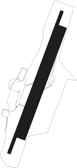
Runway info
Runway 03 / 21  | ||
| length | 1382m (4534ft) | |
| bearing | 34° / 214° | |
| width | 30m (98ft) | |
| surface | asphalt | |
| displ threshold | 180m (591ft) / 0m (0ft) | |
| Runway 03R / 21L | ||
| length | 1031m (3383ft) | |
| bearing | 34° / 214° | |
| width | 80m (262ft) | |
| surface | grass | |
Nearby beacons
| code | identifier | dist | bearing | frequency |
|---|---|---|---|---|
| LP | CHOLET NDB | 3.5 | 35° | 357 |
| ANG | ANGERS VOR | 27.3 | 3° | 113 |
| YN | LA ROCHE SUR YON LES AJONCS NDB | 28.9 | 226° | 334 |
| NTS | NANTES ATLANTIQUE VOR/DME | 30.4 | 276° | 115.50 |
| GL | NANTES NDB | 33.2 | 268° | 369 |
| AS | ANGERS NDB | 41.9 | 56° | 392 |
| LA | LAVAL NDB | 54.2 | 12° | 401 |
| RL | LA ROCHELLE NDB | 55.1 | 194° | 322 |
| POI | POITIERS BIARDS VOR | 56.8 | 113° | 113.30 |
| PI | POITIERS NDB | 57.3 | 106° | 363 |
| LM | LE MANS NDB | 64.7 | 52° | 326 |
| TUR | TOURS VAL DE LOIRE TACAN | 68.6 | 78° | 113.80 |
| REN | RENNES SAINT JACQUES VOR/DME | 68.8 | 319° | 109.25 |
| TUR | TOURS VAL DE LOIRE NDB | 73.5 | 74° | 331 |
Instrument approach procedures
| runway | airway (heading) | route (dist, bearing) |
|---|---|---|
| RW21-Y | ENOBU (243°) | ENOBU 2800ft OU502 (5mi, 288°) 2000ft |
| RW21-Y | NUVNU (214°) | NUVNU 2800ft OU502 (5mi, 215°) 2000ft |
| RW21-Y | OLALU (175°) | OLALU 2800ft OU502 (5mi, 107°) 2000ft |
| RNAV | OU502 2000ft OU503 (4mi, 214°) 2000ft LFOU (5mi, 214°) 459ft OU504 (2mi, 214°) ENOBU (12mi, 59°) 2800ft | |
| RW21-Z | ENOBU (243°) | ENOBU 2800ft OU502 (5mi, 288°) 2000ft |
| RW21-Z | NUVNU (214°) | NUVNU 2800ft OU502 (5mi, 215°) 2000ft |
| RW21-Z | OLALU (175°) | OLALU 2800ft OU502 (5mi, 107°) 2000ft |
| RNAV | OU502 2000ft OU503 (4mi, 214°) 2000ft LFOU (5mi, 214°) 459ft OU504 (2mi, 214°) OLALU (12mi, 1°) 2800ft |
Disclaimer
The information on this website is not for real aviation. Use this data with the X-Plane flight simulator only! Data taken with kind consent from X-Plane 12 source code and data files. Content is subject to change without notice.