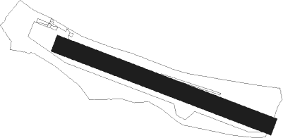
Thiverval-grignon - Beynes Thiverval
Airport details
| Country | France |
| State | Ile-de-France |
| Region | LF |
| Airspace | Paris Ctr |
| Municipality | Thiverval-Grignon |
| Elevation | 356ft (109m) |
| Timezone | GMT +1 |
| Coordinates | 48.84361, 1.90889 |
| Magnetic var | |
| Type | land |
| Available since | X-Plane v10.40 |
| ICAO code | LFPF |
| IATA code | n/a |
| FAA code | n/a |
Communication
| Beynes Thiverval Beynes Info | 120.425 |
Nearby Points of Interest:
Place du Maréchal-Foch
-Château de Pontchartrain
-Église Saint-Martin de Jouars-Pontchartrain
-rendez-vous de chasse des Clayes-sous-Bois
-Château de Grand'Maisons
-Chapelle Saint-Jacques de Maule
-Château d'Agnou
-Désert de Retz
-Fort de Bois-d'Arcy
-Cité ouvrière les Dents de Scie
-Joyenval Abbey
-cemetery of Montfort-l'Amaury
-Chapelle de la Maladrerie de Poissy
-Château de la Queue-les-Yvelines
-Prieuré de Haute-Bruyère
-Maison d'André Derain
-Château du Mesnil-Saint-Denis
-Maison royale de Saint-Louis
-Ferme de Gally
-Viaduc du Val-Saint-Léger
-Trou d'Enfer semaphore tower
-Statue of Saint Barbara
-Noyau de Poissy
-Gare de Poissy-Grande-Ceinture
-domaine national de Marly-le-Roi
Nearby beacons
| code | identifier | dist | bearing | frequency |
|---|---|---|---|---|
| HOL | VILLACOUBLAY NDB | 7.6 | 218° | 315 |
| TA | VILLACOUBLAY NDB | 8.6 | 111° | 286 |
| TSU | TOUSSUS LE NOBLE VOR | 9.3 | 115° | 108.25 |
| RBT | RAMBOUILLET VOR/DME | 11.8 | 156° | 114.70 |
| PON | PONTOISE CORMEILLES EN VE VOR | 15.9 | 27° | 111.60 |
| EPR | EPERNON VOR/DME | 16.4 | 229° | 115.65 |
| POY | ORLY (PARIS) NDB | 20.2 | 103° | 334 |
| BT | LE BOURGET (PARIS) VOR/DME | 22.9 | 77° | 116.10 |
| CGN | (PARIS) DME | 25.6 | 73° | 115.35 |
| EVX | EVREUX FAUVILLE VORTAC | 29.3 | 285° | 112.40 |
| PGS | CHARLES-DE-GAULLE (PARIS) VOR/DME | 29.7 | 78° | 117.05 |
| BOV | BEAUVAIS TILLE VOR/DME | 36.8 | 22° | 109.65 |
| BV | BEAUVAIS NDB | 39.2 | 11° | 391 |
| CHW | CHARTRES VOR/DME | 42.5 | 248° | 115.20 |
| MLN | MELUN VILLAROCHE VOR/DME | 42.7 | 113° | 113.60 |
| PTV | PITHIVIERS VOR | 43.6 | 153° | 116.50 |
| ROU | ROUEN VALLEE DE SEINE VOR | 44.7 | 315° | 116.80 |
| MTD | MONTDIDIER VOR | 48.2 | 39° | 113.65 |
| OAN | ORLEANS-BRICY NDB | 50.8 | 189° | 385 |
| CAD | CHATEAUDUN VOR/DME | 51.4 | 214° | 115.95 |
| CHN | CHATEAUDUN TACAN | 51.8 | 214° | 110.20 |
| BCY | ORLEANS VOR/DME | 51.9 | 190° | 117.35 |
| ORS | ORLEANS SAINT DENIS DE L'HOTEL NDB | 56 | 160° | 322 |
| GI | AMIENS NDB | 64 | 30° | 339 |
Disclaimer
The information on this website is not for real aviation. Use this data with the X-Plane flight simulator only! Data taken with kind consent from X-Plane 12 source code and data files. Content is subject to change without notice.