Coulommiers/voisins - Coulommiers Voisins
Airport details
| Country | France |
| State | Ile-de-France |
| Region | LF |
| Airspace | Paris Ctr |
| Municipality | Pommeuse |
| Elevation | 470ft (143m) |
| Timezone | GMT +1 |
| Coordinates | 48.83750, 3.01444 |
| Magnetic var | |
| Type | land |
| Available since | X-Plane v10.40 |
| ICAO code | LFPK |
| IATA code | n/a |
| FAA code | n/a |
Communication
| Coulommiers Voisins CTAF | 128.800 |
| Coulommiers Voisins Dep | 122.200 |
Nearby Points of Interest:
Ancienne prison (Coulommiers)
-Commanderie de Coulommiers
-Chapelle Sainte-Aubierge
-Colombier de Mauperthuis
-Moulin de Mistou
-Croix de Jouarre
-Crypte Saint-Paul
-Château Royal du Vivier
-Fontaine Saint-Fursy
-Lagny Abbey
-Immeuble des Cinq Pignons
-Commanderie de Saint-Martin-des-Champs
-Moulin Choix
-Halles (Marigny-en-Orxois)
-Fief des Époisses
-borne fleurdelysée n°34
-borne fleurdelysée n°35
-Pierre de Chilpéric
-Petit Château de Montfermeil
-hôtel-Dieu
-Hospital of Ville-Évrard
-Église Saint-Germain-d'Auxerre de Santeny
-Château d'Ormesson
-Town hall of Clichy-sous-Bois
-Église Notre-Dame-de-l'Assomption d'Ormesson-sur-Marne
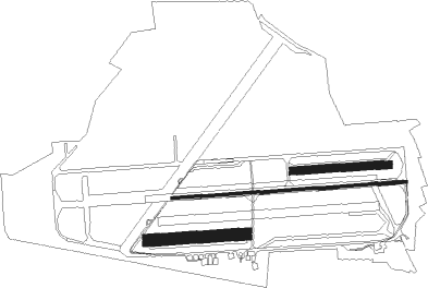
Runway info
Runway 09C / 27C  | ||
| length | 1592m (5223ft) | |
| bearing | 90° / 270° | |
| width | 20m (66ft) | |
| surface | asphalt | |
| displ threshold | 0m (0ft) / 175m (574ft) | |
| Runway 09R / 27L | ||
| length | 661m (2169ft) | |
| bearing | 90° / 270° | |
| width | 80m (262ft) | |
| surface | grass | |
| displ threshold | 0m (0ft) / 100m (328ft) | |
| Runway 09L / 27R | ||
| length | 651m (2136ft) | |
| bearing | 90° / 270° | |
| width | 50m (164ft) | |
| surface | grass | |
Nearby beacons
| code | identifier | dist | bearing | frequency |
|---|---|---|---|---|
| CLM | COULOMMIERS VOR/DME | 0.4 | 355° | 112.90 |
| MV | MELUN NDB | 17 | 187° | 434 |
| PGS | CHARLES-DE-GAULLE (PARIS) VOR/DME | 18.2 | 293° | 117.05 |
| BSN | DME | 21.1 | 7° | 114.85 |
| CGN | (PARIS) DME | 23 | 290° | 115.35 |
| BT | LE BOURGET (PARIS) VOR/DME | 23.5 | 284° | 116.10 |
| MLN | MELUN VILLAROCHE VOR/DME | 24.2 | 208° | 113.60 |
| POY | ORLY (PARIS) NDB | 25.5 | 260° | 334 |
| BRY | BRAY SUR SEINE VOR/DME | 28.1 | 147° | 114.10 |
| CTL | CHATILLON SUR MARNE VOR/DME | 28.5 | 62° | 117.60 |
| TA | VILLACOUBLAY NDB | 36.4 | 266° | 286 |
| TSU | TOUSSUS LE NOBLE VOR | 36.4 | 265° | 108.25 |
| PON | PONTOISE CORMEILLES EN VE VOR | 41.5 | 285° | 111.60 |
| TY | TROYES NDB | 47.2 | 114° | 320 |
| MTD | MONTDIDIER VOR | 47.6 | 324° | 113.65 |
| BOV | BEAUVAIS TILLE VOR/DME | 49.3 | 305° | 109.65 |
| PTV | PITHIVIERS VOR | 50.6 | 228° | 116.50 |
| TRO | TROYES BARBEREY VOR | 51.5 | 122° | 116 |
| BV | BEAUVAIS NDB | 55.1 | 304° | 391 |
| AX | AUXERRE NDB | 58.4 | 152° | 417 |
| ORS | ORLEANS SAINT DENIS DE L'HOTEL NDB | 62.2 | 221° | 322 |
Disclaimer
The information on this website is not for real aviation. Use this data with the X-Plane flight simulator only! Data taken with kind consent from X-Plane 12 source code and data files. Content is subject to change without notice.