Paris - Lognes Emerainville
Airport details
| Country | France |
| State | Ile-de-France |
| Region | LF |
| Airspace | Paris Ctr |
| Municipality | Lognes |
| Elevation | 354ft (108m) |
| Timezone | GMT +1 |
| Coordinates | 48.82207, 2.62680 |
| Magnetic var | |
| Type | land |
| Available since | X-Plane v10.40 |
| ICAO code | LFPL |
| IATA code | n/a |
| FAA code | n/a |
Communication
| Lognes Emerainville LOGNES Atis | 125.025 |
| Lognes Emerainville LOGNES Ground | 122.125 |
| Lognes Emerainville LOGNES Tower | 118.600 |
Nearby Points of Interest:
Pierre de Chilpéric
-Hospital of Ville-Évrard
-Fort de Champigny
-Église Notre-Dame-de-l'Assomption d'Ormesson-sur-Marne
-Château d'Ormesson
-Gare de Bry-sur-Marne
-Château de Bry
-Gare de Chennevières-sur-Marne-Grande-Ceinture
-Gymnase Léopold Bellan
-Immeuble des Cinq Pignons
-Lagny Abbey
-Pont de Chennevières-sur-Marne
-Fontaine Saint-Fursy
-Pont de Champigny
-château de Haute-Maison
-Viaduc ferroviaire de Nogent-sur-Marne
-Petit Château de Montfermeil
-Pavillon de la Russie de l'Exposition Universelle de 1878
-Observatoire de Saint-Maur
-Monument à Antoine Watteau
-Château Smith-Champion
-Pont de Bonneuil
-Château de Plaisance
-Pont du petit Parc
-Beauté-sur-Marne
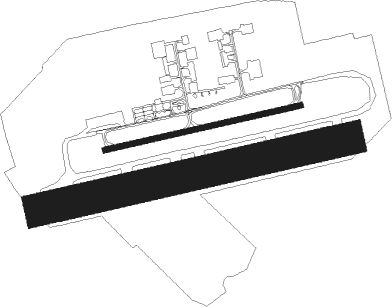
Runway info
Runway 08R / 26L  | ||
| length | 1101m (3612ft) | |
| bearing | 84° / 264° | |
| width | 114m (373ft) | |
| surface | grass | |
| Runway 08 / 26 | ||
| length | 701m (2300ft) | |
| bearing | 84° / 264° | |
| width | 20m (66ft) | |
| surface | asphalt | |
Nearby beacons
| code | identifier | dist | bearing | frequency |
|---|---|---|---|---|
| PGS | CHARLES-DE-GAULLE (PARIS) VOR/DME | 10.6 | 359° | 117.05 |
| POY | ORLY (PARIS) NDB | 10.8 | 249° | 334 |
| BT | LE BOURGET (PARIS) VOR/DME | 11.3 | 312° | 116.10 |
| CGN | (PARIS) DME | 12.8 | 327° | 115.35 |
| CLM | COULOMMIERS VOR/DME | 15.3 | 87° | 112.90 |
| TA | VILLACOUBLAY NDB | 21.1 | 265° | 286 |
| TSU | TOUSSUS LE NOBLE VOR | 21.1 | 263° | 108.25 |
| MV | MELUN NDB | 21.2 | 127° | 434 |
| MLN | MELUN VILLAROCHE VOR/DME | 23.2 | 153° | 113.60 |
| RBT | RAMBOUILLET VOR/DME | 27 | 255° | 114.70 |
| BSN | DME | 27.7 | 50° | 114.85 |
| PON | PONTOISE CORMEILLES EN VE VOR | 28.5 | 295° | 111.60 |
| HOL | VILLACOUBLAY NDB | 32.3 | 264° | 315 |
| BRY | BRAY SUR SEINE VOR/DME | 36.3 | 122° | 114.10 |
| EPR | EPERNON VOR/DME | 40.2 | 259° | 115.65 |
| BOV | BEAUVAIS TILLE VOR/DME | 41.3 | 322° | 109.65 |
| CTL | CHATILLON SUR MARNE VOR/DME | 42 | 72° | 117.60 |
| PTV | PITHIVIERS VOR | 42.5 | 209° | 116.50 |
| MTD | MONTDIDIER VOR | 44.2 | 349° | 113.65 |
| BV | BEAUVAIS NDB | 46.5 | 318° | 391 |
| ORS | ORLEANS SAINT DENIS DE L'HOTEL NDB | 55.2 | 203° | 322 |
| OAN | ORLEANS-BRICY NDB | 60 | 226° | 385 |
| BCY | ORLEANS VOR/DME | 61 | 226° | 117.35 |
| AX | AUXERRE NDB | 64.4 | 136° | 417 |
Disclaimer
The information on this website is not for real aviation. Use this data with the X-Plane flight simulator only! Data taken with kind consent from X-Plane 12 source code and data files. Content is subject to change without notice.