Melun/villaroche - Melun Villaroche
Airport details
| Country | France |
| State | Ile-de-France |
| Region | LF |
| Airspace | Paris Ctr |
| Municipality | Montereau-sur-le-Jard |
| Elevation | 300ft (91m) |
| Timezone | GMT +1 |
| Coordinates | 48.61081, 2.66657 |
| Magnetic var | |
| Type | land |
| Available since | X-Plane v10.40 |
| ICAO code | LFPM |
| IATA code | n/a |
| FAA code | n/a |
Communication
| Melun Villaroche ATIS | 128.175 |
| Melun Villaroche MELUN Tower | 121.100 |
| Melun Villaroche SEINE Approach | 134.300 |
| Melun Villaroche SEINE Approach | 118.050 |
| Melun Villaroche SEINE Approach | 120.325 |
Nearby Points of Interest:
Château de Cramayel
-Église Saint-Barthélémy de Melun
-Recollets Convent
-Prieuré Saint-Sauveur
-hôtel-Dieu
-Sépulture d'Isabelle et René Viviani
-Forêt de Rougeau
-Pigeonnier de Boissise-le-Roi
-Usine Leroy (Saint-Fargeau-Ponthierry)
-Wurzel-Jesse-Fenster
-Marché couvert
-menhir de Pierre-Fritte
-Grands moulins de Corbeil
-Table du Roi
-Église Saint-Germain-d'Auxerre de Santeny
-Fief des Époisses
-Château Royal du Vivier
-Table du Grand Maître
-Property Caillebotte
-bornes fleurdelysées
-Moulin de Choiseau
-Brévannes castle
-château de Haute-Maison
-Hôpital Émile-Roux
-Maison d'Alphonse Daudet
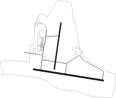
Runway info
Runway 10 / 28  | ||
| length | 1968m (6457ft) | |
| bearing | 99° / 279° | |
| width | 45m (148ft) | |
| surface | concrete | |
| displ threshold | 0m (0ft) / 83m (272ft) | |
| blast zone | 255m (837ft) / 0m (0ft) | |
| Runway 01 / 19 | ||
| length | 1302m (4272ft) | |
| bearing | 19° / 199° | |
| width | 30m (98ft) | |
| surface | asphalt | |
| blast zone | 78m (256ft) / 255m (837ft) | |
Nearby beacons
| code | identifier | dist | bearing | frequency |
|---|---|---|---|---|
| MLN | MELUN VILLAROCHE VOR/DME | 10.9 | 137° | 113.60 |
| MV | MELUN NDB | 12.8 | 100° | 434 |
| POY | ORLY (PARIS) NDB | 13.1 | 293° | 334 |
| CLM | COULOMMIERS VOR/DME | 19.6 | 56° | 112.90 |
| BT | LE BOURGET (PARIS) VOR/DME | 23.3 | 330° | 116.10 |
| PGS | CHARLES-DE-GAULLE (PARIS) VOR/DME | 23.4 | 354° | 117.05 |
| TSU | TOUSSUS LE NOBLE VOR | 23.9 | 284° | 108.25 |
| TA | VILLACOUBLAY NDB | 24.5 | 286° | 286 |
| CGN | (PARIS) DME | 25.4 | 338° | 115.35 |
| RBT | RAMBOUILLET VOR/DME | 26.8 | 274° | 114.70 |
| BRY | BRAY SUR SEINE VOR/DME | 27.8 | 108° | 114.10 |
| PTV | PITHIVIERS VOR | 31.6 | 221° | 116.50 |
| HOL | VILLACOUBLAY NDB | 34.3 | 278° | 315 |
| BSN | DME | 37.9 | 34° | 114.85 |
| PON | PONTOISE CORMEILLES EN VE VOR | 38.3 | 308° | 111.60 |
| ORS | ORLEANS SAINT DENIS DE L'HOTEL NDB | 43.8 | 212° | 322 |
| CTL | CHATILLON SUR MARNE VOR/DME | 47.9 | 60° | 117.60 |
| OAN | ORLEANS-BRICY NDB | 51.2 | 236° | 385 |
| BCY | ORLEANS VOR/DME | 52.3 | 236° | 117.35 |
| AX | AUXERRE NDB | 53.2 | 130° | 417 |
| BOV | BEAUVAIS TILLE VOR/DME | 53.5 | 328° | 109.65 |
| MTD | MONTDIDIER VOR | 56.9 | 349° | 113.65 |
| BV | BEAUVAIS NDB | 58.5 | 324° | 391 |
Departure and arrival routes
| Transition altitude | 5000ft |
| SID end points | distance | outbound heading | |
|---|---|---|---|
| RW10 | |||
| ARSI4E | 56mi | 92° | |
| TRO4E | 56mi | 106° | |
| LURE4E | 61mi | 115° | |
| POLY4E | 43mi | 172° | |
| PTV4E | 32mi | 221° | |
| RW28 | |||
| ARSI4C | 56mi | 92° | |
| TRO4C | 56mi | 106° | |
| LURE4C | 61mi | 115° | |
| POLY4C | 43mi | 172° | |
| PTV4C | 32mi | 221° | |
| STAR starting points | distance | inbound heading | |
|---|---|---|---|
| RW28 | |||
| PTV4A | 31.6 | 41° | |
| ARSI4A | 55.5 | 272° | |
| TRO4A | 55.9 | 286° | |
| DJL4A | 126.6 | 299° | |
| PIBA4A | 126.0 | 319° | |
| MOU4A | 120.8 | 333° | |
Instrument approach procedures
| runway | airway (heading) | route (dist, bearing) |
|---|---|---|
| RW28-Y | BRY (288°) | BRY PM501 (11mi, 302°) 2000ft IPM28 (8mi, 280°) 2000ft |
| RW28-Y | MLN (317°) | MLN 2000ft PM500 (5mi, 59°) 2000ft IPM28 (4mi, 351°) 2000ft |
| RW28-Y | NERIN (264°) | NERIN 2000ft IPM28 (5mi, 225°) 2000ft |
| RW28-Y | VANEX (280°) | VANEX 2000ft IPM28 (4mi, 280°) 2000ft |
| RNAV | IPM28 2000ft FPM28 (3mi, 279°) 2000ft LFPM (6mi, 281°) 350ft PM520 (5mi, 277°) PM522 (6mi, 176°) NIMLA (4mi, 141°) MLN (9mi, 94°) 2000ft PM524 (11mi, 101°) 2000ft BRY (9mi, 90°) 3000ft BRY (turn) 3000ft | |
| RW28-Z | BRY (288°) | BRY PM501 (11mi, 302°) 2000ft IPM28 (8mi, 280°) 2000ft |
| RW28-Z | MLN (317°) | MLN 2000ft PM500 (5mi, 59°) 2000ft IPM28 (4mi, 351°) 2000ft |
| RW28-Z | NERIN (264°) | NERIN 2000ft IPM28 (5mi, 225°) 2000ft |
| RW28-Z | VANEX (280°) | VANEX 2000ft IPM28 (4mi, 280°) 2000ft |
| RNAV | IPM28 2000ft FPM28 (3mi, 279°) 2000ft LFPM (6mi, 281°) 350ft PM520 (5mi, 277°) PM522 (6mi, 176°) NIMLA (4mi, 141°) MLN (9mi, 94°) 2000ft MLN (turn) 2000ft |
Holding patterns
| STAR name | hold at | type | turn | heading* | altitude | leg | speed limit |
|---|---|---|---|---|---|---|---|
| ARSI4A | BRY | NDB | right | 125 (305)° | 3000ft - 5000ft | 1.0min timed | 220 |
| DJL4A | BRY | NDB | right | 125 (305)° | 3000ft - 5000ft | 1.0min timed | 220 |
| MOU4A | BRY | NDB | right | 125 (305)° | 3000ft - 5000ft | 1.0min timed | 220 |
| PIBA4A | BRY | NDB | right | 125 (305)° | 3000ft - 5000ft | 1.0min timed | 220 |
| PIBA4A | OKRIX | VHF | left | 157 (337)° | 7000ft - 14000ft | 1.0min timed | 230 |
| PTV4A | BRY | NDB | right | 125 (305)° | 3000ft - 5000ft | 1.0min timed | 220 |
| TRO4A | BRY | NDB | right | 125 (305)° | 3000ft - 5000ft | 1.0min timed | 220 |
| *) magnetic outbound (inbound) holding course | |||||||
Disclaimer
The information on this website is not for real aviation. Use this data with the X-Plane flight simulator only! Data taken with kind consent from X-Plane 12 source code and data files. Content is subject to change without notice.