Le Plessis-belleville - Le Plessis Belleville
Airport details
| Country | France |
| State | Hauts-de-France |
| Region | LF |
| Airspace | Paris Ctr |
| Municipality | Le Plessis-Belleville |
| Elevation | 387ft (118m) |
| Timezone | GMT +1 |
| Coordinates | 49.10917, 2.73694 |
| Magnetic var | |
| Type | land |
| Available since | X-Plane v10.40 |
| ICAO code | LFPP |
| IATA code | n/a |
| FAA code | n/a |
Communication
| Le Plessis Belleville INFO | 120.400 |
Nearby Points of Interest:
La Queuse de Gargantua
-Château des Carneaux
-église Saint-Pierre et Saint-Paul, Vémars
-Gare de Senlis
-Hôtel de Rasse de Saint-Simon
-Ancien hôpital de la Charité de Senlis
-Hôtel du Haubergier
-Ramparts of Senlis
-Hôtel de Faucigny-Lucinge
-Château d'Ognon
-Collégiale Saint-Thomas, Crépy-en-Valois
-prieuré Saint-Arnoul de Crépy-en-Valois
-Chantilly Forest
-Tour Saint-Rieul, Louvres
-colombier-porche
-hameau de Chantilly
-Chantilly Racecourse
-Hôtel Spoelberch de Lovenjoul
-Pigeonnier de la ferme de Montmorency
-Poudrerie nationale de Sevran-Livry
-Adam et Eve (Saint-Sauveur)
-Colombier de Garlande
-Temple de l'amour, Creil
-Colombier d'Orgemont
-Château de Creil
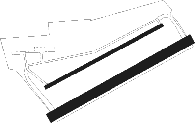
Runway info
Runway 07R / 25L  | ||
| length | 831m (2726ft) | |
| bearing | 73° / 253° | |
| width | 50m (164ft) | |
| surface | grass | |
| Runway 07L / 25R | ||
| length | 699m (2293ft) | |
| bearing | 74° / 254° | |
| width | 19m (62ft) | |
| surface | asphalt | |
Nearby beacons
| code | identifier | dist | bearing | frequency |
|---|---|---|---|---|
| PGS | CHARLES-DE-GAULLE (PARIS) VOR/DME | 7.9 | 226° | 117.05 |
| CGN | (PARIS) DME | 10.7 | 249° | 115.35 |
| BSN | DME | 13.4 | 76° | 114.85 |
| BT | LE BOURGET (PARIS) VOR/DME | 13.7 | 244° | 116.10 |
| CLM | COULOMMIERS VOR/DME | 19.2 | 134° | 112.90 |
| POY | ORLY (PARIS) NDB | 26.5 | 222° | 334 |
| PON | PONTOISE CORMEILLES EN VE VOR | 27.5 | 269° | 111.60 |
| MTD | MONTDIDIER VOR | 28.3 | 331° | 113.65 |
| BOV | BEAUVAIS TILLE VOR/DME | 30.1 | 299° | 109.65 |
| TA | VILLACOUBLAY NDB | 32.3 | 242° | 286 |
| TSU | TOUSSUS LE NOBLE VOR | 32.9 | 241° | 108.25 |
| CTL | CHATILLON SUR MARNE VOR/DME | 33 | 88° | 117.60 |
| MV | MELUN NDB | 34.6 | 157° | 434 |
| BV | BEAUVAIS NDB | 35.9 | 298° | 391 |
| MLN | MELUN VILLAROCHE VOR/DME | 39.3 | 173° | 113.60 |
| RBT | RAMBOUILLET VOR/DME | 40 | 238° | 114.70 |
| HOL | VILLACOUBLAY NDB | 42.7 | 248° | 315 |
| GI | AMIENS NDB | 45.1 | 341° | 339 |
| BRY | BRAY SUR SEINE VOR/DME | 47.6 | 142° | 114.10 |
| ABY | ALBERT BRAY NDB | 52.1 | 5° | 321 |
| PTV | PITHIVIERS VOR | 60.2 | 206° | 116.50 |
Disclaimer
The information on this website is not for real aviation. Use this data with the X-Plane flight simulator only! Data taken with kind consent from X-Plane 12 source code and data files. Content is subject to change without notice.