Villacoublay - Saint Cyr L Ecole
Airport details
| Country | France |
| State | Ile-de-France |
| Region | LF |
| Airspace | Paris Ctr |
| Municipality | Saint-Cyr-l'École |
| Elevation | 371ft (113m) |
| Timezone | GMT +1 |
| Coordinates | 48.81528, 2.06536 |
| Magnetic var | |
| Type | land |
| Available since | X-Plane v10.40 |
| ICAO code | LFPZ |
| IATA code | n/a |
| FAA code | n/a |
Communication
| Saint Cyr l Ecole CTAF | 131.025 |
| Saint Cyr l Ecole twr | 118.000 |
Nearby Points of Interest:
Ferme de Gally
-Maison royale de Saint-Louis
-Fort de Bois-d'Arcy
-Pavillon français, Trianon
-Pavillon frais
-Belvédère du Petit Trianon
-Gardens of Versailles
-Hameau de la Reine
-Trou d'Enfer semaphore tower
-Versailles domain
-Hôtel des Affaires étrangères et de la Marine
-Hôtel de la Guerre
-Grand commun
-écuries du Roi
-Château de Grand'Maisons
-Porte des gendarmes (Versailles)
-Hôpital Richaud
-rendez-vous de chasse des Clayes-sous-Bois
-domaine national de Marly-le-Roi
-Cité ouvrière les Dents de Scie
-Domain of Montreuil
-Maison des musiciens italiens
-Pavillon du Butard
-Ancienne Laiterie de Madame
-Pavillon de musique de la comtesse de Provence
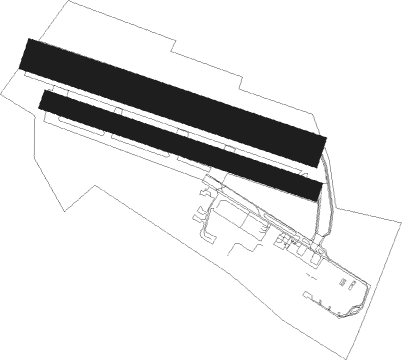
Runway info
Runway 11L / 29R  | ||
| length | 891m (2923ft) | |
| bearing | 106° / 286° | |
| width | 100m (328ft) | |
| surface | grass | |
| displ threshold | 275m (902ft) / 130m (427ft) | |
| Runway 11R / 29L | ||
| length | 866m (2841ft) | |
| bearing | 106° / 286° | |
| width | 60m (197ft) | |
| surface | grass | |
| displ threshold | 150m (492ft) / 135m (443ft) | |
Nearby beacons
| code | identifier | dist | bearing | frequency |
|---|---|---|---|---|
| TA | VILLACOUBLAY NDB | 2.9 | 144° | 286 |
| TSU | TOUSSUS LE NOBLE VOR | 3.9 | 149° | 108.25 |
| RBT | RAMBOUILLET VOR/DME | 10 | 204° | 114.70 |
| HOL | VILLACOUBLAY NDB | 10.9 | 251° | 315 |
| POY | ORLY (PARIS) NDB | 13.8 | 105° | 334 |
| PON | PONTOISE CORMEILLES EN VE VOR | 16.9 | 354° | 111.60 |
| BT | LE BOURGET (PARIS) VOR/DME | 18.1 | 68° | 116.10 |
| EPR | EPERNON VOR/DME | 19.7 | 245° | 115.65 |
| CGN | (PARIS) DME | 21.1 | 65° | 115.35 |
| PGS | CHARLES-DE-GAULLE (PARIS) VOR/DME | 24.6 | 72° | 117.05 |
| EVX | EVREUX FAUVILLE VORTAC | 35.7 | 284° | 112.40 |
| MLN | MELUN VILLAROCHE VOR/DME | 36.7 | 116° | 113.60 |
| BOV | BEAUVAIS TILLE VOR/DME | 37.4 | 8° | 109.65 |
| CLM | COULOMMIERS VOR/DME | 37.5 | 88° | 112.90 |
| MV | MELUN NDB | 39.4 | 106° | 434 |
| PTV | PITHIVIERS VOR | 40.4 | 163° | 116.50 |
| BV | BEAUVAIS NDB | 40.6 | 357° | 391 |
| BSN | DME | 45 | 69° | 114.85 |
| MTD | MONTDIDIER VOR | 47.3 | 30° | 113.65 |
| ROU | ROUEN VALLEE DE SEINE VOR | 49.7 | 310° | 116.80 |
| OAN | ORLEANS-BRICY NDB | 50.2 | 200° | 385 |
| BCY | ORLEANS VOR/DME | 51.3 | 200° | 117.35 |
| CAD | CHATEAUDUN VOR/DME | 52.8 | 222° | 115.95 |
| ORS | ORLEANS SAINT DENIS DE L'HOTEL NDB | 53.1 | 169° | 322 |
| CHN | CHATEAUDUN TACAN | 53.2 | 222° | 110.20 |
Disclaimer
The information on this website is not for real aviation. Use this data with the X-Plane flight simulator only! Data taken with kind consent from X-Plane 12 source code and data files. Content is subject to change without notice.