Troyes - Troyes Barberey
Airport details
| Country | France |
| State | Grand Est |
| Region | LF |
| Airspace | Paris Ctr |
| Municipality | Barberey-Saint-Sulpice |
| Elevation | 388ft (118m) |
| Timezone | GMT +1 |
| Coordinates | 48.32162, 4.01662 |
| Magnetic var | |
| Type | land |
| Available since | X-Plane v10.40 |
| ICAO code | LFQB |
| IATA code | QYR |
| FAA code | n/a |
Communication
| Troyes Barberey TROYES AFIS | 123.725 |
| Troyes Barberey SEINE Approach 2000+ | 118.050 |
| Troyes Barberey SEINE Approach -2000 | 120.325 |
| Troyes Barberey SEINE Departure | 120.325 |
Nearby Points of Interest:
Pont-canal de Barberey-Saint-Sulpice
-Croix la Beigne
-Hôtel de ville de Sainte-Savine
-Ancien cimetière de l'église de la Madeleine
-Hôtel de Marisy
-Hôtel Deheurles
-Hôtel de la Croix d'Or
-Hôtel Camusat
-Hôtel Juvénal des Ursins
-Maison de l'Orfèvre
-Hôtel du Lion-Noir
-Maison de l'Élection
-Hôtel de Chapelaines
-Allée couverte des Grèves de Frécul
-Prefecture hotel of Aube
-Chapitre de Troyes
-Hospice Saint-Nicolas de Troyes
-Maison du Dauphin, Troyes
-Monastère de la Visitation de Troyes
-Calvaire de la Croix Blanche
-Halle d'Estissac
-église de Géraudot
-Montiéramey Abbey
-halle de Piney
-ancienne papeterie de Chappes
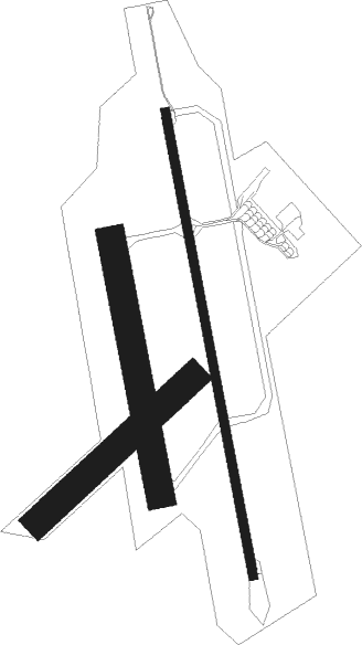
Runway info
Runway 17 / 35  | ||
| length | 1651m (5417ft) | |
| bearing | 171° / 351° | |
| width | 30m (98ft) | |
| surface | asphalt | |
| displ threshold | 0m (0ft) / 118m (387ft) | |
| Runway 17R / 35L | ||
| length | 901m (2956ft) | |
| bearing | 171° / 351° | |
| width | 100m (328ft) | |
| surface | grass | |
| Runway 05 / 23 | ||
| length | 735m (2411ft) | |
| bearing | 62° / 242° | |
| width | 100m (328ft) | |
| surface | grass | |
| displ threshold | 85m (279ft) / 0m (0ft) | |
Nearby beacons
| code | identifier | dist | bearing | frequency |
|---|---|---|---|---|
| TRO | TROYES BARBEREY VOR | 4.7 | 217° | 116 |
| TY | TROYES NDB | 4.7 | 351° | 320 |
| CAV | CHALONS VOR/DME | 28 | 16° | 111.65 |
| VAT | CHALONS NDB | 28.5 | 360° | 367 |
| CVT | CHALONS NDB | 28.8 | 35° | 347 |
| BRY | BRAY SUR SEINE VOR/DME | 29.2 | 277° | 114.10 |
| AX | AUXERRE NDB | 31.7 | 232° | 417 |
| SDI | SAINT DIZIER ROBINSON TACAN | 39.5 | 70° | 114 |
| CTL | CHATILLON SUR MARNE VOR/DME | 52 | 332° | 117.60 |
| REM | REIMS VOR | 59.4 | 2° | 112.30 |
| BSN | DME | 64.4 | 312° | 114.85 |
Departure and arrival routes
| Transition altitude | 5000ft |
| SID end points | distance | outbound heading | |
|---|---|---|---|
| RW17 | |||
| ARSI4S | 14mi | 11° | |
| ERTI4S | 19mi | 116° | |
| KASO4S | 55mi | 135° | |
| LURE4S | 18mi | 199° | |
| OKRI4S | 28mi | 232° | |
| RW35 | |||
| ARSI4N | 14mi | 11° | |
| ERTI4N | 19mi | 116° | |
| KASO4N | 55mi | 135° | |
| LURE4N | 18mi | 199° | |
| OKRI4N | 28mi | 232° | |
| STAR starting points | distance | inbound heading | |
|---|---|---|---|
| ALL | |||
| LURE1C | 18.2 | 19° | |
| PTV1C | 70.7 | 85° | |
| CTL1C | 52.0 | 152° | |
| REM1C | 59.4 | 182° | |
| RLP1C | 55.3 | 289° | |
| DJL1C | 76.7 | 314° | |
| RW17 | |||
| LURE1U | 18.2 | 19° | |
| PTV1U | 70.7 | 85° | |
| CTL1U | 52.0 | 152° | |
| DIKO1U | 49.0 | 182° | |
| ERTI1U | 19.2 | 296° | |
| BOLY1U | 14.8 | 330° | |
| RW35 | |||
| AVLO1D | 46.4 | 15° | |
| PTV1D | 70.7 | 85° | |
| CTL1D | 52.0 | 152° | |
| DIKO1D | 49.0 | 182° | |
| RLP1D | 55.3 | 289° | |
| KASO1D | 54.9 | 315° | |
Instrument approach procedures
| runway | airway (heading) | route (dist, bearing) |
|---|---|---|
| RW17 | EVLIK (208°) | EVLIK NEXOT (5mi, 266°) 2500ft |
| RW17 | NEXOT (171°) | NEXOT 2500ft |
| RW17 | OGMAP (132°) | OGMAP NEXOT (6mi, 86°) 2500ft |
| RNAV | NEXOT 2500ft FQB17 (4mi, 171°) 2500ft LFQB (6mi, 171°) 414ft QB410 (3mi, 171°) 2500ft QB412 (8mi, 297°) OGMAP (8mi, 350°) 2500ft NEXOT (6mi, 86°) NEXOT (turn) 2500ft | |
| RW35 | ABSEG (67°) | ABSEG BEDVA (9mi, 171°) DIDGO (6mi, 86°) 2500ft |
| RW35 | BEDVA (29°) | BEDVA DIDGO (6mi, 86°) 2500ft |
| RNAV | DIDGO 2500ft FQB35 (5mi, 351°) 2500ft LFQB (7mi, 351°) 433ft QB510 (3mi, 351°) 3000ft ABSEG (9mi, 228°) 3000ft ABSEG (turn) |
Holding patterns
| STAR name | hold at | type | turn | heading* | altitude | leg | speed limit |
|---|---|---|---|---|---|---|---|
| BRY1C | TY | FIX | right | 353 (173)° | 2500ft - 7000ft | 1.0min timed | 210 |
| CTL1C | TY | FIX | right | 353 (173)° | 2500ft - 7000ft | 1.0min timed | 210 |
| CTL1D | ABSEG | VHF | right | 323 (143)° | 3000ft - 6000ft | 1.0min timed | 200 |
| CTL1U | NEXOT | VHF | right | 353 (173)° | 2500ft - 6000ft | 1.0min timed | 200 |
| DIKO1D | ABSEG | VHF | right | 323 (143)° | 3000ft - 6000ft | 1.0min timed | 200 |
| DIKO1U | NEXOT | VHF | right | 353 (173)° | 2500ft - 6000ft | 1.0min timed | 200 |
| DJL1C | TY | FIX | right | 353 (173)° | 2500ft - 7000ft | 1.0min timed | 210 |
| LURE1C | TY | FIX | right | 353 (173)° | 2500ft - 7000ft | 1.0min timed | 210 |
| PTV1C | TY | FIX | right | 353 (173)° | 2500ft - 7000ft | 1.0min timed | 210 |
| REM1C | TY | FIX | right | 353 (173)° | 2500ft - 7000ft | 1.0min timed | 210 |
| RLP1C | TY | FIX | right | 353 (173)° | 2500ft - 7000ft | 1.0min timed | 210 |
| *) magnetic outbound (inbound) holding course | |||||||
Disclaimer
The information on this website is not for real aviation. Use this data with the X-Plane flight simulator only! Data taken with kind consent from X-Plane 12 source code and data files. Content is subject to change without notice.