Rouvres - Etain Rouvres
Airport details
| Country | France |
| State | Grand Est |
| Region | LF |
| Airspace | Reims Ctr |
| Municipality | Rouvres-en-Woëvre |
| Elevation | 770ft (235m) |
| Timezone | GMT +1 |
| Coordinates | 49.22917, 5.67611 |
| Magnetic var | |
| Type | land |
| Available since | X-Plane v10.40 |
| ICAO code | LFQE |
| IATA code | n/a |
| FAA code | n/a |
Communication
| Etain Rouvres ETAIN Approach | 120.125 |
Approach frequencies
| ILS-cat-I | RW01 | 110.5 | 18.00mi |
| 3° GS | RW01 | 110.5 | 18.00mi |
Nearby Points of Interest:
Hôtel de ville d'Étain
-Beffroi de Briey
-Remparts de Verdun
-Verdun Town Hall
-Sous-préfecture de Verdun
-Maison du Pape Jules II
-Immeuble Noguez
-Porte Châtel
-Immeuble, 27 rue de la Paix
-Pont-écluse Saint-Amand de Verdun
-Abbaye Saint-Vanne de Verdun
-Mine de fer Bassompierre
-Gorze Abbey
-Motte castrale de Chaillon
-Ancienne église Saint-Hubert de Gandrange
-Nécropole mérovingienne d'Audun-le-Tiche
-Maison de l'Intendance
-city walls of Longwy
-puits couvert de Longwy
-Hôtel de ville de Longwy
-Ossuaire d'Ancy-sur-Moselle
-maison du pasteur Paul Ferry
-Group Fortifications Of Saint-Quentin
-église Saint-Pierre de Veymerange
-Abbaye de Sainte-Marie-au-Bois
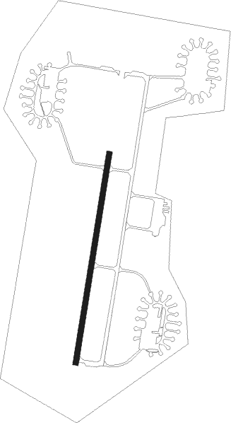
Runway info
| Runway 01 / 19 | ||
| length | 1723m (5653ft) | |
| bearing | 20° / 200° | |
| width | 45m (148ft) | |
| surface | asphalt | |
| blast zone | 255m (837ft) / 255m (837ft) | |
Nearby beacons
| code | identifier | dist | bearing | frequency |
|---|---|---|---|---|
| ETN | ETAIN NDB | 0 | 250° | 410 |
| MTZ | METZ NDB | 21 | 85° | 354 |
| MMD | MONTMEDY VOR | 23.6 | 286° | 109.40 |
| WLU | LUXEMBOURG NDB | 25.1 | 48° | 346 |
| LOU | LORRAINE NDB | 27.1 | 111° | 388 |
| LW | LUXEMBOURG NDB | 30.1 | 52° | 404 |
| LE | LUXEMBOURG NDB | 33.2 | 54° | 318 |
| LUX | LUXEMBOURG VOR/DME | 33.2 | 54° | 112.25 |
| ELU | LUXEMBOURG NDB | 37.8 | 56° | 368 |
| NAY | NANCY OCHEY TACAN | 40.2 | 157° | 116.80 |
| DIK | DIEKIRCH NDB | 41.8 | 36° | 307 |
| SDI | SAINT DIZIER ROBINSON TACAN | 47.2 | 233° | 114 |
| EPL | EPINAL MIRECOURT VOR | 56.7 | 157° | 113 |
| EMT | EPINAL NDB | 57.6 | 150° | 419 |
Instrument approach procedures
| runway | airway (heading) | route (dist, bearing) |
|---|---|---|
| RW01 | QE400 (21°) | QE400 3000ft FQE01 (6mi, 20°) 2400ft |
| RNAV | FQE01 2400ft LFQE (6mi, 22°) 786ft QE401 (3mi, 17°) 3000ft QE402 (5mi, 279°) 3000ft QE403 (6mi, 200°) 3000ft QE404 (9mi, 200°) 3000ft QE400 (5mi, 99°) 3000ft | |
| RW19-Z | QE400 (21°) | QE400 3000ft QE410 (12mi, 350°) QE411 (10mi, 16°) IE19Z (4mi, 99°) 2500ft |
| RW19-Z | QE411 (161°) | QE411 IE19Z (4mi, 99°) 2500ft |
| RNAV | IE19Z 2500ft FE19Z (4mi, 200°) 2500ft LFQE (5mi, 198°) 809ft QE411 (10mi, 341°) 3000ft |
Disclaimer
The information on this website is not for real aviation. Use this data with the X-Plane flight simulator only! Data taken with kind consent from X-Plane 12 source code and data files. Content is subject to change without notice.