La Vèze - Besancon La Veze
Airport details
| Country | France |
| State | Bourgogne-Franche-Comté |
| Region | LF |
| Airspace | Reims Ctr |
| Municipality | Morre |
| Elevation | 1270ft (387m) |
| Timezone | GMT +1 |
| Coordinates | 47.20496, 6.07587 |
| Magnetic var | |
| Type | land |
| Available since | X-Plane v10.40 |
| ICAO code | LFQM |
| IATA code | n/a |
| FAA code | n/a |
Communication
| Besancon La Veze INFO | 122.200 |
Nearby Points of Interest:
Lunettes of Trois-Châtels and Tousey
-Magasin du port Rivotte
-Hôtel Mareschal
-vestiges archéologiques
-Hôtel Bonvalot
-Château d'eau de la source d'Arcier
-Hôtel de Sorans
-Hôtel Alviset
-Hôtel Querret du Bois
-birthhouse of Victor Hugo
-Hotel de Clévans
-hôtel de Courbouzon-Villefrançon
-Hôtel de Courbouzon
-Hôtel Fleury de Villayer
-Hôtel Terrier
-Hôtel Camus
-Hôtel Petit de Marivat
-Hôtel de Valay
-Hôtel Isabey
-Hôtel Henrion de Magnoncourt
-Hôtel Gavinet
-Église des Carmes de Besançon
-Caserne Ruty
-Grand séminaire de Besançon
-hôtel de Mesmay
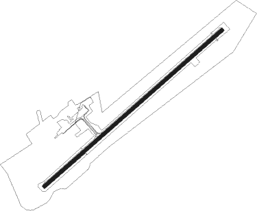
Runway info
| Runway 05 / 23 | ||
| length | 1401m (4596ft) | |
| bearing | 63° / 243° | |
| width | 23m (75ft) | |
| surface | asphalt | |
| displ threshold | 310m (1017ft) / 60m (197ft) | |
Nearby beacons
| code | identifier | dist | bearing | frequency |
|---|---|---|---|---|
| BSV | BESANCON NDB | 6.3 | 64° | 370 |
| LPS | LES EPLATURES NDB | 30.1 | 100° | 403 |
| LUL | LUXEUIL VOR | 30.3 | 24° | 117.10 |
| DO | DOLE NDB | 34.2 | 254° | 309 |
| HR | HERICOURT NDB | 34.2 | 61° | 289 |
| LAP | PRAZ DME | 34.6 | 147° | 110.65 |
| LXI | LUXEUIL SAINT SAUVEUR TACAN | 36.5 | 26° | 108.20 |
| MB | MONTBELIARD NDB | 38.9 | 71° | 330 |
| DJL | DIJON LONGVIC VOR/DME | 40 | 274° | 111.45 |
| SPR | ST PREX VOR/DME | 46.7 | 153° | 113.90 |
| GLA | GLAND NDB | 48.3 | 168° | 375 |
| RLP | ROLAMPONT VOR/DME | 53.8 | 310° | 117.30 |
| GVA | GENEVA VOR/DME | 57.1 | 177° | 115.75 |
Instrument approach procedures
| runway | airway (heading) | route (dist, bearing) |
|---|---|---|
| RW23-Y | IQM23 (244°) | IQM23 3500ft |
| RW23-Y | QM401 (216°) | QM401 6000ft IQM23 (7mi, 156°) 3500ft |
| RW23-Y | QM403 (264°) | QM403 6300ft IQM23 (7mi, 294°) 3500ft |
| RNAV | IQM23 3500ft FM23Y (3mi, 243°) 3500ft LFQM (8mi, 244°) 1309ft IQM23 (11mi, 64°) 3500ft | |
| RW23-Z | IQM23 (244°) | IQM23 3500ft |
| RW23-Z | QM401 (216°) | QM401 6000ft IQM23 (7mi, 156°) 3500ft |
| RW23-Z | QM403 (264°) | QM403 6300ft IQM23 (7mi, 294°) 3500ft |
| RNAV | IQM23 3500ft FM23Z (3mi, 243°) 3500ft LFQM (7mi, 244°) 1309ft QM501 (1mi, 239°) IQM23 (12mi, 63°) 3500ft |
Disclaimer
The information on this website is not for real aviation. Use this data with the X-Plane flight simulator only! Data taken with kind consent from X-Plane 12 source code and data files. Content is subject to change without notice.