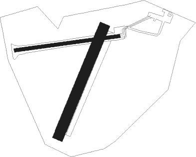
Saint Omer - Wizernes
Airport details
| Country | France |
| State | Hauts-de-France |
| Region | LF |
| Airspace | Paris Ctr |
| Municipality | Longuenesse |
| Elevation | 248ft (76m) |
| Timezone | GMT +1 |
| Coordinates | 50.72944, 2.23583 |
| Magnetic var | |
| Type | land |
| Available since | X-Plane v10.40 |
| ICAO code | LFQN |
| IATA code | n/a |
| FAA code | n/a |
Communication
| Wizernes SAINT_OMER UNIC | 123.500 |
Nearby Points of Interest:
Collège des Jésuites de Saint-Omer
-Colleges of St Omer, Bruges and Liège
-Hôpital général de Saint-Omer
-Abbaye Sainte-Colombe de Blendecques
-Marais Audomarois biosphere reserve
-Abbaye de Clairmarais
-Abbaye Saint-Jean-du-Mont de Thérouanne
-Église Saint-Jacques-le-Majeur-et-Saint-Ignace d'Aire-sur-la-Lys
-Refuge de l'abbaye Saint-Augustin de Clarques
-Bailiwick of Aire-sur-la-Lys
-City walls of Aire-sur-la-Lys
-Casteel Meulen
-Hotel of the castellany of Cassel
-Collégiale Notre-Dame à Cassel
-Église Notre-Dame-de-Lourdes de Hazebrouck
-Abbaye des Prémontrés de Licques
-Taufbecken (Terdeghem)
-Kanzel
-Château de Colembert
-Église Saint-Géry de Bierne
-City walls of Gravelines
-City walls of Bergues
-Goutte de lait de la Compagnie des mines de Marles
-Fosse n° 2 des mines de Marles
-Donjon de Bours
Nearby beacons
| code | identifier | dist | bearing | frequency |
|---|---|---|---|---|
| BNE | BOULOGNE SUR MER VOR | 14 | 252° | 113.80 |
| MVC | MERVILLE NDB | 16.3 | 114° | 327 |
| MK | CALAIS-DUNKERQUE NDB | 17.4 | 326° | 418 |
| MRV | MERVILLE NDB | 18.2 | 97° | 404 |
| ING | SAINT INGLEVERT NDB | 20.8 | 287° | 387 |
| KOK | KOKSY VORTAC | 27 | 49° | 114.50 |
| LEQ | LILLE LESQUIN VOR/DME | 34 | 101° | 109 |
| DD | OOSTENDE (OOSTENDE-BRUGGE) NDB | 35.9 | 52° | 352 |
| OO | OOSTENDE (OOSTENDE-BRUGGE) NDB | 38.1 | 55° | 375 |
| LL | LILLE NDB | 38.2 | 99° | 332 |
| ABB | ABBEVILLE VOR/DME | 38.5 | 213° | 108.45 |
| ONO | OOSTENDE NDB | 41.5 | 58° | 399 |
| DVR | DOVER VOR/DME | 42.1 | 296° | 114.95 |
| CMB | CAMBRAI EPINOY VOR/DME | 46.1 | 119° | 112.60 |
| ABY | ALBERT BRAY NDB | 50.2 | 143° | 321 |
| GI | AMIENS NDB | 54.1 | 164° | 339 |
Disclaimer
The information on this website is not for real aviation. Use this data with the X-Plane flight simulator only! Data taken with kind consent from X-Plane 12 source code and data files. Content is subject to change without notice.

