Lille/lesquin - Lille Lesquin
Airport details
| Country | France |
| State | Hauts-de-France |
| Region | LF |
| Airspace | Paris Ctr |
| Municipality | Vendeville |
| Elevation | 151ft (46m) |
| Timezone | GMT +1 |
| Coordinates | 50.57264, 3.09303 |
| Magnetic var | |
| Type | land |
| Available since | X-Plane v10.40 |
| ICAO code | LFQQ |
| IATA code | LIL |
| FAA code | n/a |
Communication
| Lille Lesquin LFQQ ATIS | 119.325 |
| Lille Lesquin LILLE Ground Control | 121.850 |
| Lille Lesquin LILLE Tower | 118.550 |
| Lille Lesquin LILLE Approach_WEST | 120.275 |
| Lille Lesquin LILLE Approach_EAST | 126.475 |
Approach frequencies
| ILS-cat-III | RW26 | 110.75 | 18.00mi |
| 3° GS | RW26 | 110.75 | 18.00mi |
Nearby Points of Interest:
Lille university hospital - Centre hospitalier régional universitaire de Lille
-Hôpital Marguerite de Flandre (Seclin)
-Pavillon Saint-Sauveur
-hôtel de ville de Lille
-Vitraux de l'église Saint-Pierre de Bouvines
-Gantois Hospice
-Salle des fêtes de Lille-Fives
-Hôtel de Marchiennes
-les cariatides
-Prefecture hotel of Nord
-Caserne Souham
-hôtel Catel-Béghin
-Hôtel d'Avelin
-Refuge de l'Abbaye de Loos
-Hôtel militaire des Bleuets
-Motte castrale Quiquempois
-Ancien carmel d'Ascq
-Chapelle de la famille Gonnet
-Hôtel du Juge Garde des Monnaies
-Hospice général de Lille
-Château de l'abbaye de Cysoing
-Pavillon Louis XVI
-Grands Moulins de Paris (Marquette-lez-Lille)
-Chapelle du Lazaro
-pharmacie
Runway info
Runway 08 / 26  | ||
| length | 2828m (9278ft) | |
| bearing | 82° / 262° | |
| width | 45m (146ft) | |
| surface | asphalt | |
| displ threshold | 0m (0ft) / 280m (919ft) | |
| Runway 01 / 19 | ||
| length | 1575m (5167ft) | |
| bearing | 23° / 203° | |
| width | 30m (98ft) | |
| surface | asphalt | |
Airport layout
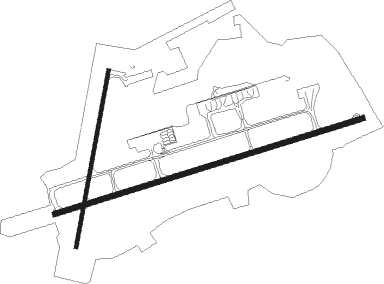
Taxiway locations
Parking locations
Nearby beacons
| code | identifier | dist | bearing | frequency |
|---|---|---|---|---|
| LEQ | LILLE LESQUIN VOR/DME | 0.6 | 200° | 109 |
| LL | LILLE NDB | 4.6 | 86° | 332 |
| MRV | MERVILLE NDB | 15.8 | 284° | 404 |
| VS | VALENCIENNES NDB | 16.5 | 130° | 317 |
| MVC | MERVILLE NDB | 19.2 | 270° | 327 |
| CMB | CAMBRAI EPINOY VOR/DME | 20.8 | 170° | 112.60 |
| MAK | MACKEL NDB | 28 | 46° | 360 |
| CIV | CHIEVRES VORTAC | 28.2 | 90° | 113.20 |
| KOK | KOKSY VORTAC | 35.5 | 320° | 114.50 |
| ABY | ALBERT BRAY NDB | 37.4 | 205° | 321 |
| DD | OOSTENDE (OOSTENDE-BRUGGE) NDB | 38.5 | 337° | 352 |
| OO | OOSTENDE (OOSTENDE-BRUGGE) NDB | 38.6 | 344° | 375 |
| ONO | OOSTENDE NDB | 39 | 353° | 399 |
| COA | COSTA VOR/DME | 47.6 | 19° | 110.05 |
| GI | AMIENS NDB | 49.7 | 220° | 339 |
Departure and arrival routes
| Transition altitude | 5000ft |
| SID end points | distance | outbound heading | |
|---|---|---|---|
| RW08 | |||
| MATI6R, MATI6E | 42mi | 120° | |
| VERM6R | 35mi | 165° | |
| ABB6R, ABB6E | 54mi | 251° | |
| TRAC6E, TRAC6R | 46mi | 284° | |
| RW26 | |||
| MATI6T, MATI6S, MATI6P, MATI6L | 42mi | 120° | |
| VERM6L, VERM6P | 35mi | 165° | |
| ABB6W, ABB6L | 54mi | 251° | |
| TRAC6L, TRAC6W | 46mi | 284° | |
| STAR starting points | distance | inbound heading | |
|---|---|---|---|
| ALL | |||
| ABB5A | 54.2 | 71° | |
| TRAC5A | 45.9 | 104° | |
| MATI5A, MATI5B | 42.4 | 300° | |
| RW08 | |||
| SULE5C | 34.9 | 16° | |
| ABB5C, ABB5F | 54.2 | 71° | |
| TRAC5F, TRAC5C | 45.9 | 104° | |
| MATI5C | 42.4 | 300° | |
| RW26 | |||
| ABB5D | 54.2 | 71° | |
| TRAC5D | 45.9 | 104° | |
| MATI5D, MATI5F | 42.4 | 300° | |
Instrument approach procedures
| runway | airway (heading) | route (dist, bearing) |
|---|---|---|
| RW08-Y | RONOR (96°) | RONOR 2000ft NEKEN (5mi, 160°) 2000ft |
| RW08-Y | SUDAP (62°) | SUDAP 2000ft NEKEN (5mi, 340°) 2000ft |
| RNAV | NEKEN 2000ft FQ08Y (5mi, 82°) 2000ft LFQQ (6mi, 79°) 206ft QQ411 (4mi, 87°) QQ412 (7mi, 64°) QQ413 (7mi, 201°) 3000ft ERNOD (21mi, 254°) 5000ft ERNOD (turn) 5000ft | |
| RW08-Z | ERNOD (60°) | ERNOD 3000ft EKRIK (7mi, 344°) 3000ft |
| RNAV | EKRIK 3000ft FQ08Z (4mi, 82°) 3000ft LFQQ (9mi, 80°) 206ft QQ411 (4mi, 87°) QQ412 (7mi, 64°) QQ413 (7mi, 201°) 3000ft ERNOD (21mi, 254°) 5000ft ERNOD (turn) 5000ft | |
| RW26 | ASBAR (303°) | ASBAR 3000ft OSLID (7mi, 18°) OLBUS (6mi, 341°) 2000ft |
| RW26 | OSLID (282°) | OSLID OLBUS (6mi, 341°) 2000ft |
| RW26 | UPMIT (253°) | UPMIT 2000ft OLBUS (3mi, 161°) 2000ft |
| RNAV | OLBUS 2000ft FQQ26 (4mi, 262°) 2000ft LFQQ (7mi, 265°) 184ft QQ510 (11mi, 260°) QQ512 (9mi, 114°) 3000ft ASBAR (14mi, 98°) 5000ft ASBAR (turn) |
Holding patterns
| STAR name | hold at | type | turn | heading* | altitude | leg | speed limit |
|---|---|---|---|---|---|---|---|
| ABB5A | LEQ | NDB | left | 275 (95)° | 2000ft - 7000ft | 1.0min timed | 220 |
| ABB5C | ERNOD | VHF | left | 145 (325)° | 5000ft - 10000ft | 1.0min timed | 220 |
| ABB5D | ASBAR | VHF | left | 194 (14)° | 5000ft - 10000ft | 1.0min timed | 220 |
| BNE5A | LEQ | NDB | left | 275 (95)° | 2000ft - 7000ft | 1.0min timed | 220 |
| BNE5C | ERNOD | VHF | left | 145 (325)° | 5000ft - 10000ft | 1.0min timed | 220 |
| BNE5D | ASBAR | VHF | left | 194 (14)° | 5000ft - 10000ft | 1.0min timed | 220 |
| CIV5A | LEQ | NDB | left | 275 (95)° | 2000ft - 7000ft | 1.0min timed | 220 |
| CIV5B | LL | FIX | right | 78 (258)° | 2000ft - 4000ft | 1.0min timed | 220 |
| CIV5C | ERNOD | VHF | left | 145 (325)° | 5000ft - 10000ft | 1.0min timed | 220 |
| CIV5D | ASBAR | VHF | left | 194 (14)° | 5000ft - 10000ft | 1.0min timed | 220 |
| CMB5A | LEQ | NDB | left | 275 (95)° | 2000ft - 7000ft | 1.0min timed | 220 |
| CMB5B | LL | FIX | right | 78 (258)° | 2000ft - 4000ft | 1.0min timed | 220 |
| CMB5C | ERNOD | VHF | left | 145 (325)° | 5000ft - 10000ft | 1.0min timed | 220 |
| CMB5D | ASBAR | VHF | left | 194 (14)° | 5000ft - 10000ft | 1.0min timed | 220 |
| MATI5A | LEQ | NDB | left | 275 (95)° | 2000ft - 7000ft | 1.0min timed | 220 |
| MATI5B | LL | FIX | right | 78 (258)° | 2000ft - 4000ft | 1.0min timed | 220 |
| MATI5C | ERNOD | VHF | left | 145 (325)° | 5000ft - 10000ft | 1.0min timed | 220 |
| MATI5D | ASBAR | VHF | left | 194 (14)° | 5000ft - 10000ft | 1.0min timed | 220 |
| SULE5C | ERNOD | VHF | left | 145 (325)° | 5000ft - 10000ft | 1.0min timed | 220 |
| TRAC5A | LEQ | NDB | left | 275 (95)° | 2000ft - 7000ft | 1.0min timed | 220 |
| TRAC5C | ERNOD | VHF | left | 145 (325)° | 5000ft - 10000ft | 1.0min timed | 220 |
| TRAC5D | ASBAR | VHF | left | 194 (14)° | 5000ft - 10000ft | 1.0min timed | 220 |
| *) magnetic outbound (inbound) holding course | |||||||
Disclaimer
The information on this website is not for real aviation. Use this data with the X-Plane flight simulator only! Data taken with kind consent from X-Plane 12 source code and data files. Content is subject to change without notice.