Brebières - Vitry En Artois
Airport details
| Country | France |
| State | Hauts-de-France |
| Region | LF |
| Airspace | Paris Ctr |
| Municipality | Vitry-en-Artois |
| Elevation | 170ft (52m) |
| Timezone | GMT +1 |
| Coordinates | 50.33629, 3.00064 |
| Magnetic var | |
| Type | land |
| Available since | X-Plane v10.40 |
| ICAO code | LFQS |
| IATA code | n/a |
| FAA code | n/a |
Communication
| Vitry en Artois INFO | 123.500 |
Nearby Points of Interest:
Place du Marché-au-Poisson de Douai
-Palais de justice de Douai
-convent of Chartreuse, Douai
-Cromlech des Bonnettes
-Hôpital-Général de Douai
-hotel de warenghien
-Maison des Templiers
-Église Saint-Stanislas de Dourges
-Fosse n° 9 des mines de l'Escarpelle
-Fosse n° 8 - 8 bis des mines de Dourges
-Pierre qui Pousse
-Chapelle Notre-Dame-de-Bonsecours d'Écaillon
-Town hall of Arras
-Abbey of St. Vaast
-Hospice Sainte-Agnès d'Arras
-Fosse n° 4 des mines de Carvin
-City walls of Arras
-Abbaye d'Henin-Liétard
-Prefecture hotel of Pas-de-Calais
-Château de Villers-Campeau
-Fosse n° 3 - 3 bis des mines de Lens
-Fosse n° 1 - 1 bis - 1 ter des mines de Liévin
-Fosse n° 11 - 19 des mines de Lens
-Ferme d'Azincourt
-Brasserie Laden Wallez
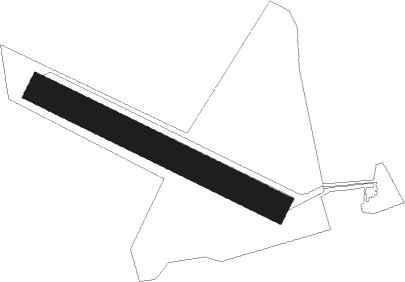
Runway info
| Runway 12 / 30 | ||
| length | 901m (2956ft) | |
| bearing | 111° / 291° | |
| width | 100m (328ft) | |
| surface | grass | |
| displ threshold | 70m (230ft) / 0m (0ft) | |
Nearby beacons
| code | identifier | dist | bearing | frequency |
|---|---|---|---|---|
| CMB | CAMBRAI EPINOY VOR/DME | 8.7 | 126° | 112.60 |
| VS | VALENCIENNES NDB | 13.5 | 87° | 317 |
| LEQ | LILLE LESQUIN VOR/DME | 13.9 | 21° | 109 |
| LL | LILLE NDB | 16.8 | 41° | 332 |
| MVC | MERVILLE NDB | 21.2 | 300° | 327 |
| ABY | ALBERT BRAY NDB | 22.8 | 208° | 321 |
| MRV | MERVILLE NDB | 23 | 319° | 404 |
| CIV | CHIEVRES VORTAC | 34.8 | 74° | 113.20 |
| GI | AMIENS NDB | 35.7 | 226° | 339 |
| MAK | MACKEL NDB | 42.1 | 38° | 360 |
| KOK | KOKSY VORTAC | 47.4 | 335° | 114.50 |
| MTD | MONTDIDIER VOR | 51 | 213° | 113.65 |
| DD | OOSTENDE (OOSTENDE-BRUGGE) NDB | 51.8 | 349° | 352 |
| OO | OOSTENDE (OOSTENDE-BRUGGE) NDB | 52.2 | 354° | 375 |
| ONO | OOSTENDE NDB | 53 | 1° | 399 |
| MK | CALAIS-DUNKERQUE NDB | 53.5 | 305° | 418 |
| BV | BEAUVAIS NDB | 63.1 | 229° | 391 |
| BOV | BEAUVAIS TILLE VOR/DME | 63.2 | 223° | 109.65 |
Disclaimer
The information on this website is not for real aviation. Use this data with the X-Plane flight simulator only! Data taken with kind consent from X-Plane 12 source code and data files. Content is subject to change without notice.