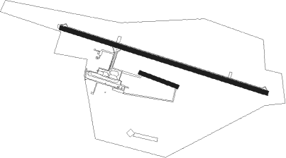
Tournes - Charleville Mezières
Airport details
| Country | France |
| State | Grand Est |
| Region | LF |
| Airspace | Paris Ctr |
| Municipality | Tournes |
| Elevation | 492ft (150m) |
| Timezone | GMT +1 |
| Coordinates | 49.78500, 4.64278 |
| Magnetic var | |
| Type | land |
| Available since | X-Plane v10.40 |
| ICAO code | LFQV |
| IATA code | XCZ |
| FAA code | n/a |
Communication
| Charleville Mezières CTAF | 126.850 |
| Charleville Mezières Twr | 126.850 |
| Charleville Mezières Dep | 126.850 |
Nearby Points of Interest:
La Macérienne
-Bains-douches de Charleville-Mézières
-Town hall (Charleville-Mézières)
-Enceinte de Mézières
-Château de Lumes
-Château Marcadet
-Bornes de Saint-Rémi
-Forge de Vrigne-aux-Bois
-Cité jardin Faure
-Cité Paris-Campagne
-City walls of Rocroi
-Haut-fourneau de Vendresse
-église Saint-Georges de Fumay
-Hôtel de ville de Sedan
-Château-Bas de Sedan
-Couvent des Capucins irlandais
-Manufacture de draps Cunin-Gridaine
-Château de Montvillers
-Tombeau du Géant
-Lompret
-Maisons espagnoles de Mouzon
-Château-ferme de Brieulles-sur-Bar
-Porcheresse Castle
-Roly
-Ferme de l'abbaye de Bucilly

Nearby beacons
| code | identifier | dist | bearing | frequency |
|---|---|---|---|---|
| BFS | FLORENNES TACAN | 27.4 | 1° | 111.50 |
| MMD | MONTMEDY VOR | 30.1 | 129° | 109.40 |
| REM | REIMS VOR | 36.7 | 232° | 112.30 |
| GSY | GOSLY (CHARLEROI) VOR/DME | 40.9 | 343° | 115.70 |
| ONC | CHARLEROI NDB | 42.4 | 353° | 323 |
| CIV | CHIEVRES VORTAC | 56.7 | 314° | 113.20 |
| SPI | SPRIMONT VOR/DME | 57.8 | 53° | 113.10 |
| HUL | HULDENBERG VOR/DME | 57.9 | 360° | 117.55 |
| HTB | BEAUVECHAIN NDB | 58.4 | 7° | 381 |
| BBE | BEAUVECHAIN TACAN | 58.5 | 7° | 116 |
| LGE | LIEGE VOR/DME | 61.1 | 44° | 115.45 |
| VAT | CHALONS NDB | 64.1 | 212° | 367 |
| ONL | LIEGE NDB | 65.1 | 45° | 290 |
Disclaimer
The information on this website is not for real aviation. Use this data with the X-Plane flight simulator only! Data taken with kind consent from X-Plane 12 source code and data files. Content is subject to change without notice.