Guipavas - Brest Bretagne
Airport details
| Country | France |
| State | Brittany |
| Region | LF |
| Airspace | Brest Ctr |
| Municipality | Guipavas |
| Elevation | 325ft (99m) |
| Timezone | GMT +1 |
| Coordinates | 48.44713, -4.42175 |
| Magnetic var | |
| Type | land |
| Available since | X-Plane v10.40 |
| ICAO code | LFRB |
| IATA code | BES |
| FAA code | n/a |
Communication
| Brest Bretagne LFRB ATIS | 129.355 |
| Brest Bretagne IROISE Info | 119.575 |
| Brest Bretagne GUIPAVAS Tower | 120.100 |
| Brest Bretagne IROISE Approach | 125.860 |
| Brest Bretagne LANDI Approach | 122.400 |
| Brest Bretagne Dep | 119.575 |
Approach frequencies
| ILS-cat-III | RW25L | 109.9 | 18.00mi |
| 3° GS | RW25L | 109.9 | 18.00mi |
Nearby Points of Interest:
Conservatoire botanique national de Brest
-Hôpital Augustin-Morvan
-Bois de Keroual
-îlot des Capucins
-Tréguelc'hier dolmen
-Chapelle-ossuaire Saint-Yves de Plouarzel
-Alignement de Saint-Denec
-Alignement de Traonigou
-Kastell Lostmarc'h
-Colombier du Château de Troërin
-Église Saint-Miliau de Guimiliau
-Église Notre-Dame de Saint-Thégonnec
-gare de Châteaulin-Ville
-Abri du marin de Douarnenez
-Puits communal de Locronan
-Chaise de Saint-Ronan
-Baptismal fonts of Église Notre-Dame de Croaz Batz
-Manufacture des tabacs de Morlaix
-Château de Kéranroux
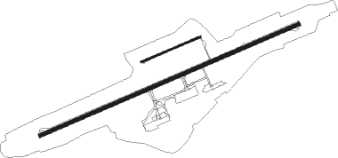
Runway info
Runway 07R / 25L  | ||
| length | 3095m (10154ft) | |
| bearing | 77° / 257° | |
| width | 45m (148ft) | |
| surface | asphalt | |
| displ threshold | 0m (0ft) / 303m (994ft) | |
| blast zone | 0m (0ft) / 56m (184ft) | |
| Runway 07L / 25R | ||
| length | 703m (2306ft) | |
| bearing | 77° / 257° | |
| width | 18m (59ft) | |
| surface | asphalt | |
| blast zone | 32m (105ft) / 31m (102ft) | |
Nearby beacons
| code | identifier | dist | bearing | frequency |
|---|---|---|---|---|
| GU | BREST NDB | 5.7 | 77° | 338 |
| BST | LANVEOC POULMIC NDB | 9.8 | 184° | 428 |
| LDV | LANDIVISIAU TACAN | 11.6 | 73° | 115.15 |
| OSA | OUESSANT NDB | 25.5 | 272° | 351 |
| QPR | QUIMPER PLUGUFFAN VOR/DME | 30.9 | 154° | 117.80 |
| ARE | MONTS D'ARREE VOR | 33.3 | 98° | 112.50 |
| RQ | QUIMPER NDB | 33.3 | 139° | 380 |
| LOR | LORIENT LANN BIHOUE NDB | 56.8 | 125° | 359 |
| LOR | LORIENT LANN BIHOUE TACAN | 56.9 | 125° | 115.80 |
Departure and arrival routes
| Transition altitude | 5000ft |
| SID end points | distance | outbound heading | |
|---|---|---|---|
| RW07R | |||
| TITU6F | 39mi | 68° | |
| BETU6F | 60mi | 69° | |
| ROSP6F, ROSP6E | 40mi | 126° | |
| QPR6F, QPR6E | 31mi | 154° | |
| MATE6E | 14mi | 270° | |
| NORB6F, NORB6E | 18mi | 360° | |
| RW25L | |||
| TITU6W | 39mi | 68° | |
| BETU6W | 60mi | 69° | |
| ROSP6W | 40mi | 126° | |
| QPR6W | 31mi | 154° | |
| MATE6X | 14mi | 270° | |
| NORB6W | 18mi | 360° | |
| STAR starting points | distance | inbound heading | |
|---|---|---|---|
| ALL | |||
| ANLE8C | 56.4 | 260° | |
| ROSP8C | 39.6 | 306° | |
| QPR8C, QPR8D | 30.9 | 334° | |
Instrument approach procedures
| runway | airway (heading) | route (dist, bearing) |
|---|---|---|
| RW07R | RB500 (125°) | RB500 5000ft RB504 (7mi, 257°) 4000ft RB506 (5mi, 178°) 3000ft IB07R (3mi, 96°) 2500ft |
| RW07R | RB502 (85°) | RB502 3500ft RB506 (3mi, 96°) 3000ft IB07R (3mi, 96°) 2500ft |
| RW07R | RB504 (98°) | RB504 4000ft RB506 (5mi, 178°) 3000ft IB07R (3mi, 96°) 2500ft |
| RNAV | IB07R 2500ft FB07R (3mi, 77°) 2000ft LFRB (6mi, 77°) 338ft RB510 (2mi, 77°) RB500 (8mi, 293°) 3000ft | |
| RW25L | ARE (278°) | ARE RB403 (6mi, 292°) RB407 (10mi, 292°) 3200ft BODIL (6mi, 291°) 3000ft |
| RW25L | MOKEB (256°) | MOKEB SOPEX (12mi, 246°) BODIL (22mi, 260°) 3000ft |
| RW25L | NOKVI (234°) | NOKVI BODIL (22mi, 215°) 3000ft |
| RW25L | SOPEX (259°) | SOPEX BODIL (22mi, 260°) 3000ft |
| RNAV | BODIL 3000ft FB25L (5mi, 257°) 3000ft LFRB (9mi, 257°) 367ft LFRB (turn) 1000ft ARE (33mi, 98°) ARE (turn) |
Holding patterns
| STAR name | hold at | type | turn | heading* | altitude | leg | speed limit |
|---|---|---|---|---|---|---|---|
| QPR8C | ARE | NDB | right | 122 (302)° | 6000ft - 10000ft | 1.0min timed | 220 |
| ROSP8C | SOVIM | VHF | left | 167 (347)° | 6000ft - 14000ft | 1.0min timed | 240 |
| *) magnetic outbound (inbound) holding course | |||||||
Disclaimer
The information on this website is not for real aviation. Use this data with the X-Plane flight simulator only! Data taken with kind consent from X-Plane 12 source code and data files. Content is subject to change without notice.