Granville
Airport details
| Country | France |
| State | Normandy |
| Region | LF |
| Airspace | Brest Ctr |
| Municipality | Bréville-sur-Mer |
| Elevation | 42ft (13m) |
| Timezone | GMT +1 |
| Coordinates | 48.87984, -1.56653 |
| Magnetic var | |
| Type | land |
| Available since | X-Plane v10.40 |
| ICAO code | LFRF |
| IATA code | GFR |
| FAA code | n/a |
Communication
| Granville GRANVILLE MULT | 118.100 |
| Granville RENNES FIR | 126.950 |
| Granville GRANVILLE Dep | 118.100 |
Nearby Points of Interest:
Enceinte de la haute ville de Granville
-Forme de radoub du port de Granville
-corps de garde de Saint-Pair
-corps de garde de la jetée
-Manoir de Quettreville
-13 rue du vieux coutainville
-hôtel-Dieu de Coutances
-Ancienne sous-préfecture de Coutances
-Tourelle, rue Geoffroy-Herbert, Coutances
-Parc médiéval de l'Évêque
-Prieuré de Saint-Léonard
-chapelle Saint-Georges de Bouillé
-Fontaine Saint-Aubert (Le Mont-Saint-Michel)
-Vieux logis
-Maison du Pot de cuivre
-Villa Bellevue (Le Mont-Saint-Michel)
-Mont-Saint-Michel Abbey
-Maison et jardin du chapeau blanc
-Enceinte des Fanils
-auberge saint pierre
-Mont-Saint-Michel and its Bay
-Ancien presbytère (Le Mont-Saint-Michel)
-Ramparts of Mont Saint-Michel
-Ancien hôtel de la Licorne (Le Mont-Saint-Michel)
-Corps de garde des Daules
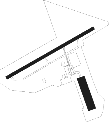
Runway info
Runway 07 / 25  | ||
| length | 961m (3153ft) | |
| bearing | 73° / 253° | |
| width | 30m (98ft) | |
| surface | asphalt | |
| displ threshold | 0m (0ft) / 135m (443ft) | |
| Runway 17 / 35 | ||
| length | 260m (853ft) | |
| bearing | 158° / 338° | |
| width | 78m (256ft) | |
| surface | grass | |
Nearby beacons
| code | identifier | dist | bearing | frequency |
|---|---|---|---|---|
| DIN | DINARD PLEURTUIT SAINT MA VOR/DME | 26.9 | 240° | 114.30 |
| JSY | JERSEY VOR/DME | 27.8 | 305° | 112.20 |
| JW | JERSEY NDB | 32.3 | 297° | 329 |
| MP | CHERBOURG NDB | 46.1 | 14° | 373 |
| REN | RENNES SAINT JACQUES VOR/DME | 49.1 | 192° | 109.25 |
| ALD | ALDERNEY NDB | 55.6 | 323° | 383 |
| LA | LAVAL NDB | 64.7 | 136° | 401 |
Disclaimer
The information on this website is not for real aviation. Use this data with the X-Plane flight simulator only! Data taken with kind consent from X-Plane 12 source code and data files. Content is subject to change without notice.