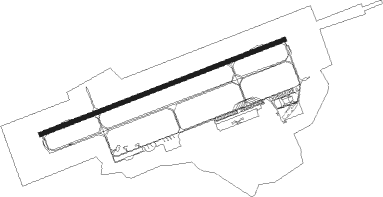
Landivisiau
Airport details
| Country | France |
| State | Brittany |
| Region | LF |
| Airspace | Brest Ctr |
| Municipality | Saint-Servais |
| Elevation | 347ft (106m) |
| Timezone | GMT +1 |
| Coordinates | 48.52599, -4.14974 |
| Magnetic var | |
| Type | land |
| Available since | X-Plane v10.40 |
| ICAO code | LFRJ |
| IATA code | LDV |
| FAA code | n/a |
Communication
| Landivisiau LANDI Tower | 119.700 |
| Landivisiau LANDI Tower | 119.200 |
| Landivisiau LANDI Approach | 120.900 |
| Landivisiau LANDI_GCA Approach | 118.800 |
| Landivisiau LANDI Approach | 119.700 |
| Landivisiau LANDI Approach-Departure | 122.400 |
Approach frequencies
| ILS-cat-I | RW25 | 108.5 | 18.00mi |
| 2.7° GS | RW25 | 108.5 | 18.00mi |
Nearby Points of Interest:
Colombier du Château de Troërin
-Église Saint-Miliau de Guimiliau
-Tréguelc'hier dolmen
-Église Notre-Dame de Saint-Thégonnec
-Manufacture des tabacs de Morlaix
-Château de Kéranroux
-Baptismal fonts of Église Notre-Dame de Croaz Batz
-Conservatoire botanique national de Brest
-Hôpital Augustin-Morvan
-Bois de Keroual
-Calvary at Plougonven
-gare de Châteaulin-Ville
-îlot des Capucins
-Île-Blanche manor
-Colombier de Lesmoal
-Chapelle-ossuaire Saint-Yves de Plouarzel
-Alignement de Saint-Denec
-Alignement de Traonigou
-Kastell Lostmarc'h
-Allée couverte de Kernescop
-Puits communal de Locronan
-Chaise de Saint-Ronan
-Abri du marin de Douarnenez
Nearby beacons
| code | identifier | dist | bearing | frequency |
|---|---|---|---|---|
| LDV | LANDIVISIAU TACAN | 0.2 | 289° | 115.15 |
| GU | BREST NDB | 6.1 | 250° | 338 |
| BST | LANVEOC POULMIC NDB | 18.4 | 229° | 428 |
| BST | LANVEOC POULMIC TACAN | 18.8 | 231° | 114.70 |
| ARE | MONTS D'ARREE VOR | 24.7 | 109° | 112.50 |
| RQ | QUIMPER NDB | 34 | 165° | 380 |
| QPR | QUIMPER PLUGUFFAN VOR/DME | 34.1 | 184° | 117.80 |
| LN | LANNION NDB | 35.3 | 77° | 345 |
| OSA | OUESSANT NDB | 36.5 | 266° | 351 |
| LOR | LORIENT LANN BIHOUE NDB | 53.9 | 137° | 359 |
Instrument approach procedures
| runway | airway (heading) | route (dist, bearing) |
|---|---|---|
| RW07 | RJ407 (95°) | RJ407 2100ft IRJ07 (5mi, 155°) 2000ft |
| RNAV | IRJ07 2000ft FRJ07 (5mi, 79°) 2000ft LFRJ (6mi, 80°) 378ft RJ410 (4mi, 76°) 1000ft RJ411 (5mi, 336°) 1000ft RJ407 (16mi, 259°) 2100ft | |
| RW25 | RJ400 (240°) | RJ400 2100ft IRJ25 (5mi, 156°) 2000ft |
| RW25 | RJ401 (258°) | RJ401 3000ft IRJ25 (5mi, 259°) 2000ft |
| RW25 | RJ402 (274°) | RJ402 2900ft IRJ25 (5mi, 336°) 2000ft |
| RNAV | IRJ25 2000ft FRJ25 (5mi, 259°) 2000ft LFRJ (6mi, 257°) 385ft RJ405 (4mi, 261°) 1000ft RJ406 (5mi, 336°) 2100ft RJ400 (16mi, 79°) 2100ft |
Disclaimer
The information on this website is not for real aviation. Use this data with the X-Plane flight simulator only! Data taken with kind consent from X-Plane 12 source code and data files. Content is subject to change without notice.