Carpiquet - Caen Carpiquet
Airport details
| Country | France |
| State | Normandy |
| Region | LF |
| Airspace | Brest Ctr |
| Municipality | Verson |
| Elevation | 253ft (77m) |
| Timezone | GMT +1 |
| Coordinates | 49.17328, -0.44988 |
| Magnetic var | |
| Type | land |
| Available since | X-Plane v10.40 |
| ICAO code | LFRK |
| IATA code | CFR |
| FAA code | n/a |
Communication
| Caen Carpiquet CAEN ATIS | 123.080 |
| Caen Carpiquet CAEN Tower | 134.525 |
| Caen Carpiquet DEAUVILLE Approach | 120.350 |
| Caen Carpiquet CAEN Dep | 134.525 |
Approach frequencies
| ILS-cat-I | RW31 | 110.95 | 18.00mi |
| 3° GS | RW31 | 110.95 | 18.00mi |
Nearby Points of Interest:
Ferme de Than
-Église Notre-Dame de Bretteville-sur-Odon
-Prison Beaulieu
-Porte de Louvigny
-Ancienne Visitation de Caen
-64 rue de Bayeux, Caen
-Bon Sauveur
-92 rue Bicoquet, Caen
-15 rue Caponière
-17 rue Caponière
-Pavillon de Beuvrelu
-St-Étienne de Caen
-10 rue Bicoquet, Caen
-Pavillons de l'entrée de la rue Guillaume-le-Conquérant
-25 rue Saint-Martin, Caen
-Palais de justice de Caen
-Statue of Bertrand du Guesclin
-Hôtel de Girard-Bureau
-Hôtel Canteil de Condé
-Hôtel Fouet
-Maison Charbonnier
-Hôtel du Grand-Cerf (Caen)
-26 rue Arcisse de Caumont
-Hôtel Marescot de Prémare
-Villa Baumier
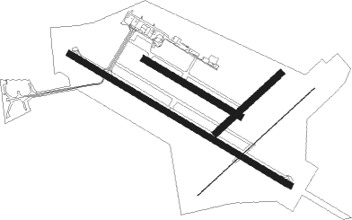
Runway info
Runway 05 / 23  | ||
| length | 1176m (3858ft) | |
| bearing | 63° / 243° | |
| width | 5m (16ft) | |
| surface | concrete | |
| Runway 13 / 31 | ||
| length | 1902m (6240ft) | |
| bearing | 115° / 295° | |
| width | 45m (148ft) | |
| surface | asphalt | |
| displ threshold | 300m (984ft) / 0m (0ft) | |
| Runway 05L / 23R | ||
| length | 651m (2136ft) | |
| bearing | 63° / 243° | |
| width | 50m (164ft) | |
| surface | grass | |
| Runway 13L / 31R | ||
| length | 821m (2694ft) | |
| bearing | 115° / 295° | |
| width | 50m (164ft) | |
| surface | grass | |
Nearby beacons
| code | identifier | dist | bearing | frequency |
|---|---|---|---|---|
| CAN | CAEN CARPIQUET VOR/DME | 0.2 | 269° | 114.45 |
| CNE | CAEN NDB | 6.1 | 114° | 404 |
| DVL | DEAUVILLE NORMANDIE VOR | 31 | 80° | 110.20 |
| LHO | LE HAVRE NDB | 35.4 | 56° | 346 |
| LGL | L'AIGLE VOR/DME | 44.9 | 111° | 112.70 |
| MP | CHERBOURG NDB | 45.5 | 297° | 373 |
| EVX | EVREUX FAUVILLE VORTAC | 66.2 | 95° | 112.40 |
| ROU | ROUEN VALLEE DE SEINE VOR | 69.9 | 80° | 116.80 |
| CHW | CHARTRES VOR/DME | 70.4 | 116° | 115.20 |
| DSA | DIEPPE NDB | 73.3 | 65° | 351 |
Departure and arrival routes
| Transition altitude | 5000ft |
| SID end points | distance | outbound heading | |
|---|---|---|---|
| RW13 | |||
| NEVI4X | 50mi | 6° | |
| DPE4X | 78mi | 65° | |
| LISE4X | 34mi | 95° | |
| LGL4X | 45mi | 111° | |
| LUSI4X | 53mi | 272° | |
| RW31 | |||
| NEVI4Y | 50mi | 6° | |
| DPE4Y | 78mi | 65° | |
| LISE4Y | 34mi | 95° | |
| LGL4Y | 45mi | 111° | |
| LUSI4Y | 53mi | 272° | |
| STAR starting points | distance | inbound heading | |
|---|---|---|---|
| ALL | |||
| LUSI4C | 52.8 | 92° | |
| NEVI4C | 49.7 | 186° | |
| DPE4C | 77.6 | 245° | |
| BERN4C | 42.9 | 275° | |
| LGL4C | 44.9 | 291° | |
Instrument approach procedures
| runway | airway (heading) | route (dist, bearing) |
|---|---|---|
| RW13 | PIKIV (141°) | PIKIV IRK13 (5mi, 241°) 3000ft |
| RW13 | XASUD (272°) | XASUD PIKIV (34mi, 287°) IRK13 (5mi, 241°) 3000ft |
| RNAV | IRK13 3000ft FRK13 (6mi, 128°) 3000ft LFRK (9mi, 115°) 280ft RK406 (14mi, 115°) XASUD (14mi, 71°) | |
| RW31 | ATGAL (318°) | ATGAL RK406 (6mi, 48°) 3000ft |
| RW31 | ERKAV (276°) | ERKAV RK406 (7mi, 228°) 3000ft |
| RW31 | XASUD (272°) | XASUD ERKAV (8mi, 266°) RK406 (7mi, 228°) 3000ft |
| RNAV | RK406 3000ft FRK31 (5mi, 295°) 3000ft LFRK (9mi, 295°) 282ft RK410 (3mi, 295°) ATGAL (18mi, 134°) XASUD (20mi, 65°) XASUD (turn) 3000ft |
Holding patterns
| STAR name | hold at | type | turn | heading* | altitude | leg | speed limit |
|---|---|---|---|---|---|---|---|
| BERN4C | CAN | NDB | left | 115 (295)° | 19500ft - 50000ft | 1.5min timed | ICAO rules |
| DPE4C | CAN | NDB | left | 115 (295)° | 19500ft - 50000ft | 1.5min timed | ICAO rules |
| LUSI4C | CAN | NDB | left | 115 (295)° | 19500ft - 50000ft | 1.5min timed | ICAO rules |
| NEVI4C | CAN | NDB | left | 115 (295)° | 19500ft - 50000ft | 1.5min timed | ICAO rules |
| *) magnetic outbound (inbound) holding course | |||||||
Disclaimer
The information on this website is not for real aviation. Use this data with the X-Plane flight simulator only! Data taken with kind consent from X-Plane 12 source code and data files. Content is subject to change without notice.