Le Mans - Le Mans Arnage
Airport details
| Country | France |
| State | Pays de la Loire |
| Region | LF |
| Airspace | Paris Ctr |
| Municipality | Le Mans |
| Elevation | 191ft (58m) |
| Timezone | GMT +1 |
| Coordinates | 47.94849, 0.20165 |
| Magnetic var | |
| Type | land |
| Available since | X-Plane v10.40 |
| ICAO code | LFRM |
| IATA code | LME |
| FAA code | n/a |
Communication
| Le Mans Arnage CTAF | 125.900 |
| Le Mans Arnage Twr | 125.900 |
| Le Mans Arnage NANTES INFO | 119.400 |
| Le Mans Arnage Dep | 125.900 |
Nearby Points of Interest:
Château des Hunaudières
-Hôpital Etoc-Demazy
-Autogare du Mans
-Cadran solaire de la Groirie
-Saint-Pierre de la Couture Abbey
-Chapelle de la Visitation
-Hôtel Coindon
-Hôtel Desportes de Linières
-Collégiale Saint-Pierre-la-Cour
-Hôtel Legras du Luart
-Hôtel de Courcival
-Hôtel Nepveu de Rouillon
-Hôtel Petot
-Auberge de la Fontaine
-Palais des comtes du Maine
-Hôtel de Vignolles
-Maison d'Adam et Ève
-Escalier de la Grande-Poterne
-Hôtel de Vaux
-Maison, 1 rue de la Pierre-de-Tucé
-Hôtel d'Arcy
-Maison du Pilier Rouge
-Maison des Deux Amis
-Maison de Scarron
-Hôtel Richer de la Jousserie
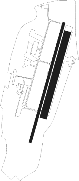
Runway info
Runway 02 / 20  | ||
| length | 1421m (4662ft) | |
| bearing | 29° / 209° | |
| width | 30m (98ft) | |
| surface | asphalt | |
| displ threshold | 0m (0ft) / 280m (919ft) | |
| Runway 02R / 20L | ||
| length | 971m (3186ft) | |
| bearing | 29° / 209° | |
| width | 80m (262ft) | |
| surface | grass | |
| blast zone | 0m (0ft) / 100m (328ft) | |
Nearby beacons
| code | identifier | dist | bearing | frequency |
|---|---|---|---|---|
| LM | LE MANS NDB | 3.5 | 209° | 326 |
| AS | ANGERS NDB | 26.4 | 224° | 392 |
| TUR | TOURS VAL DE LOIRE NDB | 32.8 | 123° | 331 |
| LA | LAVAL NDB | 35.4 | 272° | 401 |
| TUR | TOURS VAL DE LOIRE TACAN | 38.1 | 135° | 113.80 |
| CHW | CHARTRES VOR/DME | 44.7 | 56° | 115.20 |
| AMB | AMBOISE NDB | 46.5 | 122° | 341 |
| AMB | AMBOISE VOR/DME | 46.8 | 121° | 113.70 |
| ANG | ANGERS VOR | 49.2 | 249° | 113 |
| LGL | L'AIGLE VOR/DME | 52.2 | 21° | 112.70 |
| LP | CHOLET NDB | 64.5 | 232° | 357 |
Instrument approach procedures
| runway | airway (heading) | route (dist, bearing) |
|---|---|---|
| RW02 | MAPEB (59°) | MAPEB 3000ft MAVUK (5mi, 104°) 2000ft |
| RW02 | MATOT (349°) | MATOT 3000ft MAVUK (5mi, 284°) 2000ft |
| RNAV | MAVUK 2000ft FRM02 (3mi, 29°) 2000ft LFRM (6mi, 29°) 210ft RM410 (7mi, 29°) MAPEB (17mi, 229°) 3000ft MAPEB (turn) 3000ft | |
| RW20 | MAPEB (59°) | MAPEB 3000ft RM504 (22mi, 29°) 3000ft IRM20 (5mi, 104°) 3000ft |
| RW20 | RM502 (233°) | RM502 3000ft IRM20 (5mi, 284°) 3000ft |
| RW20 | RM504 (178°) | RM504 3000ft IRM20 (5mi, 104°) 3000ft |
| RNAV | IRM20 3000ft FRM20 (5mi, 209°) 3000ft LFRM (8mi, 209°) 231ft (2880mi, 180°) 2000ft MAPEB (2872mi, 0°) 3000ft |
Disclaimer
The information on this website is not for real aviation. Use this data with the X-Plane flight simulator only! Data taken with kind consent from X-Plane 12 source code and data files. Content is subject to change without notice.