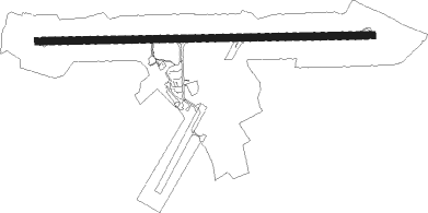
Pluguffan - Quimper Pluguffan
Airport details
| Country | France |
| State | Brittany |
| Region | LF |
| Airspace | Brest Ctr |
| Municipality | Pluguffan |
| Elevation | 291ft (89m) |
| Timezone | GMT +1 |
| Coordinates | 47.97363, -4.17494 |
| Magnetic var | |
| Type | land |
| Available since | X-Plane v10.40 |
| ICAO code | LFRQ |
| IATA code | UIP |
| FAA code | n/a |
Communication
| Quimper Pluguffan QUIMPER Tower | 118.625 |
| Quimper Pluguffan IROISE Approach | 119.575 |
| Quimper Pluguffan Dep | 118.625 |
Nearby Points of Interest:
Remparts de Quimper
-Abri du marin de Sainte-Marine
-Chaise de Saint-Ronan
-Puits communal de Locronan
-cannery Alexis Le Gall
-Abri du marin de Douarnenez
-Chantier naval Le Cœur
-Menhir de Quélarn
-Caserne Hervo
-Ancien phare de Penmarc'h
-gare de Châteaulin-Ville
-Kastell Lostmarc'h
-Tumulus de l'Hermitage
-Calvaire de Guiscriff
-Pointe du Raz
-Tourelle de la Plate
-Ossuaire de Gourin
-Ossuaire du Saint
-Croix de Bouthiry
-îlot des Capucins
Nearby beacons
| code | identifier | dist | bearing | frequency |
|---|---|---|---|---|
| QPR | QUIMPER PLUGUFFAN VOR/DME | 1 | 211° | 117.80 |
| RQ | QUIMPER NDB | 7.1 | 92° | 380 |
| BST | LANVEOC POULMIC NDB | 21.2 | 320° | 428 |
| BST | LANVEOC POULMIC TACAN | 21.7 | 318° | 114.70 |
| GU | BREST NDB | 30.5 | 348° | 338 |
| ARE | MONTS D'ARREE VOR | 31.4 | 58° | 112.50 |
| LOR | LORIENT LANN BIHOUE NDB | 32.1 | 106° | 359 |
| LDV | LANDIVISIAU TACAN | 33.3 | 2° | 115.15 |
| OSA | OUESSANT NDB | 46.2 | 299° | 351 |
| LN | LANNION NDB | 56.5 | 49° | 345 |
Departure and arrival routes
| Transition altitude | 5000ft |
| SID end points | distance | outbound heading | |
|---|---|---|---|
| RW09 | |||
| ARE1E | 31mi | 58° | |
| KORE1E | 70mi | 100° | |
| DEGE1E | 43mi | 103° | |
| IDRI1E | 31mi | 125° | |
| RW27 | |||
| ARE1W | 31mi | 58° | |
| KORE1W | 70mi | 100° | |
| DEGE1W | 43mi | 103° | |
| IDRI1W | 31mi | 125° | |
| STAR starting points | distance | inbound heading | |
|---|---|---|---|
| ALL | |||
| ARE5R | 31.4 | 238° | |
| ROSP5R | 17.0 | 272° | |
Instrument approach procedures
| runway | airway (heading) | route (dist, bearing) |
|---|---|---|
| RW09 | RQ401 (187°) | RQ401 RQ403 (12mi, 272°) IRQ09 (5mi, 185°) 3000ft |
| RW09 | RQ403 (109°) | RQ403 IRQ09 (5mi, 185°) 3000ft |
| RW09 | RQ404 (259°) | RQ404 RQ401 (14mi, 272°) RQ403 (12mi, 272°) IRQ09 (5mi, 185°) 3000ft |
| RNAV | IRQ09 3000ft FRQ09 (3mi, 92°) 3000ft LFRQ (9mi, 93°) 342ft RQ411 (8mi, 92°) RQ404 (9mi, 67°) 3000ft | |
| RW27 | ROSPO (272°) | ROSPO IRQ27 (4mi, 270°) 3000ft |
| RW27 | RQ402 (284°) | RQ402 IRQ27 (5mi, 331°) 3000ft |
| RW27 | RQ404 (259°) | RQ404 IRQ27 (5mi, 208°) 3000ft |
| RNAV | IRQ27 3000ft FRQ27 (4mi, 272°) 3000ft LFRQ (9mi, 272°) 325ft RQ410 (2mi, 274°) RQ404 (18mi, 81°) 3000ft |
Holding patterns
| STAR name | hold at | type | turn | heading* | altitude | leg | speed limit |
|---|---|---|---|---|---|---|---|
| ARE5R | RQ | FIX | right | 94 (274)° | 3000ft - 4000ft | 1.0min timed | 210 |
| GU5R | RQ | FIX | right | 94 (274)° | 3000ft - 4000ft | 1.0min timed | 210 |
| ROSP5R | RQ | FIX | right | 94 (274)° | 3000ft - 4000ft | 1.0min timed | 210 |
| *) magnetic outbound (inbound) holding course | |||||||
Disclaimer
The information on this website is not for real aviation. Use this data with the X-Plane flight simulator only! Data taken with kind consent from X-Plane 12 source code and data files. Content is subject to change without notice.