Bâle/mulhouse - Bale-mulhouse
Airport details
| Country | France |
| State | Grand Est |
| Region | LF |
| Airspace | Reims Ctr |
| Municipality | Saint-Louis |
| Elevation | 879ft (268m) |
| Timezone | GMT +1 |
| Coordinates | 47.60556, 7.52290 |
| Magnetic var | |
| Type | land |
| Available since | X-Plane v10.32 |
| ICAO code | LFSB |
| IATA code | BSL |
| FAA code | n/a |
Communication
| Bale-Mulhouse LFSB ATIS | 127.880 |
| Bale-Mulhouse BALE Ground Control | 121.605 |
| Bale-Mulhouse BALE Tower | 118.300 |
| Bale-Mulhouse BALE Approach | 130.900 |
| Bale-Mulhouse BALE Approach | 124.105 |
| Bale-Mulhouse BALE Approach | 118.580 |
| Bale-Mulhouse BALE Approach | 119.355 |
| Bale-Mulhouse BALE Departure | 119.355 |
Approach frequencies
| ILS-cat-III | RW15 | 111.55 | 18.00mi |
| ILS-cat-I | RW33 | 109.35 | 18.00mi |
| 3.5° GS | RW33 | 109.35 | 18.00mi |
| 3° GS | RW15 | 111.55 | 18.00mi |
Nearby Points of Interest:
monument du général Abatucci
-tribunal d'instance d'Huningue
-Synagogue of Hégenheim
-Silo Tower Basel
-mansion of the former slaughterhouse veterinarian
-Allschwil
-Ehemalige öffentliche Bad- und Waschanstalt
-fountain Faule Magd
-Bürgerspital Basel
-Holsteinerhof
-Bernoullianum
-Erlacherhof
-Reinacherhof
-Bockstecherhof
-public library of the University of Basel, Collections
-Gyrengarten
-Markgräflerhof
-Wildt’sche Haus
-house Stachelschützen
-Urbanbrunnen, Basel
-Haltingen water tower
-Ringelhof (Basel)
-Mues house
-Spalen schoolhouse (1879)
-Beichtiger House
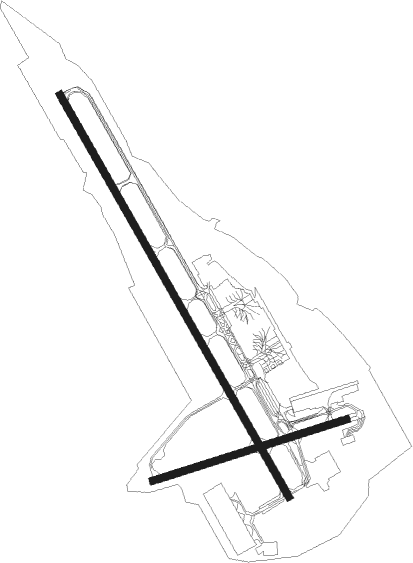
Runway info
Runway 15 / 33  | ||
| length | 3904m (12808ft) | |
| bearing | 145° / 325° | |
| width | 60m (197ft) | |
| surface | concrete | |
| displ threshold | 0m (0ft) / 1120m (3675ft) | |
| blast zone | 105m (344ft) / 0m (0ft) | |
| Runway 08 / 26 | ||
| length | 1714m (5623ft) | |
| bearing | 81° / 261° | |
| width | 60m (197ft) | |
| surface | concrete | |
| displ threshold | 0m (0ft) / 115m (377ft) | |
Nearby beacons
| code | identifier | dist | bearing | frequency |
|---|---|---|---|---|
| BS | BASLE-MULHOUSE NDB | 1.6 | 153° | 376 |
| BLM | BASLE-MULHOUSE VOR/DME | 1.8 | 319° | 117.45 |
| BN | BASLE-MULHOUSE NDB | 3.8 | 322° | 353 |
| HOC | DME | 10.1 | 134° | 113.20 |
| MB | MONTBELIARD NDB | 25 | 260° | 330 |
| GRE | GRENCHEN VOR/DME | 25.7 | 194° | 115.45 |
| WIL | WILLISAU VOR/DME | 30 | 138° | 116.90 |
| HR | HERICOURT NDB | 32.1 | 267° | 289 |
| HO | COLMAR-HOUSSEN NDB | 32.3 | 343° | 380 |
| TRA | DME | 37.3 | 85° | 114.30 |
| LPS | LES EPLATURES NDB | 43.1 | 234° | 403 |
| LHR | LAHR NDB | 46.1 | 21° | 337 |
| LRD | DME | 47.1 | 22° | 108.05 |
| FRI | FRIBOURG VOR/DME | 51.2 | 200° | 110.85 |
| STR | STRASBOURG ENTZHEIM VOR/DME | 54 | 3° | 115.60 |
| SE | STRASBOURG NDB | 59.5 | 11° | 412 |
Departure and arrival routes
| Transition altitude | 7000ft |
| SID end points | distance | outbound heading | |
|---|---|---|---|
| RW15 | |||
| ELBE7S | 11mi | 68° | |
| OLBE7S, OLBE7Y | 19mi | 161° | |
| LUME7S | 19mi | 242° | |
| MORO7T | 37mi | 256° | |
| TORP7T | 36mi | 262° | |
| LASA7S | 47mi | 303° | |
| RW33 | |||
| ELBE7N | 11mi | 68° | |
| OLBE7N | 19mi | 161° | |
| LUME7N | 19mi | 242° | |
| MORO7N | 37mi | 256° | |
| TORP7N | 36mi | 262° | |
| LASA7N | 47mi | 303° | |
| STAR starting points | distance | inbound heading | |
|---|---|---|---|
| ALL | |||
| ARPU8K | 34.9 | 94° | |
Instrument approach procedures
| runway | airway (heading) | route (dist, bearing) |
|---|---|---|
| RW15 | ADOGA (170°) | ADOGA IVDEV (12mi, 203°) 6000ft |
| RW15 | ALTIK (96°) | ALTIK 1SB15 (9mi, 39°) IVDEV (6mi, 73°) 6000ft |
| RNAV | IVDEV 4000ft FSB15 (4mi, 145°) 4000ft LFSB (11mi, 144°) 914ft TSB15 (2mi, 153°) 4000ft ALTIK (17mi, 280°) 5500ft | |
| RW33 | ALTIK (96°) | ALTIK 3SB33 (9mi, 93°) 2SB33 (14mi, 145°) 1SB33 (9mi, 145°) IXUDI (5mi, 72°) 7400ft |
| RNAV | IXUDI 6200ft FSB33 (4mi, 325°) 6200ft LFSB (15mi, 326°) 930ft TSB33 (6mi, 323°) ALTIK (13mi, 261°) 7000ft |
Holding patterns
| STAR name | hold at | type | turn | heading* | altitude | leg | speed limit |
|---|---|---|---|---|---|---|---|
| ARPU8K | ALTIK | VHF | right | 271 (91)° | 5500ft - 11000ft | DME 5.0mi | 220 |
| ARPU8K | ARPUS | VHF | left | 271 (91)° | 10000ft - 14000ft | DME 5.7mi | 220 |
| LUME8K | ALTIK | VHF | right | 271 (91)° | 5500ft - 11000ft | DME 5.0mi | 220 |
| STR8K | ALTIK | VHF | right | 271 (91)° | 5500ft - 11000ft | DME 5.0mi | 220 |
| *) magnetic outbound (inbound) holding course | |||||||
Disclaimer
The information on this website is not for real aviation. Use this data with the X-Plane flight simulator only! Data taken with kind consent from X-Plane 12 source code and data files. Content is subject to change without notice.