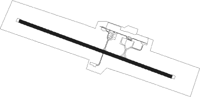
St Dizier - Brive Souillac
Airport details
| Country | France |
| State | Nouvelle-Aquitaine |
| Region | LF |
| Airspace | Bordeaux Ctr |
| Municipality | Nespouls |
| Elevation | 1016ft (310m) |
| Timezone | GMT +1 |
| Coordinates | 45.03972, 1.48556 |
| Magnetic var | |
| Type | land |
| Available since | X-Plane v10.40 |
| ICAO code | LFSL |
| IATA code | BVE |
| FAA code | n/a |
Communication
| Brive Souillac Tower | 121.125 |
Approach frequencies
| ILS-cat-I | RW29 | 109.95 | 18.00mi |
| 3.2° GS | RW29 | 109.95 | 18.00mi |
Nearby Points of Interest:
Donjon de Jayac
-château de Cavagnac
-Presbytère de La Cassagne
-Maison Cavaignac (Brive-la-Gaillarde)
-Hôtel de ville de Martel
-Hôtel Fabri
-Maison Arcambal
-Pigeonnier-porche du Four
-Castrum de Malemort
-Prieuré Saint-Xantin
-Manor d'Eyrignac
-fontaine de l'Oulié
-Canal des moines
-Château de la Treyne
-Prehistoric Sites and Decorated Caves of the Vézère Valley
-Montignac Duchêne house
-hotel de bouilhac
-Couvent Notre-Dame, Sarlat-la-Canéda
-Manoir de Gisson
-Lanterne des morts de Sarlat-la-Canéda
-Hôtel de Vienne
-Monastère des Récollets
-Pech de l’Azé
-Immeuble du Bessol
-Basilique Saint-Sauveur de Rocamadour
Nearby beacons
| code | identifier | dist | bearing | frequency |
|---|---|---|---|---|
| BSC | SOUILLAC (BRIVE) NDB | 6.3 | 108° | 351 |
| PX | PERIGUEUX NDB | 25.4 | 282° | 389 |
| FC | FIGEAC LIVERNON NDB | 25.5 | 141° | 395 |
| AR | AURILLAC NDB | 37.8 | 95° | 343 |
| BGC | BERGERAC NDB | 39.1 | 256° | 374 |
| CL | CAHORS NDB | 39.4 | 186° | 348 |
| LSU | LIMOGES NDB | 47.4 | 333° | 320 |
| LMG | LIMOGES VOR/DME | 50.4 | 329° | 114.50 |
| RZ | RODEZ NDB | 54.5 | 123° | 387 |
| LOE | LIMOGES NDB | 59.8 | 352° | 424 |
| AG | AGEN NDB | 63.6 | 222° | 400 |
Departure and arrival routes
| Transition altitude | 5000ft |
| SID end points | distance | outbound heading | |
|---|---|---|---|
| RW11 | |||
| LAVR2B | 23mi | 173° | |
| MAKO2B | 20mi | 320° | |
| RW29 | |||
| LAVR2C | 23mi | 173° | |
| MAKO2C | 20mi | 320° | |
| STAR starting points | distance | inbound heading | |
|---|---|---|---|
| ALL | |||
| MAKO1A, MAKO1R | 20.4 | 140° | |
| RW29 | |||
| XERA1A | 22.2 | 278° | |
| LAVR1A | 23.2 | 353° | |
Instrument approach procedures
| runway | airway (heading) | route (dist, bearing) |
|---|---|---|
| RW11 | BSC (288°) | BSC 6000ft SL504 (12mi, 305°) 3000ft SL505 (6mi, 288°) 3000ft ISL11 (4mi, 213°) 3000ft |
| RW11 | SL504 (149°) | SL504 3000ft SL505 (6mi, 288°) 3000ft ISL11 (4mi, 213°) 3000ft |
| RNAV | ISL11 3000ft FSL11 (4mi, 108°) 3000ft LFSL (7mi, 108°) 1065ft BSC (6mi, 108°) SL504 (12mi, 305°) 3000ft | |
| RW29 | ARMAX (272°) | ARMAX 3300ft ISL29 (4mi, 213°) 3000ft |
| RW29 | OSDAG (288°) | OSDAG 3300ft ISL29 (4mi, 288°) 3000ft |
| RW29 | UVRAK (306°) | UVRAK 3300ft ISL29 (4mi, 33°) 3000ft |
| RNAV | ISL29 3000ft FSL29 (4mi, 288°) 3000ft LFSL (6mi, 288°) 1025ft SL409 (5mi, 288°) SL410 (8mi, 87°) ARMAX (8mi, 108°) 3000ft |
Holding patterns
| STAR name | hold at | type | turn | heading* | altitude | leg | speed limit |
|---|---|---|---|---|---|---|---|
| LAVR1A | BSC | FIX | left | 114 (294)° | 3000ft - 8000ft | 1.0min timed | 220 |
| MAKO1A | BSC | FIX | left | 114 (294)° | 3000ft - 8000ft | 1.0min timed | 220 |
| XERA1A | BSC | FIX | left | 114 (294)° | 3000ft - 8000ft | 1.0min timed | 220 |
| *) magnetic outbound (inbound) holding course | |||||||
Disclaimer
The information on this website is not for real aviation. Use this data with the X-Plane flight simulator only! Data taken with kind consent from X-Plane 12 source code and data files. Content is subject to change without notice.
