Nancy/ochey - Nancy Ochey
Airport details
| Country | France |
| State | Grand Est |
| Region | LF |
| Airspace | Reims Ctr |
| Municipality | Ochey |
| Elevation | 1104ft (336m) |
| Timezone | GMT +1 |
| Coordinates | 48.58319, 5.95452 |
| Magnetic var | |
| Type | land |
| Available since | X-Plane v10.40 |
| ICAO code | LFSO |
| IATA code | n/a |
| FAA code | n/a |
Communication
| Nancy Ochey OCHEY Tower | 122.100 |
| Nancy Ochey OCHEY Approach | 127.250 |
| Nancy Ochey OCHEY Approach | 123.300 |
| Nancy Ochey OCHEY Departure | 122.100 |
Approach frequencies
| ILS-cat-I | RW20 | 108.7 | 18.00mi |
| 3° GS | RW20 | 108.7 | 18.00mi |
Nearby Points of Interest:
Bois l'Évêque dolmen
-Tombeau de Hugues des Hazards
-City walls of Toul
-Synagogue of Toul
-Hôtel de Ville de Toul
-Abbaye Saint-Léon de Toul
-grosse-maison de Villey-Saint-Étienne
-funiculaire de la Cure d'Air
-Château de Vaudémont
-villa Fournier-Defaut
-Tour Joffre Saint-Thiébaut
-L'Excelsior
-immeuble, 10 rue des Sœurs-Macarons
-Immeuble, 38 place de la Carrière
-maison Lecreulx
-Monument Barrès
-remparts de Vaucouleurs
-papeterie de la Rochette
-La Douëra
-Daum
-Maison Fruhinsholzs
-château de l'abbé de Bouzey
-Mairie-halle de Vicherey
-Cure d'air Trianon
-site archéologique d'Essey-Nancy
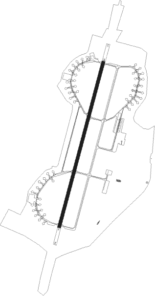
Runway info
| Runway 02 / 20 | ||
| length | 2400m (7874ft) | |
| bearing | 28° / 208° | |
| width | 45m (148ft) | |
| surface | asphalt | |
Nearby beacons
| code | identifier | dist | bearing | frequency |
|---|---|---|---|---|
| NAY | NANCY OCHEY TACAN | 0.1 | 279° | 116.80 |
| EPL | EPINAL MIRECOURT VOR | 16.4 | 158° | 113 |
| EMT | EPINAL NDB | 17.8 | 136° | 419 |
| LOU | LORRAINE NDB | 27.9 | 37° | 388 |
| GTQ | GROSTENQUIN VOR/DME | 38.6 | 62° | 111.25 |
| ETN | ETAIN NDB | 40.3 | 337° | 410 |
| MTZ | METZ NDB | 42.8 | 20° | 354 |
| RLP | ROLAMPONT VOR/DME | 49.4 | 226° | 117.30 |
| LXI | LUXEUIL SAINT SAUVEUR TACAN | 50.6 | 153° | 108.20 |
| LUL | LUXEUIL VOR | 55.4 | 159° | 117.10 |
| MMD | MONTMEDY VOR | 58.5 | 314° | 109.40 |
| WLU | LUXEMBOURG NDB | 59.2 | 6° | 346 |
Instrument approach procedures
| runway | airway (heading) | route (dist, bearing) |
|---|---|---|
| RW02 | EPL (338°) | EPL 5000ft ISO02 (10mi, 304°) 2900ft |
| RW02 | SO401 (81°) | SO401 SO403 (8mi, 139°) 5000ft ISO02 (5mi, 80°) 2900ft |
| RNAV | ISO02 2900ft FSO02 (3mi, 28°) 2900ft LFSO (6mi, 28°) 1154ft SO411 (7mi, 28°) 5000ft SO400 (9mi, 282°) 5000ft SO401 (14mi, 216°) | |
| RW20 | SO400 (138°) | SO400 SO402 (7mi, 57°) ISO20 (6mi, 107°) 2900ft |
| RNAV | ISO20 2900ft FSO20 (6mi, 208°) 2900ft LFSO (6mi, 208°) 1115ft SO408 (2mi, 208°) 4000ft SO410 (9mi, 302°) 4000ft SO400 (6mi, 27°) |
Disclaimer
The information on this website is not for real aviation. Use this data with the X-Plane flight simulator only! Data taken with kind consent from X-Plane 12 source code and data files. Content is subject to change without notice.