Pouancé - Chateaubriant Pouance
Airport details
| Country | France |
| State | Pays de la Loire |
| Region | LF |
| Airspace | Brest Ctr |
| Municipality | Ombrée d'Anjou |
| Elevation | 319ft (97m) |
| Timezone | GMT +1 |
| Coordinates | 47.73944, -1.19028 |
| Magnetic var | |
| Type | land |
| Available since | X-Plane v10.40 |
| ICAO code | LFTQ |
| IATA code | n/a |
| FAA code | n/a |
Communication
| Chateaubriant Pouance CHATEAUBRIANT INFO | 123.500 |
| Chateaubriant Pouance RENNES INFO | 134.000 |
| Chateaubriant Pouance Dep | 134.000 |
Nearby Points of Interest:
Pigeonnier de Pouancé
-Hôtel de la Houssaye
-Maison dite de l'Ange (Châteaubriant)
-Manoir de la Joubardière
-Bennefraye stone rows
-château de la Raimbaudière
-Halles de Craon
-Maison forte de l'Épronnière
-Tombe mégalithique du château de la Ferrière
-Chaire de l'église Saint-Martin de Moutiers (Ille-et-Vilaine)
-Dolmen de la Petifaie
-Grange seigneuriale de Chéripeau
-Presbytère de La Chapelle-sur-Oudon
-Château de La Picoulière
-chapelle Sainte-Anne-du-Bois (Amanlis)
-chapelle Saint-Pierre d'Argentré-du-Plessis
-Château de la Beuvrière
-Moulin de Pomméniac
-Maison
-chapelle du château de Châteaugiron
-Villa de la Douvelière
-Hôtel du Bât
-Fortifications of Vitré
-Croix du cimetière de Nouvoitou
-Prieuré Notre-Dame de Vitré
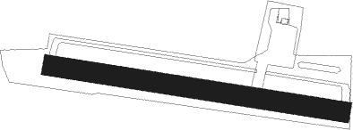
Runway info
| Runway 10 / 28 | ||
| length | 721m (2365ft) | |
| bearing | 99° / 279° | |
| width | 50m (164ft) | |
| surface | grass | |
| displ threshold | 120m (394ft) / 0m (0ft) | |
Nearby beacons
| code | identifier | dist | bearing | frequency |
|---|---|---|---|---|
| ANG | ANGERS VOR | 18.3 | 121° | 113 |
| LA | LAVAL NDB | 25 | 65° | 401 |
| REN | RENNES SAINT JACQUES VOR/DME | 29.7 | 301° | 109.25 |
| NTS | NANTES ATLANTIQUE VOR/DME | 38.7 | 216° | 115.50 |
| LP | CHOLET NDB | 38.9 | 150° | 357 |
| MT | SAINT NAZAIRE NDB | 42.3 | 245° | 398 |
| GL | NANTES NDB | 45.9 | 216° | 369 |
| DIN | DINARD PLEURTUIT SAINT MA VOR/DME | 62.1 | 314° | 114.30 |
Disclaimer
The information on this website is not for real aviation. Use this data with the X-Plane flight simulator only! Data taken with kind consent from X-Plane 12 source code and data files. Content is subject to change without notice.