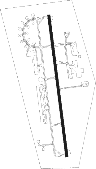
Nîmes/garons - Nimes Garons
Airport details
| Country | France |
| State | Occitania |
| Region | LF |
| Airspace | Marseille Ctr |
| Municipality | Saint-Gilles |
| Elevation | 308ft (94m) |
| Timezone | GMT +1 |
| Coordinates | 43.74772, 4.41219 |
| Magnetic var | |
| Type | land |
| Available since | X-Plane v10.40 |
| ICAO code | LFTW |
| IATA code | FNI |
| FAA code | n/a |
Communication
| Nimes Garons GARONS ATIS | 129.350 |
| Nimes Garons GARONS Tower | 123.200 |
| Nimes Garons MONTPELLIER Approach | 131.050 |
Nearby Points of Interest:
Prieuré Saint-Vincent-de-Broussan
-Vis de Saint-Gilles-du-Gard
-Le Nemausus
-Hôtel du Louvre
-Ancient wall remains
-Colomb de Daunant mansion
-Former Hôtel-Dieu
-Justice Court in Nîmes
-De Chazelles mansion
-Town hall of Nîmes
-Démians mansion (Nîmes)
-Avocaterie des pauvres
-Colisée, former cinema-theatre
-Vieux Nîmes museum
-Presbytère de la cathédrale mansion
-former Major Seminary of Nîmes
-De Balincourt mansion
-immeubles avec vestiges archéologiques
-maison de santé protestante de Nîmes
-Lagorce mansion
-Palais de Luppé
-Verrerie de Trinquetaille
-Borne milliaire du château d'Estoublon
-Arles Roman City Walls
-Gorges du Gardon
Nearby beacons
| code | identifier | dist | bearing | frequency |
|---|---|---|---|---|
| NG | GARONS DME-ILS | 1.1 | 16° | 109.55 |
| NG | NIMES NDB | 6.5 | 357° | 354 |
| AVN | AVIGNON VOR/DME | 20.7 | 53° | 114.60 |
| FG | MONTPELLIER NDB | 20.7 | 244° | 339 |
| FJR | MONTPELLIER MEDITERRANEE VOR/DME | 21.5 | 249° | 114.45 |
| DA | ALES CEVENNES NDB | 22.4 | 320° | 402 |
| AN | CAUMONT DME-ILS | 23.3 | 72° | 110.50 |
| CM | AVIGNON CAUMONT NDB | 23.4 | 72° | 369 |
| ITR | ISTRES LE TUBE TACAN | 26 | 113° | 115.70 |
| ITR | ISTRES LE TUBE NDB | 26.1 | 113° | 390 |
| ITS | ISTRES LE TUBE VOR/DME | 27.3 | 115° | 112.70 |
| ORG | ORANGE NDB | 30.6 | 48° | 328 |
| SAL | SALON DE PROVENCE NDB | 31 | 101° | 334 |
| MAR | MARSEILLE NDB | 35.1 | 110° | 383 |
| MTG | MARTIGUES VOR/DME | 36.5 | 118° | 117.30 |
| MJ | MARSEILLE PROVENCE NDB | 39.6 | 111° | 406 |
| MS | MARSEILLE NDB | 43.6 | 112° | 343 |
| ALM | AIX LES MILLES NDB | 43.9 | 104° | 413 |
| MRM | MARSEILLE PROVENCE VOR/DME | 45.5 | 112° | 108.80 |
| MTL | MONTELIMAR ANCONE VOR/DME | 51 | 24° | 113.65 |
Departure and arrival routes
| Transition altitude | 5000ft |
| SID end points | distance | outbound heading | |
|---|---|---|---|
| RW18 | |||
| MTL3S | 51mi | 24° | |
| MARI3S | 22mi | 170° | |
| FJR3S | 22mi | 249° | |
| MEN3S | 75mi | 305° | |
| RW36 | |||
| MTL3N | 51mi | 24° | |
| MARI3N | 22mi | 170° | |
| FJR3N | 22mi | 249° | |
| MEN3N | 75mi | 305° | |
| STAR starting points | distance | inbound heading | |
|---|---|---|---|
| ALL | |||
| FJR4W | 21.5 | 69° | |
| ESER4W | 45.0 | 114° | |
| MEN4W | 74.6 | 125° | |
| MTL4W | 51.0 | 204° | |
| MARI4W | 21.9 | 350° | |
Instrument approach procedures
| runway | airway (heading) | route (dist, bearing) |
|---|---|---|
| RW18 | NG (196°) | NG 4000ft TW512 (7mi, 305°) TW500 (8mi, 356°) 4000ft ITW18 (5mi, 88°) 3000ft |
| RW18 | TW500 (152°) | TW500 4000ft ITW18 (5mi, 88°) 3000ft |
| RW18 | TW502 (195°) | TW502 3000ft ITW18 (3mi, 268°) 3000ft |
| RNAV | ITW18 3000ft FTW18 (5mi, 176°) 3000ft LFTW (10mi, 178°) 350ft TW510 (4mi, 172°) TW511 (7mi, 285°) TW512 (8mi, 13°) TW500 (8mi, 356°) 4000ft ITW18 (5mi, 88°) 4000ft NG (13mi, 175°) 4000ft NG (turn) 4000ft | |
| RW36 | BADET (344°) | BADET 3000ft ITW36 (4mi, 310°) 3000ft |
| RW36 | VARES (20°) | VARES 3000ft ITW36 (5mi, 83°) 3000ft |
| RNAV | ITW36 3000ft FTW36 (5mi, 356°) 3000ft LFTW (8mi, 354°) 358ft NG (1mi, 16°) TW410 (10mi, 13°) 3800ft NG (10mi, 193°) 4000ft NG (turn) 4000ft |
Holding patterns
| STAR name | hold at | type | turn | heading* | altitude | leg | speed limit |
|---|---|---|---|---|---|---|---|
| CM4W | NG | FIX | left | 354 (174)° | 4000ft - 7000ft | 1.0min timed | 200 |
| ESER4W | NG | FIX | left | 354 (174)° | 4000ft - 7000ft | 1.0min timed | 200 |
| FJR4W | NG | FIX | left | 354 (174)° | 4000ft - 7000ft | 1.0min timed | 200 |
| MARI4W | NG | FIX | left | 354 (174)° | 4000ft - 7000ft | 1.0min timed | 200 |
| MEN4W | NG | FIX | left | 354 (174)° | 4000ft - 7000ft | 1.0min timed | 200 |
| MTL4W | NG | FIX | left | 354 (174)° | 4000ft - 7000ft | 1.0min timed | 200 |
| *) magnetic outbound (inbound) holding course | |||||||
Disclaimer
The information on this website is not for real aviation. Use this data with the X-Plane flight simulator only! Data taken with kind consent from X-Plane 12 source code and data files. Content is subject to change without notice.
