St Pierre - Saintes Thenac
Airport details
| Country | France |
| State | Nouvelle-Aquitaine |
| Region | LF |
| Airspace | Bordeaux Ctr |
| Municipality | Thénac |
| Elevation | 118ft (36m) |
| Timezone | GMT +1 |
| Coordinates | 45.70195, -0.63611 |
| Magnetic var | |
| Type | land |
| Available since | X-Plane v10.40 |
| ICAO code | LFXB |
| IATA code | n/a |
| FAA code | n/a |
Communication
| Saintes Thenac SAINTES Tower | 122.400 |
| Saintes Thenac COGNAC Approach | 122.550 |
Nearby Points of Interest:
Hôtel de Brémond d'Ars
-Ancien couvent des Jacobins de Saintes
-haras national de Saintes
-Logis de Vallade
-Halles de Pisany
-Éolienne du Clône
-hôtel Kerlivio-Broussard
-Château du Fa
-Château de Burie
-Abbatiale de Saint-Savinien
-Halles de Cozes
-Pierre Levée de Berthegrille
-Jardin de Gabriel
-Prieuré de Sainte-Gemme
-Château Chesnel
-La Frénade
-Château de Richemont
-Château d'Ardennes
-Prieuré de Pont-l'Abbé-d'Arnoult
-Domaine du Coureau
-Chapelle Saint-Jean de Châteaubernard
-Le Fâ
-moulin de Villars
-Commanderie d'Angles
-Halle de Saint-Jean-d'Angle
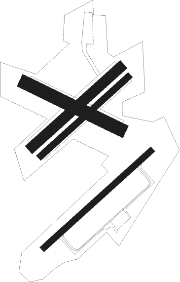
Runway info
Runway 05 / 23  | ||
| length | 1101m (3612ft) | |
| bearing | 62° / 242° | |
| width | 45m (148ft) | |
| surface | asphalt | |
| displ threshold | 101m (331ft) / 101m (331ft) | |
| Runway 05L / 23R | ||
| length | 901m (2956ft) | |
| bearing | 62° / 242° | |
| width | 80m (262ft) | |
| surface | grass | |
| displ threshold | 151m (495ft) / 194m (636ft) | |
| Runway 05R / 23L | ||
| length | 901m (2956ft) | |
| bearing | 62° / 242° | |
| width | 50m (164ft) | |
| surface | grass | |
| displ threshold | 92m (302ft) / 116m (381ft) | |
| Runway 12 / 30 | ||
| length | 801m (2628ft) | |
| bearing | 112° / 292° | |
| width | 100m (328ft) | |
| surface | grass | |
Nearby beacons
| code | identifier | dist | bearing | frequency |
|---|---|---|---|---|
| RY | ROYAN NDB | 10.9 | 250° | 427 |
| CNA | COGNAC CHATEAUBERNARD VOR/DME | 13.8 | 97° | 114.65 |
| CGC | COGNAC CHATEAUBERNARD TACAN | 13.9 | 97° | 116.20 |
| ROC | ROCHEFORT NDB | 18.4 | 298° | 396 |
| OC | COGNAC NDB | 20 | 85° | 346 |
| NB | BORDEAUX NDB | 33.4 | 171° | 361 |
| RL | LA ROCHELLE NDB | 34.4 | 316° | 322 |
| AGO | ANGOULEME NDB | 44.5 | 90° | 404 |
| BD | BORDEAUX NDB | 46.1 | 174° | 393 |
| BE | BORDEAUX NDB | 50.9 | 164° | 318 |
| BMC | BORDEAUX MERIGNAC VOR/DME | 52.6 | 186° | 113.75 |
| YN | LA ROCHE SUR YON LES AJONCS NDB | 65.1 | 327° | 334 |
| POI | POITIERS BIARDS VOR | 65.5 | 47° | 113.30 |
| LMG | LIMOGES VOR/DME | 69.9 | 86° | 114.50 |
| PX | PERIGUEUX NDB | 72.7 | 109° | 389 |
| LSU | LIMOGES NDB | 73.1 | 87° | 320 |
| BGC | BERGERAC NDB | 74.9 | 125° | 374 |
Disclaimer
The information on this website is not for real aviation. Use this data with the X-Plane flight simulator only! Data taken with kind consent from X-Plane 12 source code and data files. Content is subject to change without notice.