Les Mureaux
Airport details
| Country | France |
| State | Ile-de-France |
| Region | LF |
| Airspace | Paris Ctr |
| Municipality | Les Mureaux |
| Elevation | 86ft (26m) |
| Timezone | GMT +1 |
| Coordinates | 48.99861, 1.94167 |
| Magnetic var | |
| Type | land |
| Available since | X-Plane v10.40 |
| ICAO code | LFXU |
| IATA code | n/a |
| FAA code | n/a |
Communication
| Les Mureaux CTAF | 122.950 |
| Les Mureaux Approach MELUN SEINE | 134.300 |
| Les Mureaux Approach TOUSSUS | 119.300 |
| Les Mureaux Dep | 122.950 |
Nearby Points of Interest:
Château de Vaux-sur-Seine
-fonts baptismaux de Meulan-en-Yvelines
-dolmen des Mureaux
-École Notre-Dame les Oiseaux
-Baptismal font of Église Saint-Martin (Triel-sur-Seine)
-Villa Paul Poiret
-Baptismal font of église Saint-Michel de Juziers
-Allée couverte de la Justice
-Vierge à l'enfant
-Croix de cimetière d'Andrésy
-demeure Rêve Cottage
-Pont Boussiron
-Pont ferroviaire de Conflans-Sainte-Honorine
-Manoir de Réal
-Statue of Saint Barbara
-Chapelle de la Maladrerie de Poissy
-Noyau de Poissy
-pavillon de David
-Château d'Issou
-Gare de Poissy-Grande-Ceinture
-Jacques
-Château d'Agnou
-La Pierre-Drette
-Chapelle Saint-Jacques de Maule
-Maison d'André Derain
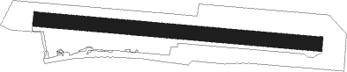
Runway info
Runway 10L / 28R  | ||
| length | 1952m (6404ft) | |
| bearing | 96° / 276° | |
| width | 50m (164ft) | |
| surface | grass | |
| displ threshold | 500m (1640ft) / 300m (984ft) | |
| Runway 10R / 28L | ||
| length | 1952m (6404ft) | |
| bearing | 96° / 276° | |
| width | 50m (164ft) | |
| surface | grass | |
| displ threshold | 500m (1640ft) / 500m (1640ft) | |
Nearby beacons
| code | identifier | dist | bearing | frequency |
|---|---|---|---|---|
| PON | PONTOISE CORMEILLES EN VE VOR | 6.9 | 44° | 111.60 |
| TA | VILLACOUBLAY NDB | 14.9 | 146° | 286 |
| TSU | TOUSSUS LE NOBLE VOR | 16 | 147° | 108.25 |
| HOL | VILLACOUBLAY NDB | 16.7 | 204° | 315 |
| BT | LE BOURGET (PARIS) VOR/DME | 20.2 | 93° | 116.10 |
| RBT | RAMBOUILLET VOR/DME | 20.8 | 171° | 114.70 |
| CGN | (PARIS) DME | 22 | 88° | 115.35 |
| POY | ORLY (PARIS) NDB | 23.9 | 121° | 334 |
| EPR | EPERNON VOR/DME | 25 | 217° | 115.65 |
| PGS | CHARLES-DE-GAULLE (PARIS) VOR/DME | 26.8 | 90° | 117.05 |
| BOV | BEAUVAIS TILLE VOR/DME | 27.5 | 26° | 109.65 |
| EVX | EVREUX FAUVILLE VORTAC | 28.4 | 273° | 112.40 |
| BV | BEAUVAIS NDB | 29.8 | 10° | 391 |
| ROU | ROUEN VALLEE DE SEINE VOR | 38.1 | 305° | 116.80 |
| MTD | MONTDIDIER VOR | 39.5 | 45° | 113.65 |
| MLN | MELUN VILLAROCHE VOR/DME | 47.4 | 122° | 113.60 |
| CHW | CHARTRES VOR/DME | 48.9 | 241° | 115.20 |
| PTV | PITHIVIERS VOR | 52.2 | 159° | 116.50 |
| GI | AMIENS NDB | 54.9 | 33° | 339 |
| OAN | ORLEANS-BRICY NDB | 60.2 | 190° | 385 |
| CAD | CHATEAUDUN VOR/DME | 60.5 | 211° | 115.95 |
| CHN | CHATEAUDUN TACAN | 60.9 | 211° | 110.20 |
| DSA | DIEPPE NDB | 62.7 | 316° | 351 |
| DPE | DIEPPE VOR | 63.2 | 320° | 115.80 |
| ABY | ALBERT BRAY NDB | 67.7 | 42° | 321 |
Disclaimer
The information on this website is not for real aviation. Use this data with the X-Plane flight simulator only! Data taken with kind consent from X-Plane 12 source code and data files. Content is subject to change without notice.