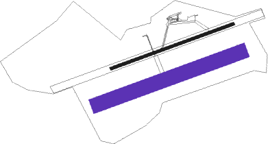
St Pierre I - Cambrai Niergnies
Airport details
| Country | France |
| State | Hauts-de-France |
| Region | LF |
| Airspace | Paris Ctr |
| Municipality | Niergnies |
| Elevation | 312ft (95m) |
| Timezone | GMT +1 |
| Coordinates | 50.14250, 3.26500 |
| Magnetic var | |
| Type | land |
| Available since | X-Plane v10.40 |
| ICAO code | LFYG |
| IATA code | n/a |
| FAA code | n/a |
Communication
| Cambrai Niergnies NIERGNIES AA | 122.925 |
Nearby Points of Interest:
Citadelle de Cambrai
-Chapelle Bricout d'Estourmel
-pierres jumelles de Cambrai
-Chaire de l'Église Saint-Géry
-Maison du bailli de Marcoing
-Ancien couvent des Récollets
-Béguinage Notre-Dame
-Béguinage Saint-Vaast et Saint-Nicolas
-Pierre qui Pousse
-Taufbecken Solesmes
-Chaire de l'église Saint-Martin de Solesmes
-Ferme d'Azincourt
-Le Gros Caillou
-Théâtre Municipal de Denain
-Fosse Mathilde
-Chapelle Notre-Dame-de-Bonsecours d'Écaillon
-Château de Villers-Campeau
-Brasserie Laden Wallez
-Cromlech des Bonnettes
-église Saint-Pierre de Moislains
-Hôpital-Général de Douai
-Place du Marché-au-Poisson de Douai
-Palais de justice de Douai
-hotel de warenghien
-convent of Chartreuse, Douai

Nearby beacons
| code | identifier | dist | bearing | frequency |
|---|---|---|---|---|
| CMB | CAMBRAI EPINOY VOR/DME | 6.7 | 307° | 112.60 |
| VS | VALENCIENNES NDB | 13 | 23° | 317 |
| ABY | ALBERT BRAY NDB | 20.2 | 250° | 321 |
| LEQ | LILLE LESQUIN VOR/DME | 26 | 337° | 109 |
| LL | LILLE NDB | 26.4 | 353° | 332 |
| CIV | CHIEVRES VORTAC | 33.8 | 53° | 113.20 |
| GI | AMIENS NDB | 35.1 | 249° | 339 |
| MVC | MERVILLE NDB | 36.5 | 302° | 327 |
| MRV | MERVILLE NDB | 38.2 | 313° | 404 |
| MTD | MONTDIDIER VOR | 46.4 | 233° | 113.65 |
| MAK | MACKEL NDB | 50.1 | 16° | 360 |
| AFI | AFFLIGEM VOR/DME | 56.7 | 49° | 114.90 |
| BSN | DME | 57.8 | 192° | 114.85 |
| REM | REIMS VOR | 58.3 | 137° | 112.30 |
| KOK | KOKSY VORTAC | 61.7 | 327° | 114.50 |
Disclaimer
The information on this website is not for real aviation. Use this data with the X-Plane flight simulator only! Data taken with kind consent from X-Plane 12 source code and data files. Content is subject to change without notice.